


 Country:
 City:
City:


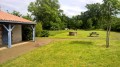
Start from the Pont de l’Ouen car park (easy parking for vans or lorries).
(S/E) At the picnic area, take the path along the edge of the pond. Follow it on your left, then turn right and leave it to reach a stream near the far end of the pond.
(1) Then turn sharply right. Stay on the path until you reach the hamlet of La Cristière. Once in the hamlet, turn right through the houses, then right again as you leave the hamlet. Take the first path on the left a few metres further on. Then take the second path on the right and join the road. When you reach the road, turn left.
(2) At a place called l’Héric, turn right and cross La Bigotière. Pass a wayside cross on the left-hand side. Turn left in front of the market garden. After the silo, before the road bends to the right, take the path on the left. Cross a road and follow another road opposite. Cross the hamlet of La Hardonnière. At the end of the hamlet, the road gives way to a path.
(3) When you reach the road, turn right. Pass the first road on the right. At the next Fork in the road, turn left. At La Chabossière, follow the path continuing from the road. Then take the first path on the left. When you reach the road, turn right. Continue along the road for about 300 metres and take the second path on the left. This path bends right at almost a 90-degree angle. Then take the path on the left and continue to the road.
(4) Turn right (the Manoir de la Boulaie is on your left). Follow the road to the roundabout. At the roundabout, take the road opposite and continue straight ahead.
(5) After La Frémondière, take the concrete path closed to vehicles directly in front of you. Continue to the end and turn left onto a perpendicular path (football and rugby pitches on your left).
(6) At the end of the path, turn right then left along the Collège Saint-Gabriel. Continue right onto Rue de La Bourrelière. Turn right and head towards the roundabout.
(7) At the roundabout, take the road opposite. A cycle path runs alongside the road on your right. At a bend, take the path on your left (lowered kerb, just after the field, before the trees). Continue to another roundabout.
(8) At the roundabout, head straight on towards Le Carteron and continue north-west along the small road. Ride to the end of the village and follow the narrow path between the house on the right and an old stone building (with an external staircase) on the left. Continue along this path.
(9) When you reach the dual carriageway, turn right onto the road running alongside it. Pass a sewage treatment plant. Then move away from the dual carriageway and head towards a roundabout.
(10) Turn left after the wooden barrier and go under the bridge. Continue along the cycle path and go over the dual carriageway. Cross the first road and reach a second junction.
(11) At the second junction, 50 metres before a roundabout, turn right. Pass through the iron gate after the secondary school and continue to the Canal de Goulaine. After crossing it, turn right and follow the canal on your right. Pass under the dual carriageway.
(12) As you come off the bridge, turn immediately left and follow the verge below the dual carriageway for 400 metres. Take the first path on the right, running alongside the AACP riding school.
(13) Cross the road (Rue de l’Arche). After 600 metres, cross the first junction where two paths meet and, 600 metres further on, leave the path on the left and take the one that turns right a few metres further on.
(14) Turn left and follow the road. Note the market garden greenhouses on your left. Take the roundabout on your right and go straight across. Continue along the small road that runs alongside the market gardens.
(15) Just before the bridge over the canal, turn right down the slope. Follow the canal, taking care not to trespass on the market garden. When you come out onto the road, turn left and cross the canal. At the three-way junction, continue straight ahead.
(16) Take the path on the left, in front of a house (the path facing another one with a no entry sign). Continue along this path to the next village. Take the road on the left as you reach the village of La Marsaudière and head towards the junction. Turn right and stay on this road, passing a first junction where you have right of way. Continue along the road, passing through the village of Le Petit Bois and then Les Feuillardes.
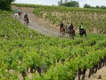
(17) At the Stop sign (waymark on the right), continue along the path opposite. Cross the vineyards of Château de la Jousselinière. At the end of the path, take the path on the left and continue through the vineyard. Cut across a tree-lined lane and, 50 metres further on (at a place called La Blinière), take a small road on the right and immediately ignore a road on the left.
(18) After the village of La Mahonnière, take the path on the left for 50 metres, then the first path on the right, in front of a tree. Cross the vineyard; the path ends as it runs alongside fir trees on the right. At the end, turn left. Continue along the path for about 700 metres. When you reach the end, turn right
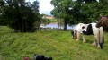
(19) Take the path immediately on the right, at the entrance to the Marais de Goulaine. Continue along this path to the village of L’Angle Essort, ignoring a road on the left. Keep to the left and pass in front of the “Les Roseaux de Goulaine” riding centre. Keep a moderate pace (at a walk) when passing this establishment and along the nearby pastures if there are horses. At the Stop sign, turn left.
(20) Take the first path on the right (the entrance to the gravel path runs alongside a pasture). At the end of the path, continue straight on along the village road. Pass two paths on the left and a house with its access road on the right.
(21) When you reach the first cluster of houses (La Bretêche), continue straight on, leaving the village on your right. Cross the vineyards; the paths are not always easy to spot. Continue for about 600 metres and take the path on the right heading south towards the hamlet of Les Renaudières without actually entering it.
(22) When you reach the road, turn left and, after about a hundred metres, before the first houses of the village of Pré Bassord, turn right and head south along Chemin du Champ Mellier; the spot is marked by a wooden telephone pole. Leave the village on your left.
(23) When you reach the junction with a road, turn left and, after 25 metres, cross the road at the recycling point (PAV), which consists of several containers, and take the path heading south. Continue along this path to the end (approximately 700 metres).
(24) Then turn left. When you reach the road, turn right, then take the first road on the left into the village of La Sédinière.
(25) Just before the houses, turn right and follow the path between the letterbox and the well. Walk through the vineyards. Continue for 80 metres, turn slightly left, then continue for 100 metres before turning right, heading towards the greenhouses in the distance.
(26) Once you reach the road, take the path straight ahead through the vineyards. Continue for about 100 metres and take the path on the left. Head towards La Guillonnière and follow the road to the right for about 100 metres.
(27) Turn immediately right (entrance to a Muscadet vineyard). A few metres further on, take the path on the left in front of the trees. Continue along the path to the road: then turn left and walk for about 200 metres.
(28) Turn right towards La Giraudière. Continue straight on towards La Butte de la Roche.
(29) At the junction, continue straight on (south-west). Note the marshes on the right.
(30) Once you have descended to the road, turn right and cross the Pont de Louen to return to the starting point (S/E).

 Association / Club / Walk leader
 Easy
Easy 

