


 Country:
 City:


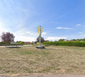
The route starts at the car park by Torvilliers Town Hall.
(S/E) As you leave the car park, turn right, then immediately left after the pedestrian crossing.
At the next junction, head straight ahead onto Rue du Château and turn left at the end.
(1) At the junction, take the path on the right between the two sheds and, at the end, turn left.
(2) Continue to the right to go up the bridge ramp.
(3) After the railway line, turn right until you reach the D660.
(4) Cross the D660 with care, veering slightly to the left towards the vineyards. Follow the path until you come to a tarmac track; take this to the right, then turn right again at the next junction onto a tarmac track through the vineyards and stay on this track.
(5) At the end of this, turn right, then immediately left. Cross the Montgueux road (D141) and continue straight on. Take thefirst path on the left leading up through the vineyards and, at the top of these, turn left again, keeping to the fence.
(6) Cross over towards the ‘Coupe de Champagne’ car park (a lovely viewpoint).
(7) Carry on past the cemetery, then take thesecond turning on the right, Chemin de la Fosse Mathieu. At the next fork, keep right. Stay on this path: watch out for a steep descent!
(8) At the bottom, turn left. Cross the Mesnil Vallon / Montgueux road (D141) with care. Follow the path opposite on the left, which climbs past the houses and across the meadows. When the slope levels off, turn right. Stay along the edge of the meadow, turning left as you go, until you reach the ridge.
(9) Continue to the right, skirting a woodland on your left, and pass in front of the old astronomical observatory. At the end of the path, cross a track and take the single track into the woodland that opens up ahead of you. Follow it to the water tower.
(10) Take the road on the right towards Macey. At thefirst bend, take the single track that opens up on the left. Follow it along the woodland and cross straight ahead at the first path. Shortly afterwards, you’ll come to a clearly marked woodland track on the right.
(11) Turn right and, at the bottom of the descent, follow the single track that opens up on the left. Follow a slope as it climbs into the woods and then descends on the other side. Continue to follow the single track, which is generally on the upper part of the slope.
(12) Just before heading back up into the woods, turn right and reach the edge of the woods.
(13) Turn left just before the edge of the woods and continue along the farm track at the edge of the woods until you reach the Route de la Grange au Rez.
(14) Carry on to the right, cross the D660 with care and continue along the road opposite. After a hairpin bend, turn left and follow the railway line on your right.
(3) Turn right to rejoin the bridge approach.
(2) At the junction at the foot of the ramp, carry straight on and take thefirst left.
(15) Continue along Grande Rue. Turn right onto Rue Gillet to reach Torvilliers Town Hall (S/E).



