


 Country:

 City:


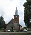
Park at Place Eugène Thomas, opposite the church and the town hall.
(S/E) Keeping the church and town hall on your right, set off along Rue de la République towards Poix-du-Nord. Cross Rue Victorien Cantineau (D934), continue straight on along Rue des Tuileries and walk past the cemetery.
(1) At the fork in the road, turn right onto the D86b, keeping the water tower on your left.
(2) At the Arbre de la Croix crossroads, turn left onto Rue du Quesnoy. Enter Poix-du-Nord, then turn right onto Rue Anatole France and immediately left.
(3) Take thefirst right onto Rue des Warennes (there’s a lovely washhouse on the right). Continue along Rue Pasteur and go straight on until you reach the church.
(4) Turn left onto Rue de l’Église. Walk past the town hall and carry on straight ahead along Rue de la Chasse, ignoring the side streets.
(5) At thesecond junction, carry on straight ahead onto Chemin Williot Res des Prés. Walk alongside the allotments and fields.
(6) At the end of the path, turn left along a stream.
(7) At the 141-metre mark, in the Poix woods, turn left onto Rue de Bousies.
(8) Enter Poix-du-Nord; after the chapel on your left, at the Fork in the road, continue to the right along Rue de Bousies. After 150 m, take thefirst right onto Rue de Wagnonville. Pass through the hamlet of Wagnonville, then pass an oratory on the right-hand side.
(9) Cross the Brunehaut local road (D932) and follow the long Chemin Brûlé.
(10) Just before the D934, turn right onto Rue du Quesnoy, towards Robersart. At the T-junction, turn left. At the next junction, first turn left then right – the (remarkable) church is on your right.
(11) At the town hall, carry on straight ahead along Rue de Landrecies. At the stop sign, ignore Chemin du Bois des Bouleaux on your left and carry on straight ahead.
(12) At the wayside cross, turn right. At the next junction, take a dirt track on the left.
(13) When you reach the tarmac road, turn right onto Rue du Chêne towards Fontaine-au-Bois. Carry straight on.
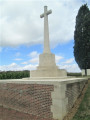
(14) At the end of the street, turn right. After about a hundred metres, turn left onto Rue du Pont. Carry on straight ahead until you reach the military cemetery, ignoring all side roads.
(15) At the junction just after the cemetery, turn left onto a path. At the next junction (marker 157), turn right towards the woodland via Rue du Cateau.
(16) Just past the Ferme du Nez Coupé, veer left onto the road and pass under a power line.
(17) At the Fork in the road at a place called La Forestière, take the left-hand track. You’ll reach the edge of the Bois l’Évêque and, straight away, turn left onto the path which stays in the undergrowth but runs along the edge of the woodland. Continue along the edge of the woodland, following several bends.
(18) You’ll come out onto a road; follow it to the left. Pass through the hamlet of Mal Garni.
(19) Take thefirst right after the hamlet, into Rue des Lignes. Turn left as the road bends and ignore thefirst path branching off to the left.
(20) At the next junction, turn left onto Rue Chemin Bourdon. At the next junction (marker 158), turn left onto Chemin Saint-Jacques. Cross a path running perpendicular to it and you’ll come to a T-junction.
(21) Then turn right onto Rue du Cateau. Carry straight on until you reach Rue de Landrecies.
(22) Turn right, then, at the corner of the sports ground, take thefirst left onto Chemin Dame Marguerite.
(23) At the end, take the D934 to the right for about 150 metres (beware of heavy traffic). Turn right and drive past the Notre-Dame de Grâce Chapel.
(24) At the end (memorial stone), follow the D934 to the left, then turn right onto Chemin du Loup. Carry straight on, ignoring all side roads.
(25) Enter the Mormal State Forest. At the barrier, take the path on the left, the Route Duhamel. Carry straight on, heading north-north-west.
(26) At the T-junction, first turn right then left and continue through the forest.
(27) At the crossroads, cross the Route de Preux. Pass the Maison Forestière de la Tenure and head towards the campsite. Turn left onto the track, then immediately right (barrier).
(28) After the campsite, turn right onto Laie des Brûlés and follow theGR®122(marked in red and white). Then turn left onto Route du Pont à Chiens (let theGR® continue straight ahead).
(29) At the end of the track, turn left onto the Route d’Hecq, then immediately right. Carry on straight ahead, north-north-west, ignoring all side paths, and cross the Ruisseau du Renard.
(30) Take thesecond path on the left after the stream. Ignore a path on the right and head towards the edge of the woodland. Please note: this section requires you to walk over a grating. Feel free to dismount and encourage your horse to follow you.
(31) Just before leaving the forest, turn right (north). Ignore a path on the left, then one on the right.
(32) Take a dirt track on the left to leave the forest. Ride straight on and, at the junction (elevation 147), turn slightly left. At the next junction, ride straight on.
(33) Follow Rue des Résistants to the right. Then turn left onto Rue Jean Jaurès and right onto Rue de l’Église. Turn left immediately onto Place Eugène Thomas. At the end, turn right to return to the starting point (S/E).


