Between Blaizac and Intres, around the Ruisseau de Gournier

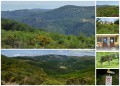
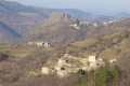
A walk that takes you through the picturesque village of Blaizac, crossing the Gournier stream and passing through a chestnut grove.

Details

1047108
Creation:
Last update:
Last review:
  • Walking
    Activity: Walking
  • ↔
    Distance: 3.65 mi
  • ◔
    Average duration: 2h 30 
  • ▲
    Difficulty: Moderate

  • ⚐
    Back to start: Yes
  • ↗
    Ascent: + 935 ft
  • ↘
    Descent: - 958 ft

  • ▲
    Highest point: 2,474 ft
  • ▼
    Lowest point: 1,798 ft

Photos

Description of the walk

Start in the village of Blaizac, near a hairpin bend on the western side.

(S/E) Head north-west, following the signposted route towards Intres. Descend and, after several bends, cross the Ruisseau de Gournier.

(1) Head back up and head north-east. Once you reach open ground, head north-north-west and join the road leading to Intres.

(2) Turn right and continue until you reach the second junction between the road and the track.

(3) Turn right, following the signposted track towards Blaizac. Walk alongside the Serre de Trémoulias on your left.

(4) At the crossroads, take the sharp right-hand bend and continue straight on downhill. Cross the Ruisseau de Gournier a second time at the Pont de Bois.

(5) Head back up towards the east.

(6) At the fork, veer to the right and begin a fairly steep, winding climb through the Bois de l’Eyraud. Reach Blaizac and turn right to return to the starting point (S/E).


Waypoints

  1. S/E : mi 0 - alt. 2,421 ft - Start: Blaizac
  2. 1 : mi 0.58 - alt. 2,139 ft - Ruisseau de Gournier (cours d'eau) - Affluent de l'Auzenet
  3. 2 : mi 1.28 - alt. 2,385 ft - Road, on the right
  4. 3 : mi 1.6 - alt. 2,260 ft - Road/path junction, on the right
  5. 4 : mi 2.13 - alt. 2,087 ft - Crossroads, on the right
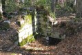
  6. 5 : mi 2.61 - alt. 1,824 ft - The Pont de Bois
  7. 6 : mi 2.79 - alt. 1,798 ft - Fork in the road, turn right
  8. S/E : mi 3.65 - alt. 2,418 ft - Return to Blaizac

Worth a visit

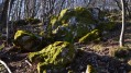
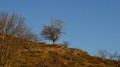
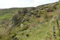
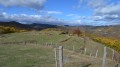
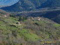
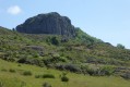
View of the Rocher d’Ajoux, the Gournier stream and the chestnut grove.

Reviews and comments

3.3 / 5
Based on 6 reviews

Reliability of the description
2.7 / 5
Ease of following the route
3.3 / 5
Route interest
3.8 / 5
Agnes2607
Agnes2607

Overall rating : 3.3 / 5

Date of your route : Apr 15, 2024
Reliability of the description : ★★★☆☆ Average
Ease of following the route : ★★★☆☆ Average
Route interest : ★★★★☆ Good
Very busy route : No

Hello
The start is poorly signposted; you need to head down to the bottom right. The route is 7.28 km long, not 5.87 km, and the elevation gain is 380, not 250. It’s a lovely walk but more challenging than expected. Several of the paths mentioned in the description don’t actually exist, so you end up taking a few slight detours. The end is tough, but even at the very start the climb is quite steep. A walk worth doing once. Thanks

Machine-translated

marcheur07
marcheur07

Overall rating : 3.3 / 5

Date of your route : Oct 13, 2019
Reliability of the description : ★★☆☆☆ Disappointing
Ease of following the route : ★★★☆☆ Average
Route interest : ★★★★★ Very good

Hello

It was a tricky start, given the description.
We parked at the bottom of the village, then headed towards the three-way junction, turning left to reach the top of the village. There’s a green transformer with a white and yellow Cross, and the start of a path that climbs a little before descending alongside cow pastures. When you reach a chestnut grove, turn right and head down to the river, where you’ll find yellow markings.
Follow the trail without any difficulty right back to the start.
In fact, the other possible starting point is in the village at the three-way junction, but on the right (sign for a rural lodge), which is signposted, then further on towards INTRES.
The walk was lovely; chestnut trees as far as the eye can see and beautiful autumn light. Not very difficult; we completed it in 1½ hours.

Machine-translated

yannis2607
yannis2607

Overall rating : 4 / 5

Date of your route : Aug 05, 2019
Reliability of the description : ★★★★☆ Good
Ease of following the route : ★★★★☆ Good
Route interest : ★★★★☆ Good

A lovely walk through the woodland, which is particularly pleasant in summer, especially during a heatwave! We did the route in reverse: that works very well too, and it means you avoid the climb at the end of the walk. On 4 August, there were still a few plants in bloom – circe, scabious, St John’s wort and willowherb at the highest points…

Machine-translated

gazok54
gazok54 ★

Thank you for bringing the difficulties you encountered on this walk to our attention.
We have sent a message to the author.

Machine-translated

lezet
lezet

Overall rating : 2.7 / 5

Date of your route : Apr 18, 2019
Reliability of the description : ★☆☆☆☆ Very disappointing
Ease of following the route : ★★★☆☆ Average
Route interest : ★★★★☆ Good

The vast majority of the description does not match the reality on the ground. Fortunately, the ‘return’ to the old signposting (yellow and white) and the compass enabled us to complete a circular walk.

Machine-translated

abert18
abert18

Overall rating : 2 / 5

Date of your route : Sep 17, 2018
Reliability of the description : ★★☆☆☆ Disappointing
Ease of following the route : ★★☆☆☆ Disappointing
Route interest : ★★☆☆☆ Disappointing

As is often the case in the Ardèche, this walk was made difficult by a very stony final climb. The route description is unreliable. I couldn’t find the hairpin bend, and the path signposted ‘Blaizac’ and ‘Intres’ isn’t the one that leads to the wooden bridge – which is actually made of stone.

Machine-translated

DURIVAL
DURIVAL

Overall rating : 4.3 / 5

Date of your route : Apr 21, 2018
Reliability of the description : ★★★★☆ Good
Ease of following the route : ★★★★★ Very good
Route interest : ★★★★☆ Good

A lovely spring walk when the chestnut trees haven’t yet put out their leaves, which gives you a wonderful view of the mountains.

Machine-translated

Other walks in the area

For more walks, use our search engine .

The GPS track and description are the property of this route's author. Please do not copy them without permission.