In the Lédonien region, explore the Val de Sorne

A walk on the outskirts of Lons-le-Saunier, through woods and meadows, featuring viewpoints and wine-growing villages. In the village of Montaigu, you can catch a glimpse of the childhood home of Claude Joseph Rouget de Lisle: the poet and author of *La Marseillaise* spent his childhood there, as well as several years from 1812 onwards (Chemin de Vatagna / Rue du 25 août 1944).
The ‘Solitaire’s Trail’ was created and is maintained by a single man!

Details

n°74480531
Creation:
Last update:
Last review:
  • Walking
    Activity: Walking
  • ↔
    Distance: 12.09 mi
  • ◔
    Average duration: 6h 50 
  • ▲
    Difficulty: Moderate

  • ⚐
    Back to start: Yes
  • ↗
    Ascent: + 1,526 ft
  • ↘
    Descent: - 1,509 ft

  • ▲
    Highest point: 1,736 ft
  • ▼
    Lowest point: 902 ft

Photos

Description of the walk

Car park at Macornay Stadium (Rue du Stade).

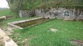
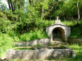
(S/E) Exit at the eastern end. Leave the road and turn left onto the ascending path, passing the first path on your left. At the 310-metre mark, continue straight on, following the beautiful low stone walls through the heart of the vineyards. Reach the 381-metre mark at the Lavoir de Tuile. Carry on for a few metres.

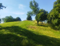
(1)Look out for a path on the right lined with low stone walls. This path does not appear on maps. Take this ‘Sentier du Solitaire’ and climb northwards. Pass a small track on the right and follow the main path up Mont des Tartres. Note the village of Montaigu on the right. You’ll reach a Fork in the road at the end.

(2)Take the path on the left, then turn right. Turn sharply right and descend to a track. Head right and enter the village of Montaigu. Pass the GR® 59 on your right, take the first street on the left, then the path on the right which leads to a viewpoint. Look out for a path behind you and follow it for about a hundred metres to reach a second viewpoint. Leave it via a short, narrow, barely marked path heading south-west and rejoin the main route. When you reach the road again, keep left towards the departmental road at Montaigu.

(3) Turn right, cross the village until you reach the 425-metre mark and the GR®59.

(4) Set off and head down to the right onto the GR®59. You’ll reach the Sorne golf course at the bottom of the descent.

(5) Turn left and, when you reach the clubhouse, turn left again onto the track, then onto a steep path opposite. At the top, turn right onto the path overlooking a vineyard, with the village of Moiron opposite. Continue along this track, crossing part of the golf course, until you reach the first houses in Vernantois. Leave the road on your left.

(6)At the crossroads, leave the GR®. Turn right, then left, and you’ll reach the church. An alternative route is possible here (see the practical information section).

(7) To the right of the church, look out for a path that climbs straight up (a very little-used and poorly maintained path, but passable). You’ll emerge onto the road at elevation 460. Follow the road uphill to the right, heading south-east, until you reach the sign for “Notre-Dame d’Auray viewpoint”.

(8) Climb up to the viewpoint, then head back down and turn left. Pass the 511 mark, turn right and head for the village of Bornay. Continue straight on to the centre of the village and the church.

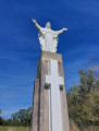
(9) Turn right, then slightly left to visit the Saint-Pierre-François Néron monument. After walking round it, return to the road, turn left, then immediately turn right and continue to a Fork in the road.

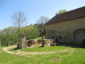
(10) Turn left twice and pass between the farm buildings. Cross the entire plateau. Leave a wide track on your right to reach a hairpin bend. 

(11) Take the path on the right, cross the road and head downhill. Turn left, then left again, and continue to the 425-metre mark at Les Baumes.

(12)Turn right. The path then veers left, then right. At the 456-metre mark (Les Baumes), take a short detour to the strange, isolated fault. Continue along the ridge until you reach the D156 (394-metre mark).

(13) Look out for the path below leading to the bottom of the valley. Descend to Moulin Boussot, where the Savignard stream flows. Continue along the right bank of the stream until you reach the road.

(14) Carry on straight ahead along the edge of the stream. Pass through a pretty hamlet and continue to the first houses in Macornay.

(15) At the crossroads, turn sharply right, then left. Follow Rue du Closeau, then Rue du Tram, and turn right onto Rue du Montreillien, continuing along it until you reach Route de Bellecombe.

(16)Turn right, then left onto Rue du Stade and head for the car park (S/E).

Waypoints

  1. S/E : mi 0 - alt. 909 ft - Macornay Stadium
  2. 1 : mi 0.82 - alt. 1,253 ft - Tuile wash house
  3. 2 : mi 1.23 - alt. 1,411 ft - Fork in the road Sentier du Solitaire
  4. 3 : mi 1.85 - alt. 1,322 ft - Montaigu
  5. 4 : mi 2.15 - alt. 1,398 ft - GR 59 Côte de la Doye
  6. 5 : mi 3.36 - alt. 984 ft - Sorne Golf Course
  7. 6 : mi 4.63 - alt. 1,129 ft - Vernantois
  8. 7 : mi 4.83 - alt. 1,165 ft - Church
  9. 8 : mi 5.5 - alt. 1,627 ft - Sign for Notre-Dame d’Auray
  10. 9 : mi 7.16 - alt. 1,621 ft - Bornay
  11. 10 : mi 7.87 - alt. 1,614 ft - Cemetery junction
  12. 11 : mi 8.91 - alt. 1,526 ft - Combelles hairpin bend
  13. 12 : mi 9.25 - alt. 1,394 ft - Les Baumes
  14. 13 : mi 10 - alt. 1,289 ft - D 156
  15. 14 : mi 10.55 - alt. 1,001 ft - Route to Vaux-sous-Bornay
  16. 15 : mi 11.34 - alt. 912 ft - Maisons, Rue du Vallon
  17. 16 : mi 11.87 - alt. 922 ft - Bellecombe Road
  18. S/E : mi 12.09 - alt. 906 ft - Macornay Stadium

Notes

Possible alternative at ( 7): from the church, stay on the main road (south). Continue along the roads on the right. A path cuts across the hairpin bend, continues uphill and crosses the road once more. Turn opposite and continue uphill to reach the route and the viewpoint. 

A few slightly tedious stretches of road, but you’ll soon forget them! The direct ascent from Vernantois church is a straightforward route. The alternative route is certainly worth considering.

Worth a visit

Parc des Bains in Lons-le-Saunier; the Jura vineyards.

In the village of Montaigu, you can catch a glimpse of the family home of Claude Joseph Rouget de Lisle – poet and author of *La Marseillaise* – where he spent his childhood and several years from 1812 onwards, at Chemin de Vatagna / Rue du 25 août 1944.

Always be cautious and plan ahead when you're outdoors. Visorando and the author of this route cannot be held responsible for any accidents occurring on this route.

The GR® and PR® markings are the intellectual property of the Fédération Française de Randonnée Pédestre.

Reviews and comments

5 / 5
Based on 1 review

Reliability of the description
5 / 5
Ease of following the route
5 / 5
Route interest
5 / 5
DROUILLOT
DROUILLOT
• Edited:

Overall rating : 5 / 5

Date of your route : Oct 16, 2025
Reliability of the description : ★★★★★ Very good
Ease of following the route : ★★★★★ Very good
Route interest : ★★★★★ Very good
Very busy route : No

This circular offers us a variety of beautiful discoveries through magnificent landscapes.
Good description.
The only technical difficulty is on the little-used path to the right of Vernantois church (7), where numerous trees cover the path and are sometimes difficult to get through. The alternative route allows you to avoid this.
To make sure you don't miss the isolated fault (12), look to the right into the charming undergrowth path!
Congratulations and thanks to the solitary individual who created and maintains the beautiful trail of the same name (1) and (2).
There is a picnic table in Macornay and Montaigu, as well as benches in the villages along the way and at the Notre Dame d'Airay viewpoint (8).
Many thanks to "Favrebrunj" for this interesting suggestion.

Machine-translated

Other walks in the area

For more walks, use our search engine .

The GPS track and description are the property of this route's author. Please do not copy them without permission.