Country:
 City:
City:


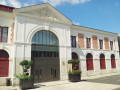
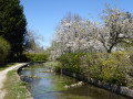
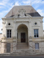
Car park in front of the Mer grain market, Avenue Maunoury.
Blue signposting: solid line, circle or triangle
(S/E) Head towards the station. Cross Rue de la Gare with care and make your way to the car park. Turn left, go through the tunnel under the railway lines and turn left again. Cross Rue Haute d’Aulnay at the pedestrian crossing slightly to the left and continue straight ahead.
(1) Turn right into the Parc de la Passerelle. At the Blue Triangle sign, turn left, continue facing the viaduct, then turn right to join Rue Basse d’Aulnay.
Follow the blue markings (solid line) again and pass under the viaduct. Turn left immediately to take a narrow lane until you reach Rue Jacques Bizeray. Cross the road with care (no pedestrian crossing), turn left, then take a narrow lane on the right and head towards the Tronne.
(2) Do not cross the footbridge but follow the Blue Triangle markings again until you reach Rue Toutevoie. Cross the road, carry on and turn right onto Rue Pierre Loison. Turn left.
Cross the D2152 at the pedestrian crossing with care, walk past the Parc de la Corbillière and follow the path alongside the swimming pool. Follow the Blue Triangle signposting for 100 m, then turn right to head off down the narrow side streets. Before reaching Chemin de Varenne, turn left, take another narrow side street and return to Rue Fortineau.
(3) Turn right, then turn left onto a path running parallel to Rue des Sources. Turn left to go round a block of houses, then left again until you reach Rue du Moulin Porte. Turn right, then left about fifty metres further on into Rue de la Fontaine. After the right-angle right-hand bend, take the path on the left which leads to a cul-de-sac joining Rue de Montcellereux.
Turn left, then immediately right onto the semi-circular Rue du Déversoir. At the end, turn left onto Rue de Montcellereux, then take the first left onto Rue de la Nuitrance. Head down to the water treatment plant (take a look at the mill), then continue through the woods to the D112.
(4) Cross with extreme caution (there is no pedestrian crossing) then take the cycle path on the left, which runs parallel to the road, to return to Mer. At the roundabout, turn right, go round the next roundabout on the right and continue straight on for about 300 m.
(5) Turn left to cross Rue du Goulet des Prés at the pedestrian crossing and take the path between the houses to reach Rue Marcel Paul. Cross this street and take the path opposite. At the square, head right; this leads to another square, which you should cross straight ahead to reach Rue Marcel Paul.
Turn left then right onto Rue Frédéric Chopin, enter the Parc des Revaux, cross it and come out onto Rue des Dorées. Follow this street to the left until you reach Avenue Charles de Gaulle. Cross at the pedestrian crossing set back to the right, then continue along Rue Jean Moulin. Cross Rue Barreau, then follow the narrow lane which leads to Rue de la Planche Croix.
Turn right, then right again, and enter Parc de la Corbillière. Walk up to the museum (well worth a visit) and admire the remarkable cedar tree (1869).
(6) Head right to walk back down towards La Tronne and leave the park. Walk up the D2152 to the right for a good hundred metres, then cross carefully at the church. At Place de l’Église, walk past the former gendarmerie and take a look at the coat of arms of Mer. Continue along the semi-pedestrianised Rue Jean et Guy Dutems.
(7) Turn right onto Rue Lenoir, take a narrow lane on the left, then turn left again at a right angle to join Rue de Pichots: be careful not to head back up Avenue du Maréchal Maunoury. Turn left again, then right onto Rue des Moines to rejoin the same semi-pedestrianised street.
Follow this street to the right, continuing along Rue Jean et Guy Dutems.
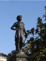
(8) At the end of Rue Dutemps, cross over towards a car park, turn right, admire the statue of the goddess Ceres, then cross the small square towards the market hall, following the signposts. Return to the car park (S/E).

 Visorando Member
 Moderate