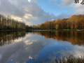
A walk in the Bois de Saint-Pierre

A short walk to help you discover the Bois de Saint-Pierre with its flora and fauna. Explore little-known paths and trails. It is a short stroll through a gently undulating countryside setting.

Details

n°111569759
Creation:
Last update:
Last review:
–
  • Walking
    Activity: Walking
  • ↔
    Distance: 2.25 mi
  • ◔
    Average duration: 1h 10 
  • ▲
    Difficulty: Easy

  • ⚐
    Back to start: Yes
  • ↗
    Ascent: + 138 ft
  • ↘
    Descent: - 141 ft

  • ▲
    Highest point: 384 ft
  • ▼
    Lowest point: 259 ft

Description of the walk

To reach the walk:

Take the Chaussée de Mons towards Ville-sur-Haine, go under the motorway bridge and take the second turning on the left towards Thieu. After 100 metres, turn left to park in the car park.
Via the Chaussée de Mons, heading towards Le Roeulx, take the first road on the right before the motorway bridge; after 10 m, turn left to park in the car park.
Via the E42 motorway towards Nimy – Brussels / Liège, take the exit towards the petrol station and park in the car park before the petrol pumps.
Via the E42 motorway towards Brussels / Liège – Nimy, take the exit towards the petrol station. Cross the car park and head towards Ville-Sur-Haine. Take the Chaussée de Mons on the left, go under the motorway bridge and take the second road on the left towards Thieu. After 100 metres, take the road towards the car park to park.

(S/E) On foot, head towards the car park exit, turn left onto Rue des Hauts Bois and, at the bend, continue straight on along the path that runs alongside the car park. At the end of the path, you’ll reach Rue du Château Saint-Pierre near the sewage treatment works.

(1) Carry on straight ahead along the path slightly to the left of the Thieu-Le Roeulx sewage treatment works.

(2) Follow the path as it turns right and crosses the Bois de Saint-Pierre. At the edge of the woods, turn right onto the path running alongside the Ruisseau Saint-Pierre; after about 200 metres, take the small bridge on the right which crosses the stream.

(3) Carry on to the right behind the barn at the Saint-Pierre farm to reach the start of Rue du Val Saint-Pierre.

(4) At the junction with Rue du Château Saint-Pierre, turn right, staying on Rue du Château Saint-Pierre, to reach the Thieu–Le Roeulx wastewater treatment plant.

(1) Take the path on the left which leads back to the starting point (S/E).

Waypoints

  1. S/E : mi 0 - alt. 384 ft - Motorway car park
  2. 1 : mi 0.46 - alt. 328 ft - Crossroads. Wastewater treatment plant
  3. 2 : mi 0.53 - alt. 341 ft - Bois de Saint-Pierre
  4. 3 : mi 1.09 - alt. 266 ft - Rue du Val Saint-Pierre
  5. 4 : mi 1.45 - alt. 344 ft - Rue du Château Saint-Pierre
  6. S/E : mi 2.25 - alt. 384 ft - Bois de Saint-Pierre

Worth a visit

(1) The name ‘Bois de Saint-Pierre’ probably derives from the historical presence of a place of worship, a chapel or land dedicated to Saint Peter in this area, which was once heavily wooded.

(3) The name Val Saint-Pierre derives from the geographical layout of the area (‘un val’, meaning a valley or hollow) and from a surname or a religious reference to Saint Peter.

(4) Rue du Château Saint-Pierre. Its name derives from the historical presence of Château Saint-Pierre (sometimes associated with a former quarry or a local seigneurial/geological site) and the proximity of landmarks dedicated to Saint Peter. This street forms part of the Way of St James.
At the junction, approximately 200 metres to the left, stood Château Saint-Pierre. It was not a medieval fortress, but a seigneurial residence and farmstead (often referred to as a ‘château-ferme’ or ‘country house’ in Hainaut place-name terminology). It was built in 1787. It was demolished in 1854 and rebuilt in 1829 by Count Gustave Visart de Bocarmé and his wife Isabelle Fontaine du Joncquoy. This family were originally from Tournai. The château housed a secondary school and was destroyed by the Germans in 1942.

This sewage treatment works, with a capacity of approximately 3,150 population equivalents, came into operation in 2014.

Other walks in the area

For more walks, use our search engine .

The GPS track and description are the property of this route's author. Please do not copy them without permission.