


Refine your search for walks in Église Notre-Dame de l'Assomption (Saulx-les-Chartreux)
Église Notre-Dame de l'Assomption (Saulx-les-Chartreux) walks


 The Bassin, the Plaine and the Forest of Saulx
 Visorando Member
 6.97 mi
 +358 ft
 -354 ft
 3h 30
3h 30
 Moderate
 Departure from Saulx-les-Chartreux (Essonne)
A varied route in a peri-urban setting, along rivers and streams and the Bassin de Saulx, and in the heart of the Rocher de Saulx departmental forest.
Please note! Work around the Bassin de Saulx means that the route has been changed at the end: follow the suggested alternative route.
Around the Yvette via Villebon and Saulx-les-Chartreux
 Association / Club / Walk leader5.85 mi
+157 ft
-157 ft
2h 50
Association / Club / Walk leader5.85 mi
+157 ft
-157 ft
2h 50
 Easy
Departure from Saulx-les-Chartreux (Essonne)
Easy
Departure from Saulx-les-Chartreux (Essonne)
This route follows thePR®10and 13 trails and the Promenade de l'Yvette. It has been chosen to avoid as much as possible the busy roads crossing the Basses Roches district in Villebon. Only the crossing over the A10 motorway via the viaduct is unavoidable, but it is short (200 m) and the pavement is wide. The rest of the route is pleasant along the Promenade de l'Yvette, the paths in the plain and around the Étang de Saulx-les-Chartreux.
Between Villebon-sur-Yvette and Saulx-les-Chartreux, following the Yvette
8.37 mi
+285 ft
-285 ft
4h 05
Moderate
Departure from Saulx-les-Chartreux (Essonne)
A very beautiful and fairly easy walk, stunning all along the Yvette, then a short steep climb on Rue des Bouleaux for 300 m and you’ll find yourself in the Gelles Departmental Forest. Overall, there’s very little walking on the road; it’s all on lovely paths, finishing around Lac de Saulx. You’ll see wild ducks and moorhens along the Yvette and also around the lake, along with swans and a few waders. If you like horses, you’ll also see several stud farms and occasionally riders. This is my Sunday jogging route.
Walks near Église Notre-Dame de l'Assomption (Saulx-les-Chartreux)
From Palaiseau to Orsay via the Bois des Gelles
 4.39 mi
+305 ft
-351 ft
2h 15
Easy
Departure from Palaiseau (Essonne)
4.39 mi
+305 ft
-351 ft
2h 15
Easy
Departure from Palaiseau (Essonne)
A short walk, urban at the start and finish, which, in between, combines a pleasant stroll along the River Yvette with wooded and undulating paths.
From the Yvette Valley to the Saclay Plateau
 7.08 mi
+315 ft
-335 ft
3h 30
Moderate
Departure from Palaiseau (Essonne)
7.08 mi
+315 ft
-335 ft
3h 30
Moderate
Departure from Palaiseau (Essonne)
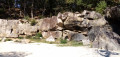
A hike from station to station that alternates between urban and forest passages. From the Yvette valley, we climb up to the Saclay plateau, where the university campus is constantly expanding. At the start of the descent, we visit an old sandstone quarry that has been converted into a climbing school.
From Palaiseau to Le Guichet via Vauhallan Abbey
 6.26 mi
+381 ft
-404 ft
3h 10
Moderate
Departure from Palaiseau (Essonne)
6.26 mi
+381 ft
-404 ft
3h 10
Moderate
Departure from Palaiseau (Essonne)
A walk from station to station that climbs up to the Saclay plateau, offering a striking contrast between the cultivated fields criss-crossed with drainage ditches and the ever-expanding university campus. A varied route with its share of ascents and descents.
 In the footsteps of the T12
14.28 mi
+276 ft
-299 ft
1.5 hrs
Moderate
Departure from Massy (Essonne) (Essonne)
This hike follows the route of the T12 tram-train, connecting Massy-Palaiseau to Évry-Courcouronnes, and allows you to discover a varied landscape combining urban areas, natural spaces and neighbourhoods undergoing rapid change. The route takes you along the greenway that runs alongside the T12, between Épinay-sur-Orge station and the Évry-Courcouronnes terminus, offering a pleasant and safe section for pedestrians and cyclists. This walk offers an immersion in the areas served by this new line, with opportunities to stop at the various stations to fully enjoy the local heritage and green spaces.
From Massy to Saint-Cyr-l'École via the Bièvre Valley
 15.09 mi
+476 ft
-233 ft
7h 20
15.09 mi
+476 ft
-233 ft
7h 20
 Difficult
Departure from Massy (Essonne) (Essonne)
Difficult
Departure from Massy (Essonne) (Essonne)
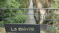
Second stage of the Grand Tour of Île-de-France via the GR®11, from Massy to Saint-Cyr l'École, behind Versailles.This stage, more bucolic than the previous one, consists of continuing up the Bièvre river in its valley, where it is almost entirely in the open air. Arriving near its source in Guyancourt, the GR® leaves the valley and continues towards Saint-Cyr-l'École.
Chemin Charles Péguy: overview
 58.91 mi
+1,775 ft
-1,549 ft
3 days
Difficult
Departure from Palaiseau (Essonne)
58.91 mi
+1,775 ft
-1,549 ft
3 days
Difficult
Departure from Palaiseau (Essonne)
This marked route follows as closely as possible the path taken by Charles Péguy in 1912 and then 1913 from his home in Lozère (Palaiseau) to Chartres, via Dourdan.
The walking route is 94 kilometres long and is marked with blue and white signposts.
The trail was created by the Amitié Charles Péguy association. It received support from the Eure-et-Loir General Council. Visorando was responsible for its first publication on the Internet.
Chemin Charles Péguy: Palaiseau - Saint-Cyr-sous-Dourdan
18.90 mi
+794 ft
-804 ft
7 hrs
 Very difficult
Departure from Palaiseau (Essonne)
Very difficult
Departure from Palaiseau (Essonne)
First of the four sections of the Charles Péguy Trail: Palaiseau-Chartres, via Dourdan.
It closely follows in the footsteps of the poet Charles Péguy, who made two pilgrimages in 1912 and 1913, each lasting four days there and back.
The Promenade de l'Yvette
 7.69 mi
+23 ft
-148 ft
3h 35
Moderate
Departure from Palaiseau (Essonne)
7.69 mi
+23 ft
-148 ft
3h 35
Moderate
Departure from Palaiseau (Essonne)
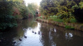
In a highly urbanised environment, this is a green space where you can relax and enjoy a pleasant walk along the Yvette river and the Bassins de Saulx and Balizy.
A hike from station to station with a shorter alternative for motorists.
From Massy to Palaiseau
 3.35 mi
+115 ft
-69 ft
1h 40
Easy
Departure from Massy (Essonne) (Essonne)
3.35 mi
+115 ft
-69 ft
1h 40
Easy
Departure from Massy (Essonne) (Essonne)
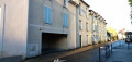
This third stage of the route serves as a transition between the official end of the green corridor and the Yvette valley. Although it is an exclusively urban route, by taking quiet paths it avoids the busiest parts of the bustling town of Massy.
Following the Orge from Sainte-Geneviève-des-Bois to Athis-Mons
 8.52 mi
+184 ft
-269 ft
4h 05
Moderate
Departure from Sainte-Geneviève-des-Bois (Essonne) (Essonne)
8.52 mi
+184 ft
-269 ft
4h 05
Moderate
Departure from Sainte-Geneviève-des-Bois (Essonne) (Essonne)
A hike from station to station that constitutes the last stage of this route along the Orge River, ending at its confluence with the Seine. Although the area is highly urbanised, the walkway along the river, which takes us back and forth across it, often offers a bucolic setting.