


Dumyat From University To Glen Road, Dunblane
Details
Creation:
Last update:
–
–
-
 Activity: Walking
 -
 Distance: 10.35 mi
 -
 Average duration: 6h 10
 -
 Difficulty: Not specified
 -
-
 Back to start: No
 -
 Ascent: + 1,624 ft
 -
 Descent: - 1,588 ft
 -
-
 Highest point: 1,358 ft
 -
 Lowest point: 125 ft
-
 Country:
United Kingdom
Country:
United Kingdom
-
 City:
Stirling
City:
Stirling -
 Start: N 56.149281° / W 3.91992°
 -
 End: N 56.185702° / W 3.965195°
 -


 Hour-by-hour weather


Waypoints
- S : mi 0 - alt. 128 ft - Start on
- 1 : mi 0 - alt. 125 ft - Turn left
- 2 : mi 0.11 - alt. 151 ft - Turn left
- 3 : mi 0.12 - alt. 171 ft - Turn right
- 4 : mi 0.19 - alt. 187 ft - Turn left
- 5 : mi 0.26 - alt. 197 ft - Keep right
- 6 : mi 0.46 - alt. 138 ft - Turn left
- 7 : mi 0.55 - alt. 213 ft - Turn right
- 8 : mi 0.56 - alt. 223 ft - Turn left
- 9 : mi 0.7 - alt. 390 ft - Turn left
- 10 : mi 0.79 - alt. 446 ft - Turn right
- 11 : mi 0.83 - alt. 463 ft - Keep left
- 12 : mi 1.53 - alt. 896 ft - Turn slight right
- 13 : mi 1.93 - alt. 1,138 ft - Keep right
- 14 : mi 1.97 - alt. 1,135 ft - Turn slight right
- 15 : mi 1.99 - alt. 1,142 ft - Turn left
- 16 : mi 2.06 - alt. 1,217 ft - Turn slight right
- 17 : mi 2.14 - alt. 1,283 ft - Turn slight right
- 18 : mi 2.25 - alt. 1,352 ft - Turn left
- 19 : mi 2.93 - alt. 725 ft - Turn sharp left
- 20 : mi 3.99 - alt. 778 ft - Turn left onto Sheriffmuir Road
- 21 : mi 5.09 - alt. 594 ft - Turn sharp right
- 22 : mi 5.39 - alt. 591 ft - Keep right
- 23 : mi 5.45 - alt. 584 ft - Turn slight right
- 24 : mi 5.78 - alt. 587 ft - Turn sharp left
- 25 : mi 6.2 - alt. 509 ft - Turn slight left
- 26 : mi 6.29 - alt. 518 ft - Turn right
- 27 : mi 7.19 - alt. 190 ft - Turn sharp right onto Upper Glen Road
- 28 : mi 7.45 - alt. 236 ft - Turn slight left onto Upper Glen Road
- 29 : mi 8.52 - alt. 328 ft - Turn slight left onto Glen Road
- 30 : mi 9.89 - alt. 246 ft - At roundabout, take exit 2 onto High Street, B8064
- 31 : mi 10.12 - alt. 197 ft - At roundabout, take exit 1 onto High Street, B8064
- 32 : mi 10.26 - alt. 180 ft - Turn right onto Stirling Road, B8064
- 33 : mi 10.3 - alt. 164 ft - Turn slight left onto Stirling Road, B8064
- E : mi 10.35 - alt. 184 ft
Other walks in the area
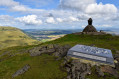
Dumyat Hill from Sheriffmuir
 Tourism professional
 3.85 mi
+761 ft
-761 ft
2h 25
3.85 mi
+761 ft
-761 ft
2h 25
 Moderate
Departure from Stirling
Moderate
Departure from Stirling
A straightforward route to the summit of Dumyat (418m / 1371ft) from Pendreich Forestry car park. It is the westernmost peak in the Ochils and on a clear day offers incredible views down to the city of Stirling, the River Forth and across to the Southern Highlands.
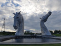
The Kelpies and locks
 Association / Club / Walk leader
 1.09 mi
+7 ft
-10 ft
0h 30
1.09 mi
+7 ft
-10 ft
0h 30
 Easy
Departure from Falkirk
Easy
Departure from Falkirk
This short wonder starts from The Helix car park and goes along the Forth and Clyde Canal Towpath to reach the impressive Kelpies horses statues! This is a family and push chairs friendly route.
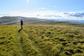
Glen Sherup Horseshoe, The Ochils
 9.86 mi
+1,982 ft
-1,978 ft
6h 15
Moderate
Departure from Perthshire and Kinross
9.86 mi
+1,982 ft
-1,978 ft
6h 15
Moderate
Departure from Perthshire and Kinross
Taking in the rolling summits of Innerdownie, Whitewisp Hill, Tarmangie Hill and – optionally – Ben Shee, this circular walk on the southern edge of Perth & Kinross is best experienced on a clear day when the views can be appreciated to their fullest.
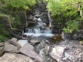
The Bracklinn Falls in Callander
 Visorando Member
 3.31 mi
+492 ft
-469 ft
1h 55
Easy
Departure from Stirling
3.31 mi
+492 ft
-469 ft
1h 55
Easy
Departure from Stirling
This walk is very easy and can be enjoyed with family.
Lower woods - Callander
 National Park1.68 mi
+220 ft
-223 ft
1h 00
Easy
Departure from Stirling
National Park1.68 mi
+220 ft
-223 ft
1h 00
Easy
Departure from Stirling
Enjoy a walk along an undulating path through this atmospheric mixed woodland to a viewpoint over the Mentieth hills.
The Glacier Trail
3.02 mi
+69 ft
-69 ft
1h 25
Easy
Departure from Stirling
Explore some of this area’s geology on the low-level glacier trail. It starts near the Roman Camp Hotel at the east end of Main Street and follows a short stretch of the River Teith.
For more walks, use our search engine .
The GPS track and description are the property of this route's author. Please do not copy them without permission.

