Country:

 City:
City:


On the Route Napoléon N85, near the Gap Bayard golf course, take the small tourist road to Col de Gleize, heading towards Col de Gleize – Les Lunels (wooden sign). Park at the Col de Gleize car park (13 km north of Gap).
(S/E) From the car park, head due south towards the start of the paths and take the one branching off to the right, heading south-west. Walk along the hillside through the forest until you reach the exit.
(1) At the edge of the woods, take the path along the hillside to the right until you reach another junction near a stream.
(2) Continue straight ahead, heading north-west, until you go round the hillock, then head south-west to reach the next junction (hard to see).
(3) Take the path on the left, the most visible one, which continues along the hillside. Double markings: round orange dots and Yellow Rectangles (PR®). Go round a small hill on the left, following a small valley, then cross the Torrent de Tavanet.
(4) At the junction in the forest, follow the path opposite (though the path on the left also leads to the Col de Guizière) and you will then reach a track.
(5) Leave the track and take the path opposite which climbs southwards. In this valley, the path is less visible as it is rarely used, but follow the Green Circle markings, keeping the valley floor on your left, until you reach the Col de Guizière.
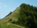
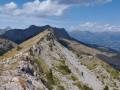
(6) At the pass, turn left onto the ridge path. It’s cattle-grazing terrain, but the route involves a series of ‘rollercoaster’ ascents and descents. Climb up to the Tête de Guizière.
(7) Descend on the other side, pass a small pass (elevation 1761m) and continue along the ridge to the Col de la Côte Gelée.
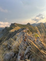
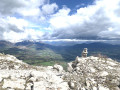
(8) At the pass, ignore the trailheads to the left and right and continue due north along the path running along the ridge line. Keep an eye out for the markings (yellow lines and dots) to ensure you stay on the best sections. The ridge walk is not recommended for those with a fear of heights, as there are a few tricky sections to reach the Pic de la Greysinière (cairn).
(9) After the peak, the path descends through pastures and then winds through the forest via numerous hairpin bends before reaching the “Le Tour de Folletière” track.
(10) Turn left until you reach the junction from the outward journey.
Turn right to reach the Col de Gleize car park (S/E).

 DANGER
 Visorando Member
 Moderate