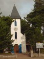
Discover the village of Quend and its hamlets (road cycling)

The commune of Quend is situated in the Marquenterre (land reclaimed from the sea). It boasts a beautiful view of the sea via Quend-plage: a vast beach where sand yachting is practised. It also comprises numerous hamlets, making it one of the largest communes in the Abbeville district.

Details

132092
Creation:
Last update:
Last review:
  • Mountain biking
    Activity: Mountain biking
  • ↔
    Distance: 18.94 mi
  • ◔
    Duration according to the author: 2 hrs 
  • ▲
    Difficulty: Moderate

  • ⚐
    Back to start: Yes
  • ↗
    Ascent: + 36 ft
  • ↘
    Descent: - 33 ft

  • ▲
    Highest point: 49 ft
  • ▼
    Lowest point: 13 ft
  • ⚐ Country: France
  • ⚐
  • ⚐ City: Quend (80120)
  • ⚑
    Start/End: N 50.322278° / E 1.554451°
  • ❏
    IGN map(s): Ref. 2106ET

  • ◶
    Type of surface:
  •  
     
     
     33% Road  34% Byway  33% Path
  • ⇧
    Bike carrying: Not specified
  • ▲
    Difficulty: Not specified
  • Hour-by-hour weather

Photos

Description of the route

Start from Quend beach at the tourist information office.

(S/E) Follow the cycle route along the D32d, heading east.

(1) At the end of the cycle path, turn left towards Routhiauville. Ride past this hamlet, continue north-east and cross the D32.

(2) Pass the ‘L’Asinerie’ donkey farm and carry on.

(3) At the Grande Retz farm, take the road on the left towards Le Muret. Go round the Petit Retz farm (strawberry greenhouses) on the right, then the Muret farm.

(4) Carefully cross the D940 towards Vieux Quend, cross the road and then turn left.

:5:: Carry on straight ahead, then turn right and then left.

(6) Turn onto the first road on the left, Rue des Peupliers, towards the old Quend railway station.

(7) At the old station, head towards Quend town via the D32c, heading west.

(8) Turn left onto Rue du Pont Gerville and carry on straight towards Hére-les-Quend.

(9) Make a U-turn to head back towards Quend town.

(10) Turn left and cross the D940, then the D32c. Go round the church square on the right and turn left onto Rue du Haut Gabet.

(11) Take the D32 on the left for 200 metres (caution: busy road).

(12) Turn right towards the Haut Gabet farm, where you turn left. Follow a stream, keeping it on your right-hand side, then on your left-hand side after a bridge. Continue along this road.

(13) At the three-way junction near Froise, turn right towards Saint-Quentin-en-Tourmont

(14) Near Saint-Quentin-en-Tourmont, turn right then left towards Quend Fort Mahon.

(15) Take the cycle path on the right towards Monchaux.

(16) At the D32d, rejoin the cycle path towards Quend Plage, heading west.

(17) Carry on, turning right before you reach the beach.

(18) Ride along the sea wall and turn left to reach the tourist information centre (S/E).

Waypoints

  1. S/E : mi 0 - alt. 46 ft - Quend beach at the tourist information centre
  2. 1 : mi 1.51 - alt. 23 ft - Turn left towards Routhiauville
  3. 2 : mi 2.72 - alt. 20 ft - Crossing the D32
  4. 3 : mi 3.72 - alt. 16 ft - La Grande Retz Farm
  5. 4 : mi 5.13 - alt. 23 ft - Crossing the D940
  6. 5 : mi 5.49 - alt. 20 ft - Turn left as you leave Vieux Quend
  7. 6 : mi 6.04 - alt. 16 ft - Towards the old Quend railway station
  8. 7 : mi 6.39 - alt. 16 ft - Former railway station
  9. 8 : mi 6.85 - alt. 16 ft - Turn left onto Rue du Pont Gerville
  10. 9 : mi 8.02 - alt. 16 ft - Turn back
  11. 10 : mi 8.74 - alt. 23 ft - Turn left
  12. 11 : mi 9.38 - alt. 20 ft - D32 on the left
  13. 12 : mi 9.55 - alt. 16 ft - Turn right towards the Haut Gabet farm
  14. 13 : mi 12.2 - alt. 16 ft - Turn right towards Saint-Quentin-en-Tourmont
  15. 14 : mi 12.86 - alt. 16 ft - Turn right towards Quend and Fort Mahon.
  16. 15 : mi 13.62 - alt. 16 ft - On the right: Cycle route on the right
  17. 16 : mi 15.91 - alt. 16 ft - Turn left onto the D32 d
  18. 17 : mi 18.15 - alt. 39 ft - Turn right before the beach
  19. 18 : mi 18.35 - alt. 30 ft - Seawall
  20. S/E : mi 18.94 - alt. 49 ft - Quend beach at the tourist information centre

Notes

Starting point for the cycle routes around the Baie de Somme.
Plenty of places to stop and get something to eat or drink.
Watch out for the wind.

Worth a visit

Situated near the famous Marquenterre Bird Park and Fort-Mahon, the area boasts a rich and interesting array of wild flora and fauna.
Chapels
Churches, chapels
Wells

Reviews and comments

4.5 / 5
Based on 2 reviews

Reliability of the description
4.5 / 5
Ease of following the route
4.5 / 5
Route interest
4.5 / 5
Buzzrando
Buzzrando

Overall rating : 5 / 5

Date of your route : Aug 03, 2020
Reliability of the description : ★★★★★ Very good
Ease of following the route : ★★★★★ Very good
Route interest : ★★★★★ Very good
Very busy route : No

A fairly windy flat route...

Machine-translated

brunodepierre
brunodepierre

Overall rating : 4 / 5

Date of your route : Apr 03, 2016
Reliability of the description : ★★★★☆ Good
Ease of following the route : ★★★★☆ Good
Route interest : ★★★★☆ Good

A lovely cycle ride offering the chance to explore the countryside around Quend Plage.
We set off from Quend town so that we could stop off halfway at Quend beach.

Machine-translated

For more walks, use our search engine .

The GPS track and description are the property of this route's author. Please do not copy them without permission.