From Tournaboup to the Refuge de l’Oule

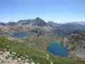
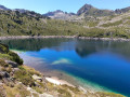
First day of a three-day circular route. The first section up to the Col de Madamète is quite stony and requires good footwear, but after that it is a real pleasure to walk past the magnificent Néouvielle lakes, which include, amongst others, Lac d’Aumar, Lac d’Aubert and Lac de l’Oule.

Details

93283928
Creation:
Last update:
Last review:
  • Walking
    Activity: Walking
  • ↔
    Distance: 11.18 mi
  • ◔
    Average duration: 8h 35 
  • ▲
    Difficulty: Very difficult

  • ⚐
    Back to start: No
  • ↗
    Ascent: + 3,921 ft
  • ↘
    Descent: - 2,743 ft

  • ▲
    Highest point: 8,225 ft
  • ▼
    Lowest point: 4,757 ft

Description of the walk

The Tournaboup car park is situated in the commune of Barèges 65120. When approaching from Lourdes, this large car park is a few kilometres past Barèges. When approaching from the Campan side, it is at the foot of the Col du Tourmalet. The road runs through this car park in both directions. Among other things, it is the starting point for several hikes.
Set off from the top of the car park, just above the ski school.

(S) Follow the GR®10 southwards.

(1) Cross the old Pont de la Gaubie road and carry straight on along the GR® towards the Col de Madaméte.

(2) At Le Pountou, ignore the path up to Lac Dets Coubous on the right and continue left towards the Col de Madaméte. Follow the Ruisseau d’Aygues Cluses. The path passes close to the Refuge d’Aigue-Cluses. This refuge is a good spot for a picnic and to top up your water flasks.

(3) Then continue to the right on the GR®10 towards the lakes and the Col de Madaméte.

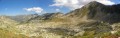
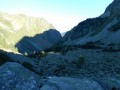
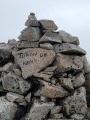
(4) At the Col de Madaméte, enjoy the magnificent 360° view. Then head down, following the GR®10 towards the Grands Lacs du Néouvielle (Lac d’Aumar, Lac d’Aubert, Lac de l’Oule).

(5) Pass the Col d’Estoudou and head down the GR®10 towards Lac de l’Oule.

(6) Once you reach Lac de l’Oule, head right towards the dam. Cross the dam. At the end of the dam is the Refuge de l’Oule, the finish point of the first stage (E).

Waypoints

  1. S : mi 0 - alt. 4,760 ft - Car park at - Tournaboup
  2. 1 : mi 0.67 - alt. 5,095 ft - Straight on along the GR10
  3. 2 : mi 1.65 - alt. 5,738 ft - Junction towards the Col de Madamète
  4. 3 : mi 3.86 - alt. 6,991 ft - Aigue-Cluses Refuge
  5. 4 : mi 5.48 - alt. 8,222 ft - Col de Madamète
  6. 5 : mi 9.39 - alt. 7,365 ft - Col d’Estoudou
  7. 6 : mi 10.44 - alt. 5,978 ft - Lac de l'Oule
  8. E : mi 11.18 - alt. 5,965 ft - Refuge de l'Oule

Notes

  • Take plenty of water with you. You can top up your supplies at the start in the car park (S), and then at the Aygues-Cluses Refuge (3).
  • Wear suitable footwear, as the section leading up to the Col de Madamète is very stony.
  • Bivouacking is prohibited throughout the Néouvielle area, exceptin a few authorised areas marked by a sign. For example, at the north-eastern end of Lac de l’Oule, there is an area where bivouacking is permitted.

This route passes through a protected area, which may be subject to special regulations:

Worth a visit

Make the most of the route as it passes close to the magnificent lakes.

Always be cautious and plan ahead when you're outdoors. Visorando and the author of this route cannot be held responsible for any accidents occurring on this route.

The GR® and PR® markings are the intellectual property of the Fédération Française de Randonnée Pédestre.

Other walks in the area

For more walks, use our search engine .

The GPS track and description are the property of this route's author. Please do not copy them without permission.