Country:
 City:
City:


Park near the school, in the car park on Place du 19 mars 1962, alongside the D7 and on the outskirts of Saint-Jean-de-Ceyrargue when approaching from the north.
(S/E) Leaving the car park, take the D2 on the left and follow the footpath to the village. Turn left and enter the village. Turn left in front of the church, pass the town hall and continue along Rue Jean Caplat. Carry on through the woodland along the path that leads downhill.
(1) Turn left immediately to follow a path that will take you back up towards the school and the D7.
(2) Before you get there, turn right onto a dirt track and head towards a three-way junction.
(3) Turn left onto another dirt track bordered by woodland on one side and olive trees on the other. You’ll come to a crossroads.
(4) Turn right onto the track, which will remain through the woodland for a short while.
(5) Turn left and continue along the path which crosses a landscape of open farmland, vineyards and woodland. Carry on for a long way along this main path, ignoring the side paths on either side. Cross a small, dry stream and continue until you come out onto a small road.
(6) Follow this road to your left and carry on to the next junction.
(7) Take the road on your right and continue until you reach a T-junction.
(8) Turn right and enter the newer part of the village of Saint-Cézaire-de-Gauzignan. When you reach the junction with Rue Basse, first turn right then left to reach the town hall square in the old part of the village.
(9) Head up to the right along the Grand Rue, pass the Place des Quatre Vents and carry on straight ahead until you reach the last houses.
(10) Leave the road and take a path on the left, continuing through vineyards and farmland. You’ll rejoin the D191A, the road you left earlier.
(11) Follow it to the right, then take the hairpin bend to the left towards Gaillard.
(12) Turn right, ignoring the path branching off to the left. Immediately keep left and follow the path as it climbs:you’ll have lovely views of the Cévennes to your left.
(13) As you leave the olive grove, take the track to the right, then left. You’ll soon enter the woodland and, once at the edge, head right.
(14) Turn left and continue along the same path for some time until you reach the D391.
(15) Follow it to the right, taking care. Then leave it by turning right towards the sewage treatment plant, which you should leave further on to your right. Continue straight on
(16) Head left to follow the path which leads back up to the village.
(1) Carry on straight ahead towards the town hall: a short detour is possible by turning left further on if you do not wish to retrace your steps exactly. Once at the town hall, join the D7 and head to the right to follow the pavement to the car park (S/E).
 Visorando Member

 Difficult
 Local authority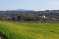
 Easy
Easy