Country:
 City:
City:


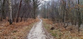
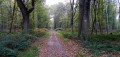
Off the marked trail
(S) At Maisons-Laffitte station, take the Pont Jean Monnet exit. On the footbridge, turn right, walk past the tourist office, then go round the building on the right, past the equestrian statue, and cross the Place du Maréchal Juin towards the railway lines.
(1) Take Rue Guynemer, which runs alongside the tracks towards the Seine, until you reach Rue du Mesnil. Turn left, then take thefirst street on the right (Rue du Bac). After a left-hand bend, turn right onto Sentier aux Vaches to reach the banks of the Seine.
(2) Turn right onto Rue de la Digue, go under the railway bridge, then join the dirt track on the left-hand side which runs alongside the Chemin de la Digue for about 1 km, before joining the tarmac path for the final sixty metres.
(3) Continue along the Seine via the Chemin l’Île Laborde (signposted ‘Dead end’).
(4) Enter the communal meadow known as Les Prés du Marais (information sign). Ignore the path branching off to the right and continue between the Seine and the nature reserve’s fence. Carry on along this fence, which curves to the right, then leave it after a few metres to join the path heading to the left of the houses. Climb the steps opposite, then take Rue de Seine up to Rue Jules Rein. Cross this road and head up Rue des Poilus on the opposite side. At the next junction, turn left onto Chemin des Sablons, which runs along a balcony-like path before reaching some agricultural greenhouses. Turn right after the greenhouses, pass between the houses to reach Rue du Général Leclerc (high stone retaining wall). Cross the street, then walk down the pavement for a few metres until you reach the opening in the wall.
(5) Enter the woodland. Continue straight on until you reach a wide path coming from the right, bordered by a stone wall. Take this path to the left until you reach thesecond junction (Étoile de Vaux).
GRP® (red and yellow markings)
(6) Take the Route de Bourbon (4th path on the right). At the next junction, turn left, then carry on straight ahead at the next two crossroads until you reach a Fork in the road. Take the right-hand fork, then pass the first junction.
(7) Cross the Avenue cavalière de la Muette (two parallel lanes separated by a tree-lined mound) before reaching a T-junction. Turn left onto Route de la Grille Royale. Pass the first set of junctions to reach the Étoile de la Porte Verte. Go round it and carry on straight ahead on the same road, towards the Château du Val. Cross the Route de Branca, then walk alongside the château buildings.
(8) Walk past the castle gate, go down a wide flight of steps to the Route de Maisons-Laffitte. Cross the road. Take the path opposite, which quickly turns right and then, a little further on, left. At the junction, carry on straight up the hill. At the next junction, turn right to reach a car park. Turn left, pass through the entrance gate to the Grande Terrasse of the Château de Saint-Germain-en-Laye. Turn right to walk alongside the terrace for about 80 metres (there is a wide opening in the fence running alongside the terrace).
Unmarked section
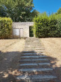
(9) Leave the GRP® and stay on the terrace. Continue straight on for 800 metres (staircase on the right-hand side, see photo).
(10) Go up the stairs, go through the gate and continue straight ahead along the Route du Petit Parc (path). Continue straight on until you reach the Route de Maisons-Laffitte. Cross it and carry on in the same direction until you reach the Étoile du Petit Parc. Take thesecond path on the right, Route de Notre-Dame du Bon Secours, pass the Étoile Caroline and carry on straight ahead until the next junction.
(11) Turn left (note the green arrow on a white background on a small post).
GRP® (red and yellow markings)
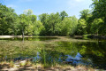
(12) At the next junction, turn left, then right after about sixty metres. Continue straight on to the Mare aux Canes (information sign).
(13) Walk round the pond on the left-hand side. Once you reach the point opposite the information sign, go down the small hill to join the Route de la Vierge. Follow it to the right until the next junction, then turn left. Continue straight on until you reach the Avenue des Loges. Turn right onto the D184, cross it (a series of pedestrian crossings with traffic lights), then turn left. Cross the access roads to the Maison d’Éducation de la Légion d’Honneur (and the Fête des Loges from late June to mid-August) to reach, at the edge of the forest, the Route de la Mare aux Cannes (a wide, dusty track). Continue straight on, pass the Étoile Richelieu and carry on to the next crossroads, Étoile Sainte-Anne (with an oratory on the left).
Unmarked route
(14) Take thefourth path on the right, Route de la Justice. Cross four paths, then the Route Vieille de Poissy (tarmac road) before entering the Parc Forestier de la Charmille. Continue in the same direction until you reach the wall; turn right and follow it for a few metres until you reach the park’s exit.
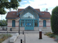
(15) Walk along the left-hand side of the car park, then turn left again onto Rue de la Bruyère. After 200 metres, take the underpass on the right, then turn left onto Rue de la Justice. Continue until you reach Avenue du Maréchal Foch. Cross it, turn left, cross Boulevard Gambetta and continue straight ahead until you reach Avenue Fernand Lefebvre. Turn right, then walk briefly along Avenue Victor Hugo until you reach the pedestrian crossing. Cross opposite the octagonal pavilion (the former customs house).
(16) Turn right onto Rue du Général de Gaulle. Cross Rue Michel Jeunet, then Boulevard Devaux (pedestrian crossing on the right), Boulevard de Paix and Rue Jean-Claude Mary, until you reach the junction between Rue Saint-Louis and Avenue Maurice Berteaux. Cross the avenue (pedestrian crossing on the right), then walk along the pavement opposite, beside the trees. Turn left immediately to go under the railway footbridge and continue until you reach the platform access.
(17) From here, you can reach the platforms at Poissy station (RER A towards Paris and line J between Mantes-la-Jolie and Paris Saint-Lazare). Walk to the pedestrian crossing, cross the two tracks towards the Seine, then turn left onto the pavement, walking alongside the building on the corner, to reach the tree-lined promenade between the Seine and the Cours du 14 Juillet. Follow it along the Seine. When you emerge from the trees, turn left then immediately right onto Avenue Émile Zola.
(18) Follow the avenue to the bridge leading to the Île de Migneaux. Continue in the same direction along the Chemin du Bord de l’Eau, then the Chemin des Pêcheurs at the entrance to the town of Villennes-sur-Seine.
(19) Pass under the railway bridge, then head up Chemin de la Sourde. Take thefirst street on the right, Rue des Iselles, until you reach Rue de Poissy. Continue in the same direction for about a hundred metres, then turn right onto Avenue Georges Clémenceau. After the shops, pass under the market hall.
(20) Walk past Saint-Nicolas Church, then turn right, facing the station. You will arrive at Villennes-sur-Seine station (E).

 Visorando Member

 Easy
Easy 
 Association / Club / Walk leader