From Linas to Luzençon

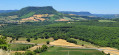
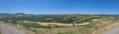
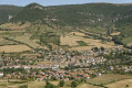
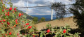
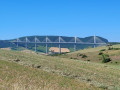
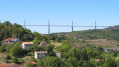
From the banks of the Cernon to the hilltop at Luzençon, an idyllic walk crowned by an exceptional 360° view of the Millau Viaduct, the village of Saint-Georges, the Larzac and the Lévézou mountains

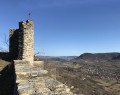
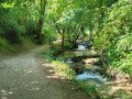
Luzençon, built on a hilltop opposite the village of Saint-Georges, is – with its12th-century castle chapel and magnificent panorama – the highlight of this refreshing, countryside walk. The walk passes through two other hamlets, Linas and Crayssaguet, and reveals all the charm of the Cernon Valley, a left-bank tributary of the Tarn

Details

39269385
Creation:
Last update:
Last review:
  • Walking
    Activity: Walking
  • ↔
    Distance: 5.16 mi
  • ◔
    Average duration: 3h 05 
  • ▲
    Difficulty: Easy

  • ⚐
    Back to start: Yes
  • ↗
    Ascent: + 791 ft
  • ↘
    Descent: - 791 ft

  • ▲
    Highest point: 1,916 ft
  • ▼
    Lowest point: 1,122 ft

Photos

Description of the walk

SNCF station car park, Saint-Georges-de-Luzençon.

(S/E) Follow the left bank of the Cernon towards Linas. At the first bridge, cross the stream and you’ll come to a Fork in the road.

(1) Turn left. Follow the road until you reach a second bridge, which you must cross. The road, keeping to the left at all times, leads to the pretty hamlet of Linas. 

(2) In the village, take the path to the right of the stone cross, then leave it 100 metres further on to follow the path on the left which passes in front of a farm shed and climbs up to cross over a field. When you reach the first junction, take the path to the right, then carry on straight ahead, and, on level ground, join a wider track which you should follow to the left. Carry on straight ahead all the way to Crayssaguet.

(3) Walk through the hamlet until you reach a sheepfold, which you should walk alongside to rejoin a dirt track. Once you reach a field, follow the track on the left up to the road.

(4) Cross the road and take the track leading uphill opposite, to the entrance to the hamlet of Luzençon. Turn left, then immediately right, onto the road leading to the top of the hill (splendid views over the Causses and the surrounding valleys, with a survey table). After the third hairpin bend, take the path leading uphill to the left towards the Chapel of Luzeron.

(5) Head back down the same path to the road, passing through the hamlet’s typical narrow streets, then turn left, then left again onto the path leading to Saint-Georges-de-Luzençon. There’ s a magnificent stone fountain to see along the way. Turn right on reaching the village, then go straight on and turn right to reach the railway line. Cross the railway line, then turn left before the river to return to the station. (S/E)

Waypoints

  1. S/E : mi 0 - alt. 1,155 ft - SNCF station - Cernon (rivière)
  2. 1 : mi 0.65 - alt. 1,148 ft - Fork in the road - Cernon (rivière)
  3. 2 : mi 1.32 - alt. 1,152 ft - Linas
  4. 3 : mi 2.66 - alt. 1,532 ft - Crayssaguet
  5. 4 : mi 3.6 - alt. 1,647 ft - Route
  6. 5 : mi 4.04 - alt. 1,906 ft - Luzeron Chapel
  7. S/E : mi 5.16 - alt. 1,155 ft - SNCF station - Cernon (rivière)

Notes

Public transport.
To find transport options, visit Transport Aveyron; Réseau LIO; SNCF; Hérault Transport
Consider carpooling or hitchhiking via Rezopouce; carpooling meet-up points.

Parking: car park at the SNCF station, Saint-Georges de Luzençon.

You can collect the key to the Saint-Martial Chapel in Luzençon from Saint-Georges-de-Luzençon Town Hall, tel: 05 65 58 41 00

Worth a visit

Saint-Martial Chapel in Luzençon.
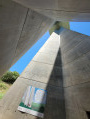
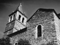
Typical of the local Romanesque architecture, this castle chapel was built at the end ofthe 11th century, and its pentagonal apse was rebuilt inthe 12th century. The last bay serves as a burial chamber. In the17th century, the chapel was opened to the public and weddings were held there. The apse, facing due east, symbolises the ever-resurrected sun, identified with Christ.

Reviews and comments

4.4 / 5
Based on 4 reviews

Reliability of the description
4.3 / 5
Ease of following the route
4.3 / 5
Route interest
4.5 / 5
GOGO
GOGO

Overall rating : 4.5 / 5

Date of your route : Jun 15, 2026
Reliability of the description : Not used / Not applicable
Ease of following the route : ★★★★☆ Good
Route interest : ★★★★★ Very good
Very busy route : No

A lovely walk with breathtaking views. The view from the chapel is magnificent. There are no particular difficulties, apart from a short climb that really works the calves before you reach the village, which is absolutely beautiful.

Machine-translated

Elrob
Elrob

Overall rating : 4 / 5

Date of your route : Nov 10, 2025
Reliability of the description : ★★★★☆ Good
Ease of following the route : ★★★★☆ Good
Route interest : ★★★★☆ Good
Very busy route : No

An easy, short walk with little elevation gain and magnificent views from the orientation tables near the Luzencon chapel.

Machine-translated

User 18088374

Overall rating : 4.3 / 5

Date of your route : Aug 14, 2025
Reliability of the description : ★★★★☆ Good
Ease of following the route : ★★★★☆ Good
Route interest : ★★★★★ Very good
Very busy route : No

A very pleasant hike combining roads, sheltered paths and open sunshine.
Best done in cool weather.
There was just one problem between the 3rd and 4th km where we turned left, but definitely too far, and ended up climbing a steep path, even though we were following the yellow markings. Not suitable for children. So make sure you follow the directions given by Visorando to get on the right road.
The view once you reach the chapel is magnificent.
Take the opportunity to breathe in the fresh air, it's fantastic.

Machine-translated

Emdoulila
Emdoulila
• Edited:

Overall rating : 4.7 / 5

Date of your route : Jan 06, 2025
Reliability of the description : ★★★★★ Very good
Ease of following the route : ★★★★★ Very good
Route interest : ★★★★☆ Good
Very busy route : No

A lovely little walk with some beautiful views. It’s easy, though there are a few climbs that’ll – just a bit – work your muscles.
Watch out for a section covered in slush after it’s rained!

Machine-translated

Other walks in the area

For more walks, use our search engine .

The GPS track and description are the property of this route's author. Please do not copy them without permission.