From Dieppe to Saint-Martin-Plage (Petit Caux) via the GR®21

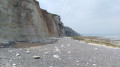
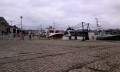
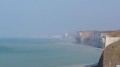
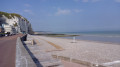
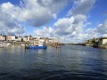
Morning of the7th stage, setting off from Dieppe to reach Petit Caux.

This walk is part of a multi-day hike: Du Havre au Tréport par le GR®21

Details

23166015
Creation:
Last update:
Last review:
  • Walking
    Activity: Walking
  • ↔
    Distance: 6.81 mi
  • ◔
    Average duration: 3h 45 
  • ▲
    Difficulty: Moderate

  • ⚐
    Back to start: No
  • ↗
    Ascent: + 699 ft
  • ↘
    Descent: - 528 ft

  • ▲
    Highest point: 331 ft
  • ▼
    Lowest point: 7 ft
  • ⚐ Country: France
  • ⚐ City: Dieppe (76200)
  • ⚑
    Start: N 49.927344° / E 1.085755°
  • ⚑
    End: N 49.966304° / E 1.193921°
  • ❏
    IGN map(s): Ref. 2008OT
  • Hour-by-hour weather

Photos

Description of the walk

(S) From the Colbert Bridge, follow the Quai de la Marine for 200 m.

(1) Turn right into an uphill cul-de-sac, take the steps onto Chemin de Labastille. At the top, turn left onto the path along the cliff top and you’ll come out in front of Notre-Dame de Bonsecours.

(2) Continue along the tarmac road, Chemin des Falaises, then at the end of the street, carry on straight ahead along the path that runs like a balcony alongside the road cutting leading to the ferry terminal.

(3) Walk up alongside the RD113 (Avenue des Canadiens), then turn left and walk for about 350 metres.

(4) Turn left onto the footpath which crosses a residential area and descends via a flight of steps to a small square by the sea.

(5) Climb back up the cliff via the Chemin du Camp de César and continue due east across the plateau.

(6) Before the end of the path, turn left and then immediately right. Pass north of Braquemont and join the RD113. Walk carefully along the roadside verge.

(7) At the next junction at the entrance to Belleville, turn left onto Rue des Beaux Horizons and follow it almost to the end.

(8) Turn left onto Rue des Embruns. At the end of the street, the tarmac gives way to a track that descends steeply towards the Val du Prêtre.

(9) Once you reach the road, walk down for less than 100 metres (access to the pebble beach is a little further down) and head back up to the right along the cliff. At the top, the path turns right then left and leads to the school in Berneval-le-Grand.

(10) Turn left onto Rue du Plain Marché to go round the village to the north.

(11) At the start of the descent, turn right onto the path which leads to Avenue Rauss. Continue along this road as it descends until you reach a picnic area on the right (E).

Waypoints

  1. S : mi 0 - alt. 20 ft - Colbert Bridge
  2. 1 : mi 0.08 - alt. 23 ft - Arques (fleuve)
  3. 2 : mi 0.38 - alt. 121 ft - Notre Dame de Bonsecours
  4. 3 : mi 1.02 - alt. 177 ft - Avenue des Canadiens
  5. 4 : mi 1.23 - alt. 174 ft - Coastal path
  6. 5 : mi 1.53 - alt. 30 ft - Water sports centre
  7. 6 : mi 2.19 - alt. 213 ft - Camp César
  8. 7 : mi 3.89 - alt. 308 ft - Rue des Beaux Horizons
  9. 8 : mi 4.32 - alt. 322 ft - Rue des Embruns
  10. 9 : mi 5.04 - alt. 75 ft - Route du Val du Prêtre
  11. 10 : mi 6 - alt. 331 ft - Berneval School
  12. 11 : mi 6.57 - alt. 289 ft - Towards Avenue Rauss
  13. E : mi 6.81 - alt. 167 ft - Picnic area

Notes

Red and white GR® signposting.
(S) All amenities available in Dieppe.
(10) A 500-metre walk leads to the village of Berneval, with a small convenience shop at the roundabout where the RD113 meets Rue Pasteur.
(E) Another picnic spot without shade a little further down the esplanade, with benches facing the English Channel.

Worth a visit

(S) The Pollet district of Dieppe.
(9) Access to the pebble beach is possible depending on the tide.

Always be cautious and plan ahead when you're outdoors. Visorando and the author of this route cannot be held responsible for any accidents occurring on this route.

The GR® and PR® markings are the intellectual property of the Fédération Française de Randonnée Pédestre.

Reviews and comments

4.3 / 5
Based on 4 reviews

Reliability of the description
4.5 / 5
Ease of following the route
4.5 / 5
Route interest
4 / 5
User 13537896

Overall rating : 4.3 / 5

Date of your route : Jul 13, 2026
Reliability of the description : ★★★★☆ Good
Ease of following the route : ★★★★☆ Good
Route interest : ★★★★★ Very good
Very busy route : No

A small correction to the description: the route is 17km, not 10km.
A magnificent walk starting from my home in Dieppe.
In the Val du Prêtre: flora and fauna very typical of the Normandy coast.

Machine-translated

User 9041296

Overall rating : 4.7 / 5

Date of your route : Jul 15, 2025
Reliability of the description : ★★★★★ Very good
Ease of following the route : ★★★★★ Very good
Route interest : ★★★★☆ Good
Very busy route : No

Aaa

Machine-translated

MIPO
MIPO

Overall rating : 4.3 / 5

Date of your route : Dec 23, 2024
Reliability of the description : ★★★★☆ Good
Ease of following the route : ★★★★☆ Good
Route interest : ★★★★★ Very good
Very busy route : Yes

A lovely walk on the way there, but the return journey was less interesting

Machine-translated

Flofloflo
Flofloflo

Overall rating : 4 / 5

Date of your route : Apr 06, 2024
Reliability of the description : ★★★★★ Very good
Ease of following the route : ★★★★★ Very good
Route interest : ★★☆☆☆ Disappointing
Very busy route : No

Please note: the Colbert Bridge in Dieppe is closed if you’re arriving by train
Next, a coastal path that’s not very coastal at all

Machine-translated

Other walks in the area

For more walks, use our search engine .

The GPS track and description are the property of this route's author. Please do not copy them without permission.