


You can walk there and back or go one way and return by boat (€5/person in July 2025).
From Chora Sfakion to Loutros


Very pretty route along the coast from Chora Sfakion to Loutros.
Passes through pretty coves and turquoise beaches, with a beautiful view of the village of Loutros on arrival.
The first part from Chora Skafion is on the road, but then a pretty trail awaits you.
There are a few technical sections with pebbles, but overall it's a fun hike. Make sure you wear good shoes.
Details
Creation:
Last update:
Last review:
–
–
-
 Activity: Walking
-
 Distance: 4.19 mi
-
 Average duration: 2h 20
-
 Difficulty: Moderate
-
-
 Back to start: No
-
 Ascent: + 1,312 ft
-
 Descent: - 1,325 ft
-
-
 Highest point: 397 ft
-
 Lowest point: 7 ft
-
 Country:
Greece
-
 Start: N 35.201841° / E 24.135076°
-
 End: N 35.200424° / E 24.079264°
-


 Hour-by-hour weather
Waypoints
- S : mi 0 - alt. 49 ft
- E : mi 4.19 - alt. 36 ft
Notes
Other walks in the area
From Hora Sfakion to Loutro
 Visorando Member5.35 mi
+1,946 ft
-1,936 ft
4h 10
Moderate
Departure from Greece
An exceptional coastal walk. The path is well-marked and clearly signposted. There are a few inclines, but nothing too steep, with one slightly dizzying and unsecured section (just take care). You’ll arrive in Loutro, a peaceful, traditional seaside village that’s simply magnificent.
From Chora Sfakion to Loutro
2.81 mi
+896 ft
-1,161 ft
2h 05
Moderate
Departure from Greece
A superb walk along the coast with the option of stopping several times along the way to swim. Bring plenty of water as the walk is in direct sunlight.
You can return the same way or by boat
Descent of the Imbros Gorge
 3.77 mi
+207 ft
-2,149 ft
1h 55
Moderate
Departure from Greece
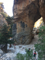
Less well known but also less crowded and more shaded than the Samaria Gorge, the Imbros Gorge offers a beautiful descent almost to the Libyan Sea.We did this descent in the middle of August on a fairly hot day and didn't suffer from the heat at all, as we left at 8:30 a.m. and spent 80% of the time in the shade.The descent took us two hours, taking our time (photos).The descent costs €10 per person (there is a small hut at the start of the descent with someone there)and the taxi back up costs €25.
From Aghia Roumeli (Αγια Ρουμελη) to Loutro (Λουτρό)
 9.13 mi
+1,890 ft
-1,880 ft
5h 50
Moderate
Departure from Greece
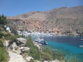
A hike that starts at the bottom of the Samaria Gorge in Agia Roumeli. There are opportunities for a swim at the start of the route and at Agios Pavlos (3 km in), then at 13 km, at the end, at Marmara and Loutro.
Samaria Gorge from Xyloskalo to Agia Roumeli
8.90 mi
+4,167 ft
-8,241 ft
7h 45
 Difficult
Departure from Greece
A must-do hike in Crete, the Samaria Gorge offers spectacular scenery in the heart of the national park of the same name. The trail starts at Xyloskalo (1,250 metres above sea level) and descends to the coastal village of Agia Roumeli, following an impressive 16-kilometre canyon.
The route is very well marked: just follow the descent along the entire route. The start is the most demanding part, with a steep and sometimes slippery slope; handrails have been installed to make it easier to progress. The path then alternates between pine forests, rocky passages and river crossings, before reaching the narrowest part of the gorge, which is only a few metres wide.
Throughout the journey, several clearly marked checkpoints allow you to measure your progress and find places to rest. The arrival in Agia Roumeli, on the shores of the Libyan Sea, rewards your efforts with the opportunity to swim and enjoy the village's taverns.
The Kakomouri to Plakias circuit via the ridges
 4.46 mi
+646 ft
-643 ft
2h 35
 Easy
Departure from Greece
An easy walk around Kakomouri in Plakias; only the final descent presents a moderate challenge.
Kallergi mountain hut circular loop from Omalos via Xylaskalo
7.79 mi
+2,244 ft
-2,238 ft
5h 30
Difficult
Departure from Greece
A hike that takes you to the Kallergi refuge, then down to Xylaskalo (the starting point for the Samaria Gorge) and back to Omalos. The route is fairly well signposted, but it’s quite easy to miss a marker and stray from the path. The first section up to the Kallergi refuge is quite difficult, with a very stony path, before joining a track; after Xylaskalo, the return journey is by road.
A circular walk from Sougia to Lissos
6.77 mi
+2,106 ft
-2,090 ft
4h 55
Difficult
Departure from Greece
A circular walk starting from Sougia to the ancient port of Lissos. This walk is well signposted (the E4 trail in yellow and black, and with red markings on the ground). It is not very difficult, but there are a few sections where you need to take care, particularly the descent towards Lissos.
For more walks, use our search engine .
The GPS track and description are the property of this route's author. Please do not copy them without permission.

