In the woods north-west of Baudour

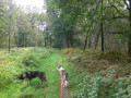
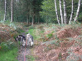
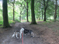
A pleasant walk entirely through woodland. However, you will need to cross two secondary national roads. Also suitable for mountain bikes.

Details

n°15354940
Creation:
Last update:
Last review:
  • Walking
    Activity: Walking
  • ↔
    Distance: 4.85 mi
  • ◔
    Average duration: 2h 25 
  • ▲
    Difficulty: Easy

  • ⚐
    Back to start: Yes
  • ↗
    Ascent: + 190 ft
  • ↘
    Descent: - 184 ft

  • ▲
    Highest point: 354 ft
  • ▼
    Lowest point: 164 ft

Photos

Description of the walk

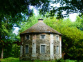
The walk starts from the small car park opposite the water tower, next to Rue de Herchies (N524). You’ll see a sign reading ‘Réservoir le château d’eau – Chemin des Loups’, as well as trail markings: red, green, red-yellow and blue (mountain biking).

(S/E) Start the walk by taking the wide path behind the gate.

(1) About 200 m after setting off, leave the Red-Yellow markings by taking the first path on the left. At a T-junction, turn right, ignore a small path on the left and take the next one, also on the left. You’ll reach the T-junction with the Chemin du Marquis.

(2) Turn right. About 30 m further on (wooden arrows with a Red Rectangle and a Green Rectangle, plus the blue mountain bike symbol), turn left and head for the next junction.

(3) Ignore the path on the right – you’ll take that on the way back – and carry on straight ahead. Cross the Route de Mons (N526) with care and continue straight on (sign saying ‘Except for cyclists and horse riders’, marked with a Red Rectangle).

(4) When you reach a T-junction, turn left. At the Y-junction, near a sign with the Red Rectangle and the blue mountain bike symbol, turn right and do the same at the next junction, at a place called Pré Fleuri. Cross Rue de Chièvres (N525) with extreme caution, and continue straight ahead.

(5) Take the first track on the right. A little further on, ignore the first sharp bend to the right and, at the next junction, take the unmarked track on the right. 20 metres further on, there is another track which joins this one a little further ahead. At the four-way junction, go straight on.

(6) At the second junction, turn right. Opposite you is a house and, to your right, the N525; cross the road with care. About 400 metres further on, cross the N526 again (sign: ‘No cars’) and follow a section of the outward route for about a hundred metres.

(3) After a small open clearing with ferns, take the narrow path on the left. You’ll reach the Croix Caillaux, a five-way junction with two tarmac roads.

(7) Take the second path on the right after a gate (sign saying ‘No cars’) between two embankments on the right and a picnic area on the left.
At the junction, carry on straight ahead, then take the first turn left then right. Walk along the Mont Garni golf course on your left and rejoin the route you took on the way there.

(1) Carry on straight ahead and head for the car park opposite the water tower (S/E).

Waypoints

  1. S/E : mi 0 - alt. 315 ft - Car park
  2. 1 : mi 0.15 - alt. 325 ft - Junction of the Grand Circular Loop
  3. 2 : mi 0.98 - alt. 279 ft - Chemin du Marquis
  4. 3 : mi 1.28 - alt. 269 ft - Junction of the short circular loop
  5. 4 : mi 1.58 - alt. 249 ft - T-junction
  6. 5 : mi 2.23 - alt. 167 ft - Path on the right
  7. 6 : mi 2.92 - alt. 289 ft - Crossroads
  8. 7 : mi 3.69 - alt. 282 ft - Croix Caillaux
  9. S/E : mi 4.85 - alt. 315 ft - Car park

Notes

Sturdy walking shoes or, in the event of heavy rain, wellies.

There is a picnic area about 2 km from the car park.

Please note: in autumn, hunting takes place and access is prohibited. Dates for 2021: 26 October 2021, 2 and 16 November, 7 and 28 December 2021. Other dates may apply.

Worth a visit

The Mont Garni Golf Course (18 holes) is Belgium’s first public golf course. It is considered one of the longest in Belgium.

If, opposite the car park, you take the road next to the water tower (west-south-west), behind a barrier, you will reach the ‘12 ’ and then the ‘10 ’ of the 12.34 km Le Bois de Baudour (east) walk.

Reviews and comments

4.2 / 5
Based on 2 reviews

Reliability of the description
4 / 5
Ease of following the route
4.5 / 5
Route interest
4 / 5
Yaya-Aless
Yaya-Aless

Overall rating : 4.3 / 5

Date of your route : Feb 03, 2025
Reliability of the description : ★★★★☆ Good
Ease of following the route : ★★★★★ Very good
Route interest : ★★★★☆ Good
Very busy route : No

A lovely walk – my partner and I had a great time!

Machine-translated

Daroly
Daroly

Overall rating : 4 / 5

Date of your route : Aug 25, 2022
Reliability of the description : ★★★★☆ Good
Ease of following the route : ★★★★☆ Good
Route interest : ★★★★☆ Good
Very busy route : No

We preferred the first part of the route. Between points 5 and 6, we could hear the busy roads far too clearly.

We enjoyed the picnic spots, especially the one at Croix Caillaux

Machine-translated

Other walks in the area

For more walks, use our search engine .

The GPS track and description are the property of this route's author. Please do not copy them without permission.