Country:

 City:


Warning: the snow-covered terrain on this snowshoe route can make it easy to lose your bearings. For ease of navigation, it is advisable to follow the route on the app using geolocation.
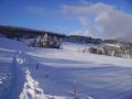
Start at the Col de la Charbonnière: park along the D214 towards Saales / Col de Steige. Please be careful at the start: respect the skiers and stay close to the cross-country ski trails.
(S/E) Head towards the biathlon stadium (signpost showing the trail layout). Turn immediately left along the track, follow a wide circular loop, then take the path branching off to the left. At a junction, carry straight on until you reach another junction, near the D214 (wooden barrier).
(1) Continue straight ahead, veering slightly to the right. The route runs straight ahead, slightly downhill.
(2) Cross a forest track and carry on straight ahead. At the next junction, turn sharply right down a slope and carry on straight ahead until you reach a three-way junction.
(3) Take the path on the right, then cross a small stream. At the next three-way junction, near a road, turn right and you’ll reach a stream.
(4) Turn right onto the path which climbs alongside this stream.
(5) At the next junction, continue straight ahead, slightly uphill, and return to the starting point at the Col de la Charbonnière (S/E).

 Visorando Member

 Moderate