From one side of the Aisne to the other in Bormal

This circular, starting from Bomal (municipality of Durbuy), takes us through varied, undulating landscapes (forests, pastures, park) around the Aisne valley. 

Details

682324
Creation:
Last update:
  • Walking
    Activity: Walking
  • ↔
    Distance: 8.07 mi
  • ◔
    Average duration: 4h 35 
  • ▲
    Difficulty: Moderate

  • ⚐
    Back to start: Yes
  • ↗
    Ascent: + 958 ft
  • ↘
    Descent: - 951 ft

  • ▲
    Highest point: 856 ft
  • ▼
    Lowest point: 433 ft

Photos

Description of the walk

If you are coming by train, stop at Bomal station and walk to the starting point (10 minutes on foot).
If you are coming by car, leave it in the car park near the football pitch, which is the starting point.

(S/E) Cross Rue des Ardennes and take Rue du Nofiot. Pass to the left of the Athénée. Leave Rue de la Rote on your right and continue straight ahead on the uphill path. Continue until you reach the "Mont des Pins" holiday centre. Join an asphalt road.

(1) Take it to the left for just a few metres, then immediately take the path on the left. At the end, descend to the right onto a narrow path and continue until you reach a wider path.

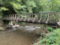
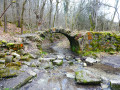
(2) At the T-junction, leave the path on the right and take the one on the left, which descends steeply to the Aisne. Cross the footbridge and continue to the road. Follow this for a few dozen metres and turn right onto Rue Lagelire.

(3) At the top of the street, turn left onto Rue du Tombeux. At the end, turn right onto Rue Inzè Vas. Pass in front of the "al Cwène di Bwès" ("le Coin du Bois" in Walloon) hall. The asphalt gives way to an uphill path.

(4) After about 200 metres on this path, take the path on the right. After a slight descent, it climbs to a T-junction, from where you can see the village of Ozo.

(5) Turn right. Cross the village to the left (towards Izier).

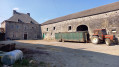
(6) Walk past a large farm and, further on, after the last house on the left, take the asphalt path that descends slightly through the fields. At the end, the asphalt disappears and the path leads to a road. Cross the road and take the path opposite. Ignore the path on the right and the two paths on the left.

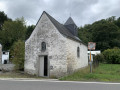
(7) At the T-junction, turn left. Continue to the Saint-Rahi Chapel.

(8) Continue and, at the next crossroads, continue straight ahead for about 200 metres until you reach a path on the left: be careful, it is discreet, so don't miss it.

(9) Follow this path. Cross the road and continue straight ahead. The path veers to the right and then enters the woods. At the two venerable lime trees, continue to the left on the main path marked in red and white (GR®).

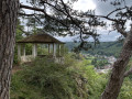
(10) After a right-hand bend, make a detour to the viewpoint (on your left) to enjoy the view, then continue until you find a local walking trail marker (green diamond) in a left-hand bend.

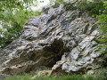
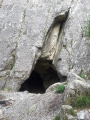
(11) Descend to the left onto a marked path, which appears to be private but is in fact public. It leads to a house below. The path descends to the right just before reaching the house. Follow it; it is marked and descends towards the Aisne. Just before the Grotte des Nutons, a path with a hairpin bend allows you to descend to the river. Follow it on the right and then cross via the footbridge. Continue to the car park (S/E).


Waypoints

  1. S/E : mi 0 - alt. 446 ft - Car park at the football ground.
  2. 1 : mi 1.39 - alt. 715 ft - Nature reserve (limestone grassland)
  3. 2 : mi 2.3 - alt. 719 ft - T-junction
  4. 3 : mi 2.99 - alt. 515 ft - Rue du Tombeux
  5. 4 : mi 3.4 - alt. 607 ft - Path
  6. 5 : mi 3.96 - alt. 722 ft - T-junction
  7. 6 : mi 4.93 - alt. 830 ft - Ozo
  8. 7 : mi 6.06 - alt. 663 ft - Four-way crossroads
  9. 8 : mi 6.39 - alt. 702 ft - Saint-Rahi Chapel
  10. 9 : mi 6.61 - alt. 689 ft - Small path on the left
  11. 10 : mi 7.21 - alt. 623 ft - Belvedere and viewpoint.
  12. 11 : mi 7.36 - alt. 679 ft - Beacon
  13. S/E : mi 8.07 - alt. 446 ft - Car park at the football ground.

Notes

Route on paths that are sometimes rocky.
NB: The footbridge that was destroyed by the Aisne floods in 2022 has now been rebuilt.

Worth a visit

The Saint-Rahi Chapel is located on the site of a former 12th-century hamlet.
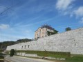
The Château de Bomal (private property) and the public park at the foot of the château.
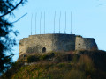
Five kilometres from Bomal, ruins of Logne Castle, museum, departure point for kayaking trips on the Ourthe.
7 kilometres away, the medieval village of Durbuy.

In Bomal: shops, cafés, railway station (Liège-Marloie line).

Always be cautious and plan ahead when you're outdoors. Visorando and the author of this route cannot be held responsible for any accidents occurring on this route.

The GR® and PR® markings are the intellectual property of the Fédération Française de Randonnée Pédestre.

Reviews and comments

4.5 / 5
Based on 12 reviews

Reliability of the description
4.5 / 5
Ease of following the route
4.5 / 5
Route interest
4.6 / 5
User 26568905
• Edited:

Overall rating : 5 / 5

Date of your route : Jan 18, 2026
Reliability of the description : ★★★★★ Very good
Ease of following the route : ★★★★★ Very good
Route interest : ★★★★★ Very good
Very busy route : No

On 18 January 2026, the footbridge has still not been rebuilt, contrary to the information provided on the website in N.B.

Machine-translated

ArinaTomberg
ArinaTomberg
• Edited:

Overall rating : 3.7 / 5

Date of your route : Sep 27, 2025
Reliability of the description : ★★★☆☆ Average
Ease of following the route : ★★★☆☆ Average
Route interest : ★★★★★ Very good
Very busy route : No

This is clearly not the ideal time to undertake this walk. The footbridge between points 2 and 3 still does not exist. So, if you don't want to wade knee-deep through the river, with its strong current and slippery rocky bottom, it is better to start at point 3. In addition, the road between points 3 and 4 is broken up. Therefore, given the current state of the route, it is best to start at point 10, where there is a car park, and then follow the path to point 4 to avoid the impassable sections. The most beautiful parts of the walk are thanks to our frequent detours. Shortly before point 1, we turned left, following a sign pointing to a path leading to the summit of Mount Pelé, which offers a magnificent view of the valley. We then continued along a path parallel to the route until we reached point 2. After taking a slight wrong turn near point 11, we discovered an impressive cliff overlooking the path.

Machine-translated

PolGillet
PolGillet
• Edited:

Overall rating : 4 / 5

Date of your route : Jul 03, 2023
Reliability of the description : ★★★★☆ Good
Ease of following the route : ★★★★★ Very good
Route interest : ★★★☆☆ Average
Very busy route : No

Pay attention to the signs (on the map) indicating the destroyed bridge. It's quite a long detour, but it's a hike.

Machine-translated

nordine59
nordine59
• Edited:

Overall rating : 4.7 / 5

Date of your route : Aug 08, 2022
Reliability of the description : ★★★★★ Very good
Ease of following the route : ★★★★★ Very good
Route interest : ★★★★☆ Good
Very busy route : No

Please note... between points 2 and 3, there is no longer a bridge to cross the Aisne... nice in summer to dip your feet in the water, but in winter!!! Route to be followed using the Visorando app only.

Machine-translated

flahaux
flahaux
• Edited:

Overall rating : 4.7 / 5

Date of your route : Aug 16, 2021
Reliability of the description : ★★★★★ Very good
Ease of following the route : ★★★★★ Very good
Route interest : ★★★★☆ Good
Very busy route : No

Very well described and signposted walk

Machine-translated

joseph59
joseph59
• Edited:

Overall rating : 5 / 5

Date of your route : Jan 11, 2021
Reliability of the description : ★★★★★ Very good
Ease of following the route : ★★★★★ Very good
Route interest : ★★★★★ Very good
Very busy route : No

Beautiful, well-marked walk

Machine-translated

Srhkdr
Srhkdr
• Edited:

Overall rating : 5 / 5

Date of your route : Jan 11, 2021
Reliability of the description : ★★★★★ Very good
Ease of following the route : ★★★★★ Very good
Route interest : ★★★★★ Very good
Very busy route : No

A great walk through different landscapes. We lost our way twice but managed to find our way back each time thanks to the app. I highly recommend it!

Machine-translated

joseph59
joseph59
• Edited:

Overall rating : 4.3 / 5

Date of your route : Nov 24, 2020
Reliability of the description : ★★★★☆ Good
Ease of following the route : ★★★★☆ Good
Route interest : ★★★★★ Very good
Very busy route : No

A lovely walk worth repeating

Machine-translated

Pierredespa
Pierredespa
• Edited:

Overall rating : 5 / 5

Date of your route : Nov 23, 2019
Reliability of the description : ★★★★★ Very good
Ease of following the route : ★★★★★ Very good
Route interest : ★★★★★ Very good

A lovely walk to explore Bomal and the surrounding area. Nice elevation changes. Beautiful panoramic views with clear vistas. A bit muddy once you leave the tarmac in autumn. Take care at the end when you descend the winding path to the football car park: there are no markings.

Machine-translated

benoit390
benoit390
• Edited:

Overall rating : 4.3 / 5

Date of your route : Sep 14, 2019
Reliability of the description : ★★★★★ Very good
Ease of following the route : ★★★☆☆ Average
Route interest : ★★★★★ Very good

Superb hike, magnificent region. You need to be familiar with reading maps, as it is easy to get your bearings but there is little help in terms of signposts. That went really well. No mistakes.

Machine-translated

tiffany4.8
tiffany4.8
• Edited:

Overall rating : 4.3 / 5

Date of your route : Jan 01, 2019
Reliability of the description : ★★★★☆ Good
Ease of following the route : ★★★★★ Very good
Route interest : ★★★★☆ Good

The hike wasn't marked, there are markers but you shouldn't pay attention to them or you'll take the wrong path! There's a lot of mud in winter, so be careful not to slip! Otherwise, it's a nice hike, even though we spent a good part of it walking on asphalt roads through fields. The second hike from Bomal, which includes castles, seems more interesting to me, with better views and the same starting point (we skipped the beginning of the hike and went to see the different points). Luckily, there's a map on Visarando, which helped us avoid getting lost more than once!

Machine-translated

Fmpkc
Fmpkc
• Edited:

Overall rating : 4.3 / 5

Date of your route : Sep 25, 2017
Reliability of the description : ★★★★☆ Good
Ease of following the route : ★★★★☆ Good
Route interest : ★★★★★ Very good

Lovely walk!

Machine-translated

Other walks in the area

For more walks, use our search engine .

The GPS track and description are the property of this route's author. Please do not copy them without permission.