


Refine your search for walks in Col de les Ares (1608m)
Col de les Ares (1608m) walks


 Visorando Member
Walks near Col de les Ares (1608m)
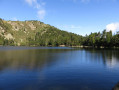
 From Esposolla to the Camporells lakes

 9.26 mi
 +3,537 ft
 -1,161 ft
 7h 20
 Difficult
 Departure from Fontrabiouse (Pyrénées-Orientales)
The third, challenging stage of the Capcir route.
Explore areas used for high-altitude pastoralism. Ascent to the Portella d’Orlu.
Pass by numerous high-altitude ponds.
Chemin Vauban From Formiguères to Rouze
13.74 mi
+1,286 ft
-3,018 ft
7h 25
 Moderate
Departure from Formiguères (Pyrénées-Orientales)
This section of the Chemin Vauban links Formiguères to Rouze, crossing the Capcir and then the Donezan. The route, which is generally easy and pleasant, alternates between forest tracks, sections through the undergrowth, paths along ridges and more open stretches offering beautiful panoramic views. The route runs alongside the Galbe river, crosses the Col des Ares – which marks the border between the Pyrénées-Orientales and Ariège – and then continues through the Donezan region via Carcanières and Le Puch. It also takes you past the magnificent Château d’Usson before reaching the village of Rouze.
Vauban Trail from Rouze to Aunat
9.41 mi
+1,414 ft
-1,585 ft
5h 35
Moderate
Departure from Rouze (Ariège)
This section of the Chemin Vauban links Rouze to Aunat, gradually leaving the Donezan behind to reach the Aude Pyrenees. The route, which is generally easy and accessible, alternates between sections through woodland and pleasant paths, notably crossing the border between Ariège and Aude. The section between Campagna-de-Sault and the Col de la Clause is particularly interesting for its heritage and numerous information boards, which provide a better understanding of the areas passed through, especially around the Dournes tunnel.From the Col de la Clause, the route continues mainly downhill through woodland before gradually reaching the village of Aunat.
Camporells Refuge - Lac des Bouillouses via Petit Peric
 7.14 mi
+1,503 ft
-2,267 ft
6 hrs
 Very difficult
Departure from Formiguères (Pyrénées-Orientales)
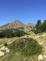
Part of the long itinerary (9 days) around Carlit, hiking from refuge to refuge, based on the Peyrics tour and using various marked trails.
Camporells Refuge - En Beys Refuge
 6.82 mi
+1,562 ft
-2,490 ft
4h 30
Moderate
Departure from Formiguères (Pyrénées-Orientales)
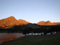
Second stage of the Tour Des Pérics.This stage should only be undertaken in good weather and when there is no fog.Otherwise, you must use the Visorando app or a GPS device to track your route.
⚠️ You are entering the Orlu National Hunting and Wildlife Reserve, where certain regulations must be observed. See practical information.
From Les Camporells to Les Bouillouses
 8.65 mi
+2,828 ft
-3,606 ft
6h 25
Difficult
Departure from Formiguères (Pyrénées-Orientales)
The fourth challenging day of the Capcir route.
Including the two Pérics to climb.
Including a detour via Lac de l’Aude.
Classified as difficult due to sections of scree and the ascent of two peaks.
Crossing from Balcère to Les Angles
4.84 mi
+489 ft
-755 ft
2h 40
 Easy
Departure from Les Angles (Pyrénées-Orientales) (Pyrénées-Orientales)
An easy, two-thirds shaded route suggested by a Year 3 class. Superb views to help children from the countryside discover the mountains: lake, forests.
From Coll del Torn to Esposolla (Espousouille)
 13.99 mi
+1,706 ft
-2,848 ft
7h 55
Difficult
Departure from Matemale (Pyrénées-Orientales)
Second stage of the Capcir route.
A long day, with no real difficulties.
Views of the Matemale and Puyvalador lakes.
Crossing the Puyvalador dam.
Arrival at Espousouille, in the Galba Valley.
Pic de Tarbesou and the Rabassoles Lakes
 7.67 mi
+2,060 ft
-4,078 ft
5h 20
Difficult
Departure from Ascou (Ariège)
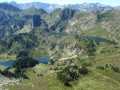
A beautiful hike not far from the Ascou-Pailhères resort. On the agenda are the magnificent Pic de Tarbesou viewpoint (2364m) and the three Rabassoles lakes. To spice things up, the last part requires good navigation skills to find your way.
Refuge d'en Beys - Refuge des Bésines
 5.61 mi
+2,178 ft
-1,759 ft
4h 30
Difficult
Departure from Orlu (Ariège)
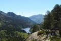
Amendment on 12 September 2022: new route marked on the ground, approved on Saturday 10 September 2022.Third stage of the Tour des Pérics. Day classified as difficult. Short distance but difficult terrain.The climb from the refuge d'en Beys to the passage through the Orlu Reserve (2,400 m) is difficult.The balcony path from (6) to (8) is very beautiful.
⚠️ From (S/E) to (5)you are in the Orlu National Hunting and Wildlife Reserve, where regulations must be observed. See practical information.