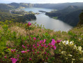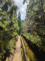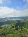
Circular walk at Lagoa das Sete Cidades

A must-do hike on the island of São Miguel. Exceptional panoramic views of the lakes and the ocean. 6 hours, including a lunch break.

Details

19678590
Creation:
Last update:
Last review:
  • Walking
    Activity: Walking
  • ↔
    Distance: 11.56 mi
  • ◔
    Average duration: 7h 20 
  • ▲
    Difficulty: Moderate

  • ⚐
    Back to start: Yes
  • ↗
    Ascent: + 2,310 ft
  • ↘
    Descent: - 2,313 ft

  • ▲
    Highest point: 2,766 ft
  • ▼
    Lowest point: 1,299 ft

Photos

Description of the walk

Park in the long-stay car park (like at the airport).

(S/E) Walk down the road to a superb panoramic view. (Toilets and refreshment bar nearby).

(1) Here, take the Vista do Rei Sete Cidades path straight ahead. Continue downhill to the junction with a road.

(2) Turn right onto the road and follow it for a few metres. You’ll come to a bend.

(3) Leave the road and turn left; you’ll reach the start of the climb.

(4) Carry on and cross over the drainage tunnel, then you’ll reach a junction of tracks.

(5) Carry on straight ahead along thePR®4SMIMata do Canàrio – Sete Cidades path. Continue on to reach Pico da Cruz.

(6) Descend from the peak along a road until you reach the junction with a small dirt track.

(7) Take this to the right – this is the Canario – Sete Cidades track. You’ll then walk alongside a forest with superb views.

(8) Turn left along the edge of the forest until you reach a junction with a road.

(9) Take the road on the right and continue downhill to the car park where you started (S/E).

Waypoints

  1. S/E : mi 0 - alt. 2,005 ft - Long-stay car park
  2. 1 : mi 0.58 - alt. 1,844 ft - Trail junction
  3. 2 : mi 3.63 - alt. 1,375 ft - Road junction
  4. 3 : mi 3.98 - alt. 1,309 ft - Bend
  5. 4 : mi 4.5 - alt. 1,391 ft - Low point
  6. 5 : mi 6.21 - alt. 1,657 ft - Junction with the PR4SMI path
  7. 6 : mi 8.97 - alt. 2,726 ft - Pico da Cruz
  8. 7 : mi 9.28 - alt. 2,572 ft - Canario junction
  9. 8 : mi 9.62 - alt. 2,612 ft - Edge of the woodland
  10. 9 : mi 10.11 - alt. 2,480 ft - Road
  11. S/E : mi 11.56 - alt. 2,005 ft - Long-stay car park

Notes

(1) Toilets nearby and refreshment kiosk

Worth a visit

Take in the scenery.

Always be cautious and plan ahead when you're outdoors. Visorando and the author of this route cannot be held responsible for any accidents occurring on this route.

The GR® and PR® markings are the intellectual property of the Fédération Française de Randonnée Pédestre.

Reviews and comments

4 / 5
Based on 3 reviews

Reliability of the description
3.7 / 5
Ease of following the route
4.3 / 5
Route interest
4 / 5
Mercou
Mercou

Overall rating : 4.7 / 5

Date of your route : Jul 06, 2026
Reliability of the description : ★★★★☆ Good
Ease of following the route : ★★★★★ Very good
Route interest : ★★★★★ Very good
Very busy route : Yes

We set off from the car park as planned. A quick glance at the lakes, which, fortunately, were bathed in sunshine. The first section is a forest track of little interest and very busy with quad bikes, motorbikes, cars…
On the other hand, section 2 (point 6) is more enjoyable, with magnificent viewpoints (lookout points) in fine weather. (Sometimes shrouded in the mist typical of the area.) And the final stretch along the road (point 9) is less enjoyable. But you’ve got to complete the circular route!

Machine-translated

User 26241479

Overall rating : 3 / 5

Date of your route : May 18, 2026
Reliability of the description : ★★★☆☆ Average
Ease of following the route : ★★★★☆ Good
Route interest : ★★☆☆☆ Disappointing
Very busy route : No

We were quite disappointed with this hike. We set off from the car park at Miradouro da Vista do Rei, heading clockwise. It’s a pleasant, easy path at the start, up to marker n5 for about 9.5 km, where a track joins the small viewpoint. Before that, you don’t always get a view of the lakes, which is a bit frustrating.
That’s when things get tough. The path becomes very rugged and much more difficult, with long climbs along the ridge. We came across groups of quad bikes and 4x4s using the area as their playground.
There is very little of interest in this part of the walk apart from some lovely views from the sheer edges of the collapsed crater that holds the two lakes.
Then, if you don’t want to add several kilometres to the route, you really must turn off at marker n7 to take a shortcut along a steep little path through the moorland. It can be slippery when it’s rained, so be careful, especially before reaching the road.
Because that’s the problem with this route: you end up more than 3km from the car park where you started, and you have to walk them on tarmac! After 7 hours and quite a bit of effort, it’s disappointing.
It’s worth noting that the weather was fine and not too hot at the start of May.
If I had to give one piece of advice, it would be to avoid doing the full circuit unless you fancy tackling nearly 20 km just for the sake of the effort.
We met quite a few people at checkpoints 6 and 9 who had only done that section and were satisfied.
A couple aged 62 and 66 in good shape.

Machine-translated

Chambrin Muriel
Chambrin Muriel

Overall rating : 4.3 / 5

Date of your route : Jun 09, 2025
Reliability of the description : ★★★★☆ Good
Ease of following the route : ★★★★☆ Good
Route interest : ★★★★★ Very good
Very busy route : Yes

A lovely walk offering breathtaking scenery!
Estimated time: 7 hours 20 minutes; we completed it in 6 hours 20 minutes, including plenty of stops to admire the scenery and a quick lunch break (a quarter of an hour...)
A word of advice: set off in the morning....

Machine-translated

VirginieW
VirginieW

Actually, I’d got the sheets mixed up – my mistake – and now everything seems much clearer!! Thanks

Machine-translated

grandin
grandin ★

VirginieW
The duration shown by the software is 7 hours 10 minutes, not 3 hours 30 minutes!

Machine-translated

VirginieW
VirginieW

Hello,

You’ve stated a 6-hour hike, including a break, for a route advertised as taking 3½ hours (there and back?)
Is the time on the information sheet underestimated? Or was the break a good one?

Thank you for clarifying.
Virginie

Machine-translated

Other walks in the area

For more walks, use our search engine .

The GPS track and description are the property of this route's author. Please do not copy them without permission.