


Start from Agua de Alto. Park in the car park to the west of the village, near the Ribereira da Praia hydroelectric power station.
Circular Lagoa de Fogo starting from Agua de Alto


The walk begins with a steep climb, though it isn’t too long. This route can be done either way, but I recommend the direction suggested here (clockwise), which is less difficult.
Details
Creation:
Last update:
Last review:
–
–
-
 Activity: Walking
 -
 Distance: 8.50 mi
 -
 Average duration: 5h 55
 -
 Difficulty: Difficult
 -
-
 Back to start: Yes
 -
 Ascent: + 2,333 ft
 -
 Descent: - 2,343 ft
 -
-
 Highest point: 2,201 ft
 -
 Lowest point: 135 ft
-
 Country:
Azores
Country:
Azores
-
 City:
Vila Franca do Campo
City:
Vila Franca do Campo -
 Start/End: N 37.716882° / W 25.467823°
 -


 Hour-by-hour weather
Description of the walk
Waypoints
- S/E : mi 0 - alt. 151 ft - Car park – Agua de Alto
- 1 : mi 0.56 - alt. 505 ft - Start of the trail
- 2 : mi 1.29 - alt. 745 ft - Junction
- 3 : mi 1.86 - alt. 1,129 ft - Junction
- 4 : mi 2.47 - alt. 1,496 ft - Junction
- 5 : mi 2.7 - alt. 1,637 ft - Junction
- 6 : mi 4.16 - alt. 1,903 ft - Lagoa do Fogo
- 7 : mi 6.84 - alt. 823 ft - Junction
- 8 : mi 7.02 - alt. 732 ft - Caminho dos Escuteiros
- 9 : mi 7.18 - alt. 663 ft - Start of the trail
- 10 : mi 8.33 - alt. 200 ft - Museum
- S/E : mi 8.5 - alt. 151 ft - Car park – Agua de Alto
Other walks in the area
Lagoa do Fogo
 Visorando Member
 6.64 mi
+1,601 ft
-1,601 ft
4h 25
6.64 mi
+1,601 ft
-1,601 ft
4h 25
 Moderate
 Departure from Vila Franca do Campo (Azores)
Return to the shore of Lago do Fogo
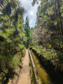
Starting from the car park at the foot of the slope, the road remains a wide track until it turns into a path after a hotel complex.
After a steeper section, the route becomes almost flat and runs alongside an irrigation channel under the trees, finally opening out onto a clearing where several channels converge from the hills above.
The viewpoint over the lake is then close by, and you can continue by following the track to the right.
Discover tea at Gorreana
2.11 mi
+545 ft
-545 ft
1h 25
Moderate
In the north of São Miguel, the Gorreana tea plantation offers a landscape unique in Europe. This short walk begins in front of the historic factory, where tea has been produced since 1883. The path climbs gently up the hillside and runs alongside the vast rows of tea bushes that undulate as far as the eye can see. As you walk, superb panoramic views open up over the lush plantations and the Atlantic Ocean. The atmosphere is peaceful, lulled by the breeze and the scents of the vegetation. After the walk, don’t miss a tour of the factory, where you’ll discover the various stages of tea production, before finishing with a tasting of the black and green teas grown on site. An accessible walk, ideal for combining nature, heritage and the discovery of a unique craft in the Azores.
Lagoa das Furnas circular walk from Furnas
 6.39 mi
+810 ft
-787 ft
3h 40
Moderate
Departure from Povoação (Azores)
6.39 mi
+810 ft
-787 ft
3h 40
Moderate
Departure from Povoação (Azores)
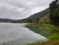
A lovely walk from Furnas that takes you along the lakeside and past the geothermal area where the famous cozido is cooked.
Quatro Caminhos do Faial da Terra
4.66 mi
+0 ft
-0 ft
2h 10
Moderate
Departure from Povoação (Azores)
This circular route through the village of Faial da Terra develops partially in the geosite of Caldeira of Povoação. Begin the walk at the center of the village and follow the marks by a road accessing agricultural fields. Along it you will cross several times the regional road, passing by the old whale watching tower, place used by the ancients to watch and locate the different cetaceans species.
Lago di Canario
1.80 mi
+240 ft
-233 ft
1h 00
 Easy
Easy
A beautiful walk from Lago di Canario to the Grota Di Inferno viewpoint. Parking at the start, two viewpoints over the lake, then a wide path to the viewpoint. The viewpoint stretches for 200 metres, forming a small path with magnificent views. Return via the same route.
Circular walk at Lagoa das Sete Cidades
 11.56 mi
+2,310 ft
-2,313 ft
7h 20
Moderate
11.56 mi
+2,310 ft
-2,313 ft
7h 20
Moderate
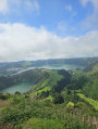
A must-do hike on the island of São Miguel. Exceptional panoramic views of the lakes and the ocean. 6 hours, including a lunch break.
Sete Cidades towards the King's viewpoint
 7.57 mi
+1,509 ft
-1,519 ft
4h 50
Moderate
7.57 mi
+1,509 ft
-1,519 ft
4h 50
Moderate
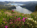
From Sete Cidades, walk along the green lake and climb up to the mirador do rei viewpoint. There is a beautiful view of the green and blue lakes. Continue along a wide, almost flat path to the car park at the Lomba do Vasco viewpoint. Head back down towards Sete Cidades on a short stretch of road, then turn left at the bend and take a signposted path on the right further on. Return via a very steep downhill road, which will really work your thighs... You can return to the town centre by following the Azure Lake or, for a shorter route, take the first street on the right at the bottom of the slope.
A very pretty circular walk.
For more walks, use our search engine .
The GPS track and description are the property of this route's author. Please do not copy them without permission.

