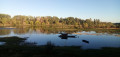
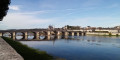
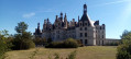
Route patrimoniale de Baule

This route allows you to explore, in 10 stages, on foot or by bike, the historic heritage sites of Baule.
Along the route, 10 information boards will provide details on the architectural features and history.

You can find the corresponding leaflet, as well as further information, descriptions and anecdotes, on the Baule local council website.

Details

n°4142027
Creation:
Last update:
Last review:
  • Touring/Gravel
    Activity: Touring/Gravel
  • ↔
    Distance: 5.80 mi
  • ◔
    Duration according to the author: 2 hrs 
  • ▲
    Difficulty: Easy

  • ⚐
    Back to start: No
  • ↗
    Ascent: + 75 ft
  • ↘
    Descent: - 82 ft

  • ▲
    Highest point: 358 ft
  • ▼
    Lowest point: 269 ft
  • ⚐ Country: France
  • ⚐ City: Baule (45130)
  • ⚑
    Start: N 47.81608° / E 1.688527°
  • ⚑
    End: N 47.799082° / E 1.663881°
  • ❏
    IGN map(s): Ref. 2120E

  • ◶
    Type of surface:
  •  
     
    ■ 60% Road ■ 40% Byway
  • Hour-by-hour weather

Photos

Description of the route

(S) Start in the Baulette neighbourhood along the River Mauve, from signpost no. 1

(1) Follow the walk along the embankment. The valley is on your right and the River Mauve on your left.

Turn right and take the first path after signpost no. 2.

(2) Stop at the foot of the village where the old harbour used to be. Signpost no. 3. Walk up the slope to signpost no. 4.

(3) The manor house. Continue up the slope. Walk past the cemetery.

(4) The church and the monument. Signpost no. 5

Cross the D2152 road to the town hall, which is on your right after the junction

(5) Town hall – Signpost no. 6. Continue along the road to the Clos Saint Aignan signpost no. 7.
Carry on to the station. Pass under the railway line (the railway line was opened in 1846).

Follow the road opposite, then Rue Jean Bordier, to Langlochère. At No. 84, a winegrower’s house dating from the first third of the 16th century

(6) Langlochère – Signpost no. 8. Turn back.

Instead of continuing along the road to the left as you leave the Langlochère neighbourhood, carry on along the path through the fields.

Do not take the first path on the left; go straight on until the next junction.

Les Constants – A monument unveiled in June 1871 on the grave of 70 French soldiers who died during the fighting on 7 December 1870. Demolished in the early 1970s.

Turn left onto the path. Continue to a junction and take the road on the right. Continue along Rue des Platériaux.

At the junction with four stop signs, turn right onto Rue de Villeneuve

(7) Former Villeneuve Cemetery – Sign no. 9

Continue along Rue de Villeneuve. At the junction, turn left onto Rue du Pont.

Pass under the railway line.

Cross the D2152 county road.

(8) Les Vallées

Halfway down the slope is an old winegrower’s house. Sign no. 10. Carry on straight ahead.

(E) Lavau. You’ve arrived in the Lavau district, home to old quarries and cave dwellings.

From here, you can join the Loire à Vélo route.

Waypoints

  1. S : mi 0 - alt. 282 ft - Baulette
  2. 1 : mi 0.49 - alt. 285 ft - The valley
  3. 2 : mi 1 - alt. 279 ft - The village – The harbour
  4. 3 : mi 1.19 - alt. 315 ft - The seigneury
  5. 4 : mi 1.33 - alt. 348 ft - Église Saint-Aignan (Baule)
  6. 5 : mi 1.48 - alt. 338 ft - The town hall
  7. 6 : mi 3.01 - alt. 358 ft - Langlochère
  8. 7 : mi 4.8 - alt. 338 ft - Villeneuve
  9. 8 : mi 5.37 - alt. 312 ft - Les Vallées
  10. E : mi 5.8 - alt. 276 ft - Lavau

Reviews and comments

4.7 / 5
Based on 1 review

Reliability of the description
5 / 5
Ease of following the route
5 / 5
Route interest
4 / 5
MARYSE45
MARYSE45

Overall rating : 4.7 / 5

Date of your route : Aug 05, 2025
Reliability of the description : ★★★★★ Very good
Ease of following the route : ★★★★★ Very good
Route interest : ★★★★☆ Good
Very busy route : No

We made a slight change to the route: we started and finished at the La Corne des Patûres open-air café to make a loop and have lunch there.
We all enjoyed both the walk and the pleasant time we had at the guinguette.

Machine-translated

Other walks in the area

For more walks, use our search engine .

The GPS track and description are the property of this route's author. Please do not copy them without permission.