Country:
 City:


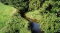
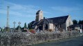
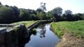
Starts from Trelly Church (ample parking along the D49, opposite the church).
Green signposts (Yellow Square route)
(S/E) From the car park, head towards the war memorial and follow the main road (D49) to the right. Take the first left, just before the sign marking the exit from Trelly, and pass through the hamlet of l’Orangerie.
(1) At the ‘give way’ sign, carry on straight ahead and head down a track with a rough surface.
(2) Pass under the railway bridge and turn right onto a track.
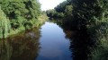
(3) At Moulin de Sey, take the footbridge over the River Sienne, pass the ruins of the mill (private property but access permitted to cyclists) and continue along a gravel track. You will then rejoin the tarmac road.
(4) At the junction, turn right at a 90° angle. At the ‘give way’ sign at the entrance to Quettreville, follow the D143 to the right as far as the church.
(5) Turn right into Rue Pavée, ride past the church, then turn left downhill. At the ‘Stop’ sign, turn right and cross the River Sienne.
(6) Just before the Quettreville ‘Exit’ sign, turn left into a cul-de-sac. When the road bends to the right, carry on straight ahead and cross a stream.
(7) Go round a white barrier (private property but cyclists are permitted to pass) and continue along a gravel track.
(8) Cross the railway line at level crossing no. 44 and turn immediately left, then right.
(9) At the T-junction, turn left and ride past some farm buildings.
(10) At the three-way junction (signposted ‘Fauvel’), turn left.
(11) At the T-junction, turn left and then immediately right. Continue straight on along the main road, ignoring a few turn-offs to the right and one turn-off to the left towards the railway line.
(12) At the ‘give way’ sign, turn right onto the cycle path running parallel to the D971 towards Coutances. After about a hundred metres, follow the D73 to the right towards Saussey.
(13) At the next junction, turn right onto the D235 towards Trelly. There is a steep but short climb, followed by a similarly steep descent.
(14) At a place called Maladrie (not shown on the 1:25,000 map), turn left onto the D76 towards Contrières. Head uphill, go round the church on the left, let the D76 branch off to the left and ride alongside a car park on your left.
(15) At the corner of the car park, turn left onto the D539 towards Trelly.
(16) At the next junction, turn right, staying on the D539 towards Trelly. The road winds up and down as you follow this winding route.
(17) Cross a bridge over a river, head uphill on the opposite side, ignore a turn-off on the left and head downhill.
(18) At the ‘give way’ sign, turn left and follow the D49 to Trelly Church (S/E).



 Visorando Member