Chemin du Hajet

This route takes you on a tour of the countryside surrounding the resort of Barbotan-les-Thermes, as well as the hills around Lake Uby.

Details

n°383995
Creation:
Last update:
Last review:
  • Walking
    Activity: Walking
  • ↔
    Distance: 5.29 mi
  • ◔
    Average duration: 2h 40 
  • ▲
    Difficulty: Easy

  • ⚐
    Back to start: Yes
  • ↗
    Ascent: + 233 ft
  • ↘
    Descent: - 240 ft

  • ▲
    Highest point: 561 ft
  • ▼
    Lowest point: 361 ft
  • ⚐ Country: France
  • ⚐ City: Cazaubon (32150)
  • ⚑
    Start/End: N 43.950099° / W 0.042837°
  • ❏
    IGN map(s): Ref. 1742SB
  • Hour-by-hour weather

Photos

Description of the walk

(S/E) From the Maison du Tourisme et du Thermalisme, walk alongside the car park towards the Casino, pass the motorhome parking area, then turn left onto Boulevard Paul Daudé.

(1) Cross this boulevard, reach the steps and follow the path.

(2) At the junction, turn left and carry on straight ahead. When you reach the tarmac road, turn left.

(3) Head into the woodland towards Ferme Jean Marie and make your way to the water tower.

(4) Turn right and follow the road to the hamlet known as l’Enclos.

(5) Carry on past the hamlets of Cambos and Hajet to reach Lac de l’Uby.

(6) Turn right onto the road just before Lac de l’Uby to join the fitness trail. Follow the trail to the Leisure Centre, then continue along the trail.

(7) Turn right to enter a wooded area which will take you to the hamlet of Jouanlanne.

(2) Turn left to reach the steps leading to the N524.

(1) Follow the same route back and head for the Maison du Tourisme et du Thermalisme (S/E).

Waypoints

  1. S/E : mi 0 - alt. 381 ft - Tourism and Thermal Spa Centre
  2. 1 : mi 0.19 - alt. 397 ft - Crossing Boulevard Paul Daudé
  3. 2 : mi 0.36 - alt. 466 ft - Path junction
  4. 3 : mi 1.27 - alt. 551 ft - Entering the woodland
  5. 4 : mi 1.73 - alt. 558 ft - Water tower
  6. 5 : mi 2.57 - alt. 486 ft - The enclosure
  7. 6 : mi 3.39 - alt. 387 ft - Fitness trail
  8. 7 : mi 4.5 - alt. 387 ft - Woodland path
  9. S/E : mi 5.29 - alt. 381 ft - Tourism and Thermal Spa Centre

Notes

Wear sturdy shoes and take a bottle of water.
The route is fully signposted with red markers

Worth a visit

Lake Uby.
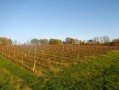
The vineyard.

Reviews and comments

5 / 5
Based on 1 review

Reliability of the description
5 / 5
Ease of following the route
5 / 5
Route interest
5 / 5
ChristianQ
ChristianQ

Overall rating : 5 / 5

Date of your route : Jan 04, 2026
Reliability of the description : ★★★★★ Very good
Ease of following the route : ★★★★★ Very good
Route interest : ★★★★★ Very good
Very busy route : No

Few people at this time of year on a pleasant, well-maintained trail, very passable in rainy weather, with a picnic by the lake and a visit to the thermal baths at the end...

Machine-translated

Other walks in the area

For more walks, use our search engine .

The GPS track and description are the property of this route's author. Please do not copy them without permission.