Chemin de la Caussade

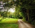
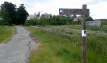
This route will take you through the Barbotan countryside, passing through a forest of oak and fir trees before reaching the centre of Barbotan.

Details

383811
Creation:
Last update:
Last review:
  • Walking
    Activity: Walking
  • ↔
    Distance: 5.21 mi
  • ◔
    Average duration: 2h 35 
  • ▲
    Difficulty: Easy

  • ⚐
    Back to start: Yes
  • ↗
    Ascent: + 213 ft
  • ↘
    Descent: - 217 ft

  • ▲
    Highest point: 561 ft
  • ▼
    Lowest point: 371 ft

Photos

Description of the walk

Park in front of the Tourist and Thermal Centre (next to the casino) in Barbotan-les-Thermes.

(S/E) From the Maison du Tourisme et du Thermalisme, walk along the car park towards the casino, pass the motorhome parking area, then turn left onto Boulevard Paul Daudé.

(1) Cross this boulevard, reach the steps and follow the path opposite.

(2) At the junction, turn left and continue straight on. At the tarmac road, turn left and follow it.

(3) Leave this road and head into the woodland towards Ferme Jean Marie, then make your way to the water tower.

(4) Turn left to join the D15. Take the path opposite, then turn left until you reach the N524.

(5) Cross the N524 (take care), turn right, then left towards a cleared area of woodland.

(6) Take the path and follow it to the D403. This path heads north-west before turning south-west to join the road.

(7) Cross the D403, continue straight ahead, then take the bridge on the right.

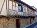
(8) Before the half-timbered house, turn left to reach the Résidence Soleil d’Oc. Continue on your way towards Avenue des Landes.

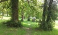
(9) Turn left onto this avenue, then at the stop sign, turn right onto Avenue des Thermes. Turn left into Parc Adrien Barthélémy and continue to the Tourist Office (S/E).

Waypoints

  1. S/E : mi 0 - alt. 381 ft - Tourist Information Centre and Thermal Spa Centre
  2. 1 : mi 0.19 - alt. 397 ft - Crossing Boulevard Paul Daudé
  3. 2 : mi 0.36 - alt. 466 ft - Turn left at the fork
  4. 3 : mi 1.25 - alt. 541 ft - Entering the woodland
  5. 4 : mi 1.73 - alt. 558 ft - Water tower
  6. 5 : mi 2.17 - alt. 502 ft - Crossing the N524
  7. 6 : mi 2.23 - alt. 502 ft - Chemin de la Caussade
  8. 7 : mi 3.73 - alt. 495 ft - Crossing the D403
  9. 8 : mi 4.24 - alt. 541 ft - Half-timbered house
  10. 9 : mi 4.62 - alt. 505 ft - Avenue des Landes
  11. S/E : mi 5.21 - alt. 381 ft - Tourist Information Centre and Thermal Spa Centre

Notes

Wear sturdy walking shoes and take a bottle of water.
The route is fully signposted with red markers.

Worth a visit

Adrien Barthélémy Thermal Park.
The flora and fauna of the Marais.

Reviews and comments

4 / 5
Based on 4 reviews

Reliability of the description
3.8 / 5
Ease of following the route
4 / 5
Route interest
4.3 / 5
novie
novie
• Edited:

Overall rating : 3.7 / 5

Date of your route : Jan 22, 2022
Reliability of the description : ★★★☆☆ Average
Ease of following the route : ★★★★☆ Good
Route interest : ★★★★☆ Good
Very busy route : No

Navigating solely by map can sometimes be tricky – there are too many signposts for too many routes – but fortunately, following a track is very handy, as usual.

Machine-translated

Alida.simone
Alida.simone

Overall rating : 3.3 / 5

Date of your route : Nov 09, 2021
Reliability of the description : ★★★☆☆ Average
Ease of following the route : ★★★☆☆ Average
Route interest : ★★★★☆ Good
Very busy route : No

The end of the route is a bit tricky to follow

Machine-translated

PPC5740
PPC5740
• Edited:

Overall rating : 4 / 5

Date of your route : Feb 10, 2020
Reliability of the description : ★★★★☆ Good
Ease of following the route : ★★★★☆ Good
Route interest : ★★★★☆ Good

Once you’ve found the stairs, the walk takes you along paths where the ground is uneven (so a pair of sturdy shoes is recommended). It’s a bit of a shame that the description doesn’t mention the additional numbers on some of the signposts.

The main drawback remains the same: the ‘Red Rectangle’ markings are used everywhere, making it sometimes difficult to tell the routes apart, even with an IGN map.

The tourist office was closed, so there was no way to get a general map of the suggested routes!

For your information, after WPT 8 we headed down through the holiday let properties; the signpost was misleading. “We hesitated between staying on the edge of the woods or heading down towards the village.”

Enjoy your walks

Machine-translated

plabourse
plabourse

Overall rating : 5 / 5

Date of your route : May 09, 2017
Reliability of the description : ★★★★★ Very good
Ease of following the route : ★★★★★ Very good
Route interest : ★★★★★ Very good

A rather tough stretch through the cleared section under the blazing sun
On our way back to Barbotan, we decided to take the greenway to return to the centre via the old station

Machine-translated

Other walks in the area

For more walks, use our search engine .

The GPS track and description are the property of this route's author. Please do not copy them without permission.