Country:
 City:


Free car park on Place Saint-Pierre.
(S/E) Head towards Allée de Verdun and turn right to walk along the lower part of the village: there’s a lovely view of the valley on your left. Continue left onto Chemin des Jardins, then take Chemin de la Gourbillière on the right until you reach the junction with Rue du Rocher.
(1) Turn left, staying on Chemin de la Gourbillière, and continue to the small square in front of the Jérusalem mill (small car park). This mill has recently been restored but is not, as far as we know, open to visitors: there’s a beautiful panoramic view of the Luberon.
(2) Take the Chemin de la Roche Redonne on the left, passing by the Conservatoire des Terrasses: admission is free and it doesn’t take you far off the route. Join the unmarked but clearly visible path at the Croix de la Roche Redonne.
(3) Head right onto this path until you reach a wider farm track. Continue to the right to rejoin a signposted path, then turn left to head back down. Cross the D60 (Route de Joucas) with care and head straight ahead to find, next to the bins, a path that is officially closed but where walkers are permitted to pass provided they stay on the signposted path: there are numerous signposts.
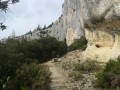
(4) Follow this path, cross the River Imergue and begin the ascent, passing on the right by the Chapelle Saint-Michel, built on the cliff face.
(5) Retrace your steps and continue climbing to the right until you reach a plateau. Carry on to the right and then walk alongside a village of drystone shelters before reaching the junction with the Grande Heath Sud.
(6) Leave the Chemin de Mange-Tian by taking a path on the right. Walk alongside the low stone walls and follow the yellow markings. Cross a first path, then a second, and head back down to the D60: Mont Ventoux comes into view on your left during this descent.
(7) After crossing the road, take the Chemin de Trabari opposite. Stay on the signposted path as it crosses private property. Make your way to the small square by the mill.
(2) Head left along Rue des Hauts to reach the top of the village: a stunning panoramic view of Mont Ventoux, Gordes, Joucas, etc.
(8) Then head back down into the village of Goult until you reach Rue du Jeu de Paume. Turn left, then left again to pass through the Porte de l’Orme. Immediately afterwards, turn right into Rue du Château, then turn right again to reach Place de la République: there is an information board for visiting Goult, with detailed descriptions dotted around the village – allow an hour. Walk to the end of the street, turn left onto Rue du Cheval Blanc, then right onto Rue de la Fontaine to reach the D105 (Route de Roussillon). Turn right onto Avenue Eugénie Ducroit, keeping the Church of Saint-Sébastien in sight. Once in front of the church, take the street on the left to return to the car park (S/E).
 Visorando Member

 Moderate


 Difficult