Brocéliande: Comper and Tréban castles

A lovely little walk to do before visiting the Centre Imaginaire Arthurien.

Details

n°4115194
Creation:
Last update:
Last review:
  • Walking
    Activity: Walking
  • ↔
    Distance: 6.05 mi
  • ◔
    Average duration: 2h 55 
  • ▲
    Difficulty: Easy

  • ⚐
    Back to start: Yes
  • ↗
    Ascent: + 190 ft
  • ↘
    Descent: - 187 ft

  • ▲
    Highest point: 433 ft
  • ▼
    Lowest point: 262 ft

Description of the walk

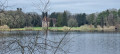
Park in the Château de Comper car park.

(S/E) Set off along the road to the right and turn left at the Fork in the road. Walk between the ponds and continue a little further up the road to the right.

(1) Take the path slightly to the left and head north-west. At the forest track, turn left.

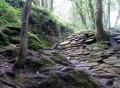
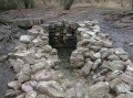
(2) Turn left (outside the hunting season) to reach the Trois Roches site: three large blocks of puddingstone resting on an ancient Roman road.
Then continue due north, cross the forest track and turn left towards the D773. You’ll come out onto the road at a war memorial from 1939–45.

(3) Cross the departmental road and take the path opposite.

(4) Turn onto the path on the right and continue through the Landes de la Fontaine Bourse. Carry on straight ahead, ignoring the paths on either side.

(5) Turn left, then immediately left again, and head down towards Brangelin. Cross one road and come out onto another.

(6) Turn left onto the tarmac road towards Trébran, ignoring the junction with the road leading to Brangelin.

(7) Turn right before entering Trébran.

(8) Turn left and walk past several farmhouses on the Noë Reculard.

(9) Cross the departmental road again and take the overgrown path opposite, which turns right then left before joining a wider track. At the junction, carry straight on towards Comper.

(10) Turn left to follow the road to the car park at Comper Castle (S/E).

Waypoints

  1. S/E : mi 0 - alt. 374 ft - Château de Comper car park
  2. 1 : mi 0.32 - alt. 348 ft - Forest track
  3. 2 : mi 1.48 - alt. 377 ft - The Trois Roches fork
  4. 3 : mi 2.03 - alt. 371 ft - Crossing the D773
  5. 4 : mi 2.14 - alt. 361 ft - Path through the moors
  6. 5 : mi 3.13 - alt. 364 ft - Forest track
  7. 6 : mi 3.84 - alt. 266 ft - Tarmac road
  8. 7 : mi 4.49 - alt. 295 ft - Entrance to Trébran
  9. 8 : mi 4.65 - alt. 331 ft - La Noé Reculard
  10. 9 : mi 4.99 - alt. 367 ft - Crossing the D773
  11. 10 : mi 5.85 - alt. 364 ft - Comper
  12. S/E : mi 6.05 - alt. 367 ft - Château de Comper car park

Worth a visit

Les Trois Roches: according to popular belief, three fairies carried them whilst Mont-Saint-Michel was being built. When they heard that the work was finished, the relieved fairies are said to have dropped them where they still lie today.

Reviews and comments

3.4 / 5
Based on 3 reviews

Reliability of the description
3.7 / 5
Ease of following the route
3.7 / 5
Route interest
3 / 5
User 16940216

Overall rating : 4.7 / 5

Date of your route : May 05, 2025
Reliability of the description : ★★★★★ Very good
Ease of following the route : ★★★★★ Very good
Route interest : ★★★★☆ Good
Very busy route : Yes

Nothing to report.

Machine-translated

riko 56
riko 56
• Edited:

Overall rating : 3 / 5

Date of your route : Nov 06, 2021
Reliability of the description : ★★★☆☆ Average
Ease of following the route : ★★★☆☆ Average
Route interest : ★★★☆☆ Average
Very busy route : No

We weren’t able to complete the circular route for fear of wasting too much time trying to find the right route. In places, the trail markings are non-existent – perhaps worn away over time. At the ‘Three Rocks’, we couldn’t find the forest track, which was overgrown with vegetation. The route needs to be re-marked. In our opinion, this is a little-used walk, which is a shame, as it is certainly worth a go: it starts at the castle, has a wooded section and forms a circular route.

Machine-translated

Le gal laurence
Le gal laurence

Overall rating : 2.7 / 5

Date of your route : Aug 09, 2021
Reliability of the description : ★★★☆☆ Average
Ease of following the route : ★★★☆☆ Average
Route interest : ★★☆☆☆ Disappointing
Very busy route : No

Hello, I’m usually extremely pleased with Visarando’s explanations.
On this route, which I had with me on paper, it was impossible to find the three rocks. We got lost, even though we’d felt we were following the route correctly; we had to check Google Maps several times to work out where we were, and in the end decided to head back to Comper via the road with heavy traffic – which wasn’t the point – rather than carry on, as we didn’t want to get even more lost. We’d already been walking for at least three hours.
It’s a shame, but as I love Visarando and am very happy with the explanations, I’m going to keep at it. Laurence

Machine-translated

Other walks in the area

For more walks, use our search engine .

The GPS track and description are the property of this route's author. Please do not copy them without permission.