Country:

 City:


Start: park in the top car park of the Chateau de Castelnaud and remember to pay the parking fee!
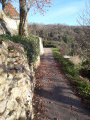
(S/E) Retrace your steps out of the car park and at the sharp left bend in the road, take the track to the right. After 50 m, take the right fork down the hill with great views down the valley to your right.
(1) At the split, follow the path to the left steeply uphill and onto the ridge above the Dordogne.
There are lovely views of the Dordogne River and the valley through the trees, but take care as the slopes to the right are very steep. Follow the path along the cliff top to where, just to the right of the path, is a large cross. This is the Croix de La Mission and was erected in the nineteenth century at a stunning viewpoint where the cliffs jut out from the path.
(2) Head back to the path, which shortly turns left away from the cliffs and soon becomes a tarmac road. Fork left at a junction and then right where the road meets the main Chateau access road. Take care here of traffic as you walk steeply uphill, then down to a four-way junction.
(3) Turn right on the narrow road down the hill to the next junction, to which you'll return later on this walk.
(4) Go straight on. About 100m after a large house on the left, take the left fork down the hill across the field, which becomes a track running down the left side of a pretty valley. Ignore a path on the left and continue to a path junction.
(5) Turn right and continue gently downhill, eventually leading to views of the Chateau de Fayrac on the right. The path then turns to the left, where you can enjoy fine views across the river to the village of Beynac and its Chateau on the cliff above.
(6) The well-marked path crosses a deforested area and then goes quite sharply uphill, levelling up just before the small settlement of La Trelle.
(7) Descend into the village and after passing between two buildings, turn sharp left onto a small road. Stay left at the road junction and take the track on the right.
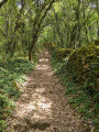
Continue to a path junction where you take the left fork and there is a long steady climb which winds its way to the top of the hill. Near the top, at a path junction, take the right fork and, after a final bit of uphill, turn left at a path junction. Follow the relatively flat and pretty path through the trees and take the left turn at another junction until you eventually reach a small road.
(8) Note: If you’ve been following the red signs of the Perigord Noir route to this point, now is the time to stop (!).
Turn left away from that route along the road. After 100 m, take a wide, pretty path to the left and follow it down, with woods initially on the left and a meadow on the right until you eventually return to a junction from earlier.
(4) Retrace your steps back up the hill.
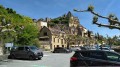
(3) Go straight on down the hill and left at the road junction ahead. Follow that road until it turns sharp right above a car park, where you go straight on and gently uphill along a limited access road. There are lovely views to the right and the road takes you to the beautiful village below the Chateau de Castelnaud where many refreshment options are available.
(9) When ready, head up the hill away from the village and back to the car park where you started.(S/E)
 Visorando Member
 Easy