


Refine your search for walks in Castellane (rivière) - Affluent du Têt
Castellane (rivière) - Affluent du Têt walks


 Pic de Toulouse - Roc des Quarante Croix
 Visorando Member
 10.79 mi
 +2,349 ft
 -2,365 ft
 7h 00
7h 00
 Moderate
 Departure from Mosset (Pyrénées-Orientales)
Parcours très varié, sans aucune difficulté. Vue incroyable du Pic de Toulouse. Le Roc des Quarante Croix n'est pas facile à trouver : c'est l'occasion grâce à ce circuit.La trace gpx est nécessaire.
 Below the Col Jau, towards the old ski lift
 4.26 mi
+1,014 ft
-1,017 ft
4 hrs
Moderate
Departure from Mosset (Pyrénées-Orientales)
4.26 mi
+1,014 ft
-1,017 ft
4 hrs
Moderate
Departure from Mosset (Pyrénées-Orientales)
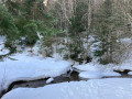
Circular hike starting below the Col de Jau at the start of the old ski resort. Except for the track leading from the road to the car park, we were able to complete the entire hike in virgin snow and discover areas marked only by animal tracks in all directions.
Walks near Castellane (rivière) - Affluent du Têt
Chemin Vauban From Formiguères to Rouze
13.74 mi
+1,286 ft
-3,018 ft
7h 25
Moderate
Departure from Formiguères (Pyrénées-Orientales)
This section of the Chemin Vauban links Formiguères to Rouze, crossing the Capcir and then the Donezan. The route, which is generally easy and pleasant, alternates between forest tracks, sections through the undergrowth, paths along ridges and more open stretches offering beautiful panoramic views. The route runs alongside the Galbe river, crosses the Col des Ares – which marks the border between the Pyrénées-Orientales and Ariège – and then continues through the Donezan region via Carcanières and Le Puch. It also takes you past the magnificent Château d’Usson before reaching the village of Rouze.
Chemin Vauban: from Olette to Sauto
10.54 mi
+4,596 ft
-1,398 ft
8h 50
 Difficult
Departure from Olette (Pyrénées-Orientales)
Difficult
Departure from Olette (Pyrénées-Orientales)
This section of the Chemin Vauban links Olette to Sauto via a route that is much better signposted than the previous one. The route remains, however, long and challenging, with some steep ascents and descents, but in return offers sumptuous and varied scenery. In particular, it takes you through the villages of Canaveilles and Llar, before gaining altitude towards the Serre de Clavera, then beginning the final descent towards Sauto.⚠️ Warning: the route runs alongside and crosses a military firing range between (10) and (11). Before setting out on this route, it is essential to check the days and times of firing exercises to ensure that passage is permitted.
Vauban Trail from Rouze to Aunat
9.41 mi
+1,414 ft
-1,585 ft
5h 35
Moderate
Departure from Rouze (Ariège)
This section of the Chemin Vauban links Rouze to Aunat, gradually leaving the Donezan behind to reach the Aude Pyrenees. The route, which is generally easy and accessible, alternates between sections through woodland and pleasant paths, notably crossing the border between Ariège and Aude. The section between Campagna-de-Sault and the Col de la Clause is particularly interesting for its heritage and numerous information boards, which provide a better understanding of the areas passed through, especially around the Dournes tunnel.From the Col de la Clause, the route continues mainly downhill through woodland before gradually reaching the village of Aunat.
Crossing from Balcère to Les Angles
4.84 mi
+489 ft
-755 ft
2h 40
 Easy
Departure from Les Angles (Pyrénées-Orientales) (Pyrénées-Orientales)
Easy
Departure from Les Angles (Pyrénées-Orientales) (Pyrénées-Orientales)
An easy, two-thirds shaded route suggested by a Year 3 class. Superb views to help children from the countryside discover the mountains: lake, forests.
Thués-Entre-Valls - Carança refuge
 5.40 mi
+3,832 ft
-653 ft
5h 50
Moderate
Departure from Thuès-Entre-Valls (Pyrénées-Orientales)
5.40 mi
+3,832 ft
-653 ft
5h 50
Moderate
Departure from Thuès-Entre-Valls (Pyrénées-Orientales)
This is the first stage of the Thués - Fillols loop, which takes you up the Carença Gorge to the refuge of the same name.
Thués-Entre-Valls – Fillols Route
34.29 mi
+14,088 ft
-14,383 ft
5 days
Moderate
Departure from Thuès-Entre-Valls (Pyrénées-Orientales)
A 5-day route in the Catalan Pyrenees, offering the chance to explore the stunning Carença Gorges before finishing with an ascent of the Catalan giant: the Canigou.
From Mas de Lastourg to Serdinya along the banks of the River Têt
2.15 mi
+197 ft
-0 ft
1h 10
Easy
Departure from Fuilla (Pyrénées-Orientales)
To get from the outskirts of the Mas de Lastourg campsite to Serdinya without taking the main road, there is a lovely path that runs alongside the River Têt.Please note: you are not permitted to cross the campsite – it is private property!
De Lastourg à Villefranche-de-Conflent
1.50 mi
+69 ft
-138 ft
0h 45
Easy
Departure from Fuilla (Pyrénées-Orientales)
Comment gagner Villefranche-de-Conflent depuis Lastourg sans emprunter la dangereuse N116, qui n'a aucune circulation piétonne de prévue ?Petite découverte d'un circuit alternatif le long de la Têt !Attention, cette randonnée qui emprunte un itinéraire partiellement sur le terrain d'ERDF (non clôturé), se fait à vos risques et périls !
Camporells Refuge - En Beys Refuge
 6.82 mi
+1,562 ft
-2,490 ft
4h 30
Moderate
Departure from Formiguères (Pyrénées-Orientales)
6.82 mi
+1,562 ft
-2,490 ft
4h 30
Moderate
Departure from Formiguères (Pyrénées-Orientales)
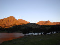
Second stage of the Tour Des Pérics.This stage should only be undertaken in good weather and when there is no fog.Otherwise, you must use the Visorando app or a GPS device to track your route.
⚠️ You are entering the Orlu National Hunting and Wildlife Reserve, where certain regulations must be observed. See practical information.
 Very difficult