


Refine your search for walks in Cascade des Êtrés
Cascade des Êtrés walks


 Crêt de Chalam via Montagne des Moines
 Visorando Member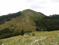
 7.04 mi
 +3,232 ft
 -3,215 ft
 6h 05
6h 05
 Difficult
 Departure from Chézery-Forens (Ain)
Here is a circular route to reach Crêt de Chalam from Chézery-Forens: the outward journey follows a little-known route via Montagne des Moines (you won't meet many people). The return journey follows the "classic" route.
Crêt Chalam from Forens
 Tourist office
 6.19 mi
+3,235 ft
-3,225 ft
5h 40
Difficult
Departure from Chézery-Forens (Ain)
6.19 mi
+3,235 ft
-3,225 ft
5h 40
Difficult
Departure from Chézery-Forens (Ain)
Open from 1 April to 30 November, subject to snow conditions.
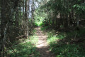
This summit is a must-see for the views it offers over the Valserine Valley, the Jura and Mont Blanc. After an ascent through the forest, a series of steps completes the hike, offering a contemplative reward!
The hike starts in Forens. The view gradually opens up onto the Valserine Valley and the Haute Chaîne du Jura. The last few metres are along a steep path, then up some steps to the summit. From there, you can enjoy a 360° panorama of Mont Blanc, which seems so close above the Jura mountains and the folds of the surrounding Jura massif. Also note the "Borne au Lion", the 17th-century border between Franche-Comté, Bugey and the Duchy of Savoy. Information panels recount the lives of the resistance fighters who hid here during the Second World War. To conclude the hike, a short detour to the beautiful Étrès waterfall is a must.
The Étrès waterfall from Forens
 2.60 mi
+725 ft
-725 ft
1h 50
2.60 mi
+725 ft
-725 ft
1h 50
 Easy
Departure from Chézery-Forens (Ain)
Easy
Departure from Chézery-Forens (Ain)
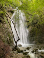
Here is an accessible and enjoyable walk, perfect for enjoying summer days in the shade of trees, to the rhythm of a refreshing stream. The trail passes through peaceful, green surroundings and leads you to the Cascade de l'Etrès waterfall, nestled discreetly in the landscape. A well-deserved refreshing break. A simple and rejuvenating outing in nature to share with your family.
Walks near Cascade des Êtrés
Chézery-Forens - Lélex
10.72 mi
+3,478 ft
-2,444 ft
7h 55
Difficult
Departure from Chézery-Forens (Ain)
Open from1 April to 30 November – subject to there being no snow.
Second stage of the “La petite boucle de la Valserine” circular walking route, from Chézery to Lélex.
This stage, starting from Chézery, will take you through a beautiful variety of landscapes, including wild rivers, lush forests, panoramic viewpoints and Jura valleys. Make the most of this stage to take in the stunning views.
Le Gralet - Chézery-Forens
 8.12 mi
+449 ft
-3,232 ft
4h 05
Difficult
Departure from Péron (Ain)
8.12 mi
+449 ft
-3,232 ft
4h 05
Difficult
Departure from Péron (Ain)
Open from 1 April to 30 November, subject to snow conditions.
The third stage of the hiking tour: from Mijoux to Chézery-Forens via the Haute Chaîne du Jura.
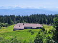
Set off on a crossing of the Haut-Jura between Mijoux and Chézery-Forens, through varied landscapes of valleys, peaks and forests. Over three days, you will walk along the Jura ridges, passing by the Grand Mont Rond, the Crêt de la Neige and the Reculet, with magnificent views of Mont Blanc and the Alps. This crossing takes you to the heart of the Haute Chaîne du Jura, for an authentic experience in the heart of nature. As you will need to carry your own food, remember to bring supplies so you can enjoy this adventure to the full.
Grande Traversée du Jura: from La Borne au Lion to Culoz
62.98 mi
+11,985 ft
-15,436 ft
6 days
 Very difficult
Departure from La Pesse (Jura)
Very difficult
Departure from La Pesse (Jura)
The GTJ runs through the Jura Mountains from Mandeure (Doubs) to Culoz (Ain), crossing the Haut-Jura Regional Nature Park and offering a detour into Switzerland. The route suggested here covers the second half of the itinerary.
Opened in 2004, the GTJ follows the GR®5, GR®9 and GR® de Pays trails for 400 km. Winding along ridges, skirting lakes and emerging from forests, this is a route accessible to most people, with no particular difficulty. It can be tackled as a 2–3-day trip for families, or as the full 15–20-day route.
The route winds through the heart of the Haut-Jura Regional Nature Park and the Haute Chaîne du Jura National Nature Reserve: a protected area to be explored with respect.
La Borne au Lion - Refuge de la Loge
6.86 mi
+2,060 ft
-1,617 ft
4h 55
 Moderate
Departure from La Pesse (Jura)
Moderate
Departure from La Pesse (Jura)
Open from 1 April to 30 November (subject to there being no snow)
First stage of the Grande Traversée du Jura walking route: from La Borne au Lion to Culoz, in 6 days.
The GTJ links Mandeure (Doubs) to Culoz (Ain) in 15 to 20 days, crossing the Jura Mountains and the Haut-Jura Regional Nature Park. The route proposed here corresponds to the second half of the itinerary.
The route winds through the heart of the Haut-Jura Regional Nature Park and the Haute Chaîne du Jura National Nature Reserve: a protected area to be explored with respect.
Part of the route passes through the Haute Chaîne du Jura National Nature Reserve.
Dogs and tent camping are prohibited.
Please respect these rules to help preserve this exceptional environment.
La Poutouille Refuge - Lancrans
10.44 mi
+1,893 ft
-5,092 ft
6h 25
Difficult
Departure from Péron (Ain)
Open from 1 April to 30 November ( subject to there being no snow)
Third stage of the Grande Traversée du Jura walking route: from La Borne au Lion to Culoz, in 6 days.
The GTJ links Mandeure (Doubs) to Culoz (Ain) in 15 to 20 days, crossing the Jura Mountains and the Haut-Jura Regional Nature Park. The route proposed here corresponds to the second half of the itinerary.
The route winds through the heart of the Haut-Jura Regional Nature Park and the Haute Chaîne du Jura National Nature Reserve: a protected area to be explored with respect.
Part of the route crosses the Haute Chaîne du Jura National Nature Reserve.
Dogs arenot permitted, even on a lead, and camping in tents is prohibited
Please respect these rules to preserve this exceptional environment.
La Poutouille - Lancrans
 10.55 mi
+1,900 ft
-5,092 ft
6h 30
Very difficult
Departure from Péron (Ain)
10.55 mi
+1,900 ft
-5,092 ft
6h 30
Very difficult
Departure from Péron (Ain)
Open from1 April to 30 November – subject to there being no snow.
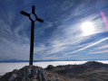
The section between La Poutouille and Lancrans is the third stage of the six-day walking tour, “The GTJ from Mijoux”.
The GR®9 enters the Ain department via Mijoux, before following the spectacular ridges of the Monts-Jura, passing through the Crêt de la Neige, the highest point of the massif. It then descends towards Bellegarde-sur-Valserine, crosses the Retord plateau, and then crosses the Grand Colombier. The trail continues its route to Culoz and the Rhône Valley, before leaving the Ain to reach Savoie and continuing southwards.
Part of the route passes through the Haute Chaîne du Jura National Nature Reserve, which is subject to specific regulations:Dogs are not permitted, even on a lead, and camping in tents is also prohibited.
Please respect these rules to preserve the richness of this exceptional environment.
Giron - Lélex
 12.38 mi
+1,588 ft
-1,995 ft
7h 05
Very difficult
Departure from Giron (Ain)
12.38 mi
+1,588 ft
-1,995 ft
7h 05
Very difficult
Departure from Giron (Ain)
Open from 1 April to 30 November – subject to there being no snow.
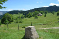
Third stage of the GRP® de la Valserine. From the Roche Fauconnière viewpoint and its panoramic view of the Cirque d'Orvaz, the trail leads to the Lion marker, a historic landmark of the Franco-Comtois border in the 17th century and a key site of the Resistance. It is here that the GR® de Pays crosses the Grande Traversée du Jura and the GR® 5, before a long, gentle descent towards Lélex, a ski resort nestled in the Valserine valley.
Menthières - Valserhône
10.99 mi
+2,152 ft
-4,459 ft
6h 55
Very difficult
Departure from Chézery-Forens (Ain)
Open from 1 April to 30 November – subject to there being no snow.
The fifth and final stage of the GRP® de la Valserine. The stage begins in the forest before reaching the mountain pastures and the Pierre à Fromage. The Crêt de la Goutte (1,621 m) offers a breathtaking panorama of the Alps, Mont Blanc and the three great lakes — Lake Geneva, Lake Annecy and Lake Bourget. The descent crosses the nature reserve between the Crêt du Miroir and Crêt du Milieu to Sorgia-d’en-Haut, then the path heads into the forest before following the banks of the Valserine to Bellegarde-sur-Valserine.
Protected area: dogs and tent camping are prohibited in the Haute Chaîne du Jura National Nature Reserve.
If the Valserine riverside path is closed, follow the diversion via the Voie du Tram to reach the centre of Bellegarde.
Bellecombe - Mijoux
9.06 mi
+666 ft
-1,552 ft
4h 45
Difficult
Departure from Bellecombe (Jura)
Open from 1 April to 30 November – subject to snow conditions.
From Bellecombe to Mijoux via the Haute Chaîne: the second stage of the four-day walking tour “La Valserine enchanteresse”.
La Valserine is no fairy, but she enchants with every step. Her magical valley guides us between the high plateaus and ridges of the Jura, offering breathtaking views of the Alps. A journey through wild nature and poetry.
Lélex - Menthières
 13.56 mi
+3,904 ft
-3,317 ft
9h 40
Very difficult
Departure from Lélex (Ain)
13.56 mi
+3,904 ft
-3,317 ft
9h 40
Very difficult
Departure from Lélex (Ain)
Open from 1 April to 30 November – subject to there being no snow.
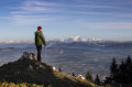
Fourth stage of the GRP® de la Valserine. From Lélex, the trail climbs through the forest to the Chalet de la Loge, the gateway to the nature reserve. The ascent then eases off through clearings and woodland to the ridges, where an exceptional panorama opens up over Lake Geneva, the Alps and Mont Blanc. The route crosses the massif’s two highest points: the Crêt de la Neige (1,720 m) and the Reculet (1,718 m), before skirting the Roche Franche cirque. After the Chalet du Gralet, the forest accompanies you for the final few kilometres to Menthières.
Protected area: dogs and tent camping are prohibited in the Haute Chaîne du Jura National Nature Reserve.