


Carreg Cennen Long Route
Details
Creation:
Last update:
–
–
-
 Activity: Walking
 -
 Distance: 3.50 mi
 -
 Average duration: 2h 10
 -
 Difficulty: Not specified
 -
-
 Back to start: Yes
 -
 Ascent: + 682 ft
 -
 Descent: - 686 ft
 -
-
 Highest point: 846 ft
 -
 Lowest point: 420 ft
-
 Country:
United Kingdom
Country:
United Kingdom
-
 Area: Brecon Beacons
 -
 City:
Dyffryn Cennen
City:
Dyffryn Cennen -
 Start/End: N 51.856644° / W 3.937386°
 -


 Hour-by-hour weather


Waypoints
- S/E : mi 0 - alt. 689 ft - Start on
- 1 : mi 0.02 - alt. 696 ft - Turn sharp left
- 2 : mi 0.02 - alt. 696 ft - Turn slight right
- 3 : mi 0.22 - alt. 784 ft - Turn left
- 4 : mi 0.62 - alt. 482 ft - Turn sharp left
- 5 : mi 0.87 - alt. 633 ft - Turn slight left
- 6 : mi 0.96 - alt. 699 ft - Turn slight right
- 7 : mi 1.35 - alt. 840 ft - Turn left
- 8 : mi 1.47 - alt. 817 ft - Turn slight left
- 9 : mi 1.69 - alt. 846 ft - Turn right
- 10 : mi 1.94 - alt. 804 ft - Turn right
- 11 : mi 2.5 - alt. 686 ft - Turn sharp right
- 12 : mi 2.8 - alt. 643 ft - Turn sharp right
- 13 : mi 3.13 - alt. 548 ft - Turn left
- 14 : mi 3.25 - alt. 614 ft - Turn slight right
- 15 : mi 3.3 - alt. 617 ft - Keep left
- 16 : mi 3.31 - alt. 617 ft - Turn sharp left
- 17 : mi 3.5 - alt. 696 ft - Turn sharp left
- S/E : mi 3.5 - alt. 696 ft
Other walks in the area
Day 2 of the Brecon Beacons Way - Carreg Cennen Castle to YHA Llanddeusant
 Association / Club / Walk leader12.56 mi
+2,096 ft
-1,991 ft
7h 35
Association / Club / Walk leader12.56 mi
+2,096 ft
-1,991 ft
7h 35
 Moderate
 Departure from Dyffryn Cennen (Carmarthenshire)
This walk takes us north from Carreg Cennen Castle, into the Black Mountains on the second leg of the Brecon Beacons Way. There are a couple of climbs but nothing too difficult and there's plenty to see along the way.
Day 1 of the Brecon Beacons Way - Llangadog Station to Carreg Cennen Castle
9.84 mi
+1,368 ft
-758 ft
5h 45
Moderate
Departure from Llangadog (Carmarthenshire)
This is a short walk to begin the Brecon Beacons Way, going from west to east. You might need a few hours to get to Llangdog Station at the start of the walk or you might choose to stay in the village before setting out on the trail. Either way, this route is an easy way to break into your stride without any strain or stress.
The Brecon Beacons Way from Llangadog Station to Abergavenny Station
113.23 mi
+21,112 ft
-21,027 ft
8 days
Moderate
Departure from Llangadog (Carmarthenshire)
This is the Beacons Way "the other way" from West to East. The prevailing wind comes from the west, so I prefer to have it at my back than in my face. However, there are a lot of North-South headings along this route and even an occasional westerly path. The scenery is fantastic either looking forward, back or to the side. A route to be enjoyed either way.
Day 3 of the Brecon Beacons Way - YHA Llanddeusant to Craig-y-Nos
9.96 mi
+2,205 ft
-2,425 ft
6h 30
Moderate
Departure from Llanddeusant (Carmarthenshire)
The route leaves Llanddeusant and heads into the Black Mountains on the third leg of the Brecon Beacons Way. It's generally a walk south along ridges and mountain tops to finally drop down to the Craig-y-nos Country Park on the Afon Tawe river.
Llyn-y-Fan-Fawr, Mynydd Ddu from Llanddeusant
 Visorando Member11.18 mi
+2,136 ft
-2,251 ft
7h 00
Visorando Member11.18 mi
+2,136 ft
-2,251 ft
7h 00
 Difficult
Departure from Llanddeusant (Carmarthenshire)
Difficult
Departure from Llanddeusant (Carmarthenshire)
This is a brilliant linear trail in the Brecon Beacons National Park, incorporating many good viewpoints and one extra-special one. It begins in Carmarthenshire near the village of Llandeusant and ends in Powys in the Glyntawe valley, crossing a mountain ridge that beats Pen-y-Fan in my view, but because it's less accessible is less well-known.
Day 4 of the Brecon Beacons Way - Craig-y-Nos to YHA Brecon Beacons
16.24 mi
+2,818 ft
-2,510 ft
9h 55
Moderate
Departure from Tawe-Uchaf (Powys)
We're now well into the Brecon Beacons Way and this route begins with a walk through the Ogof Ffynnon Ddu National Nature Reserve, designated to protect its limestone pavements, associated flora and caves beneath. Then it heads north to climb up to Fan Llia and follow the crags over to Storey Arms. It then takes the Taff Trail to YHA Brecon Beacons.
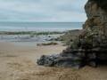
Bishopston Valley and Pwlldu Bay
 4.86 mi
+341 ft
-354 ft
2h 30
Moderate
Departure from Pennard (Swansea)
4.86 mi
+341 ft
-354 ft
2h 30
Moderate
Departure from Pennard (Swansea)
Pwlldu is a pretty little bay on the south coast of the Gower Peninsula, which stretches west of Swansea. This bay is unique in that it is only accessible on foot or by mountain bike, although the two or three dwellings (holiday lettings) are probably accessible by quad bike or a small off-road vehicle capable of negotiating a very stony track and fording a river. Whilst all the tracks and paths taken are officially signposted as footpaths, most of the forest sections are barely passable, such is the extent to which the vegetation has grown since the last local roadmender retired. It is mainly brambles and fallen trees blocking the way that hinder progress. There are indeed ‘Pwlldu’ signposts along the first three kilometres, but these too are sometimes in a dreadful state. In short, a truly wonderful experience as an introduction to the Gower Peninsula.

 Easy
Easy For more walks, use our search engine .
The GPS track and description are the property of this route's author. Please do not copy them without permission.

