Canoeing in the Gulf of Morbihan, from Larmor-Baden to Auray

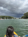
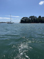
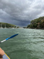
A one-way route that is quite a challenge as it is relatively long, yet very rewarding. You’ll need to contend with the wind, choppy water and currents that are sometimes against you – such as between Pointe de Locmiquel and Pointe du Blair – or in your favour, such as when sailing up the Rivière d’Auray. But these conditions naturally vary with the tides and the day’s weather. You’ll admire the scenery of the gulf, the passing sailing boats and, gradually, the coastline narrowing into the ‘Loc’h’, as it’s known.

Details

n°105349628
Creation:
Last update:
Last review:
–
  • Boating/Canoeing/Kayaking
    Activity: Boating/Canoeing/Kayaking
  • ↔
    Distance: 7.47 mi
  • ◔
    Duration according to the author: 4 hrs 
  • ▲
    Difficulty: Difficult

  • ⚐
    Back to start: No
  • ↗
    Ascent: + 23 ft
  • ↘
    Descent: - 26 ft

  • ▲
    Highest point: 33 ft
  • ▼
    Lowest point: -7 ft

Photos

Description of the walk

Park at Larmor Baden on Rue de Pen en Toul, near the junction with Chemin du Moulin. Walk down with the canoe for 200 metres along Chemin du Moulin, then along Chemin de Kerdelan to the coast (a small beach at high tide), where you can launch the canoe.

(S) Set off southwards towardsÎleBerder.

(1) Pass between the shore and the northern tip ofÎleBerder. Please note: at low tide, this passage is dry! In this case, you have two options:
- Carry the canoe for a short or long distance until you reach water again.
- Go round the island to the east. However, you must be very careful of the Jument current on this route. In the event of a strong incoming tide, it is impossible to paddle against the current.

(2) Then head west and stay close to the coast. Leave Pointe du Berchis to starboard, followed by Anse de Locmiquel (do not enter it).

(3) Pass Pointe de Locmiquel and alter course west-north-west towards Pointe du Blair. Leave the Île de Sept Îlesto starboard and cross the mouth of the Anse de Baden.

(4) Pass Pointe du Blair, turn to starboard and enter the Rivière d’Auray (known as the Loc’h). Sail up the river north-north-west and then north. Depending on tidal conditions, the route will be either straight or slightly winding, covering a distance of approximately 6 km. The river gradually narrows.

(5) Just past Pointe de Vide-Bouteille, turn to starboard into the Rivière du Bono.

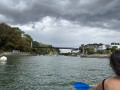
(6) Pass under a viaduct and head towards the old suspension bridge. Shortly before reaching it, you’ll see the entrance to Port du Bono on your starboard side. A clearly visible sloping access ramp allows you to carry your canoe on foot up to the Place du Banc Marie, situated at the end of Quai Jean Bart (E).

Waypoints

  1. S : mi 0 - alt. 10 ft - Larmor-Baden
  2. 1 : mi 0.57 - alt. 0 ft - Berder Passage
  3. 2 : mi 0.68 - alt. -3 ft - Heading west
  4. 3 : mi 1.96 - alt. 7 ft - Pointe de Locmiquel
  5. 4 : mi 2.9 - alt. 7 ft - Pointe du Blair
  6. 5 : mi 6.85 - alt. -7 ft - Confluence of the Bono and the - Auray (rivière)
  7. 6 : mi 7.3 - alt. -3 ft - Pont Joseph Le Brix
  8. E : mi 7.47 - alt. 7 ft - Port – Place du Banc Marie - Vieux pont du Bono

Notes

Done in a two-seater Itiwit canoe. Bring a lifejacket, swimwear, sunglasses and a water bottle.

As this is a one-way route, you’ll need to organise at least two vehicles – one at the starting point and another at the finishing point.

If the tide is low enough, you may occasionally need to go round oyster beds that are exposed in places. It is best to undertake this trip at high tide: check the tide times.

Worth a visit

Swimming is highly recommended in summer to cool off and take a break, particularly before you reach your destination. The water is lovely.

If you have time, you can walk around Île Berder: allow around 45 minutes for this.

For more walks, use our search engine .

The GPS track and description are the property of this route's author. Please do not copy them without permission.