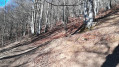
Lameza Forest Hut

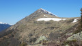
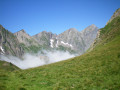
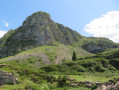
This walk takes you along the Arros stream from where it joins the Estours stream right up to its source. You’ll first come across the Arros mountain pastures with their abandoned barns, then, after another climb, the Lameza forest hut and its mountain pasture at the foot of the Vallier massif.

Details

n°740523
Creation:
Last update:
Last review:
  • Walking
    Activity: Walking
  • ↔
    Distance: 5.36 mi
  • ◔
    Average duration: 4h 25 
  • ▲
    Difficulty: Average

  • ⚐
    Back to start: Yes
  • ↗
    Ascent: + 2,224 ft
  • ↘
    Descent: - 2,224 ft

  • ▲
    Highest point: 4,419 ft
  • ▼
    Lowest point: 2,221 ft
  • ⚐ Country: France
  • ⚐
    Area: Pyrenees
  • ⚐ City: Seix (09140)
  • ⚑
    Start/End: N 42.826785° / E 1.152446°
  • ❏
    IGN map(s): Ref. 2048OT
  • Hour-by-hour weather

Photos

Description of the walk

Access by road: from Seix, head towards Guzet. At the hamlet of Moulin Lauga, take the road on the right at the bend towards Estours. Continue straight on along this small road, passing beneath the hamlet of Estours. Cross the stream and take the track (in good condition) until you reach the car park at the hydroelectric power station.

(S/E) Cross the bridge and take the track that climbs alongside the power station. The track climbs almost straight up, gaining an elevation of around 150m. 10m before the end of the track, take the path that climbs to the right (follow theGR® markings). Pass by a first group of barns in the woods (partly in ruins).

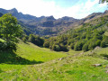
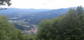
(1) A wooden bridge takes you across the Arros stream before you reach the first mountain pasture (and viewpoint). As you walk along the pasture, you’ll see the Arras barns (in ruins) on your right.

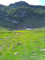
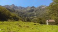
(2) Continue to follow the path (GR®), which climbs once more into the woods. Note a waterfall on the left (at an altitude of around 1,220 m). Just before reaching the mountain pasture, the path passes between two rocky outcrops and emerges at the end of the second one, arriving at the mountain pasture near the Lameza Forest Cabin.

(3) Continue to the right, following the Lameza Stream, to reach the highest point of the walk.

(4) The return journey follows the same route back to the car park at the hydroelectric power station (S/E).

Waypoints

  1. S/E : mi 0 - alt. 2,221 ft - Hydroelectric power station car park
  2. 1 : mi 0.9 - alt. 3,153 ft - Bridge
  3. 2 : mi 1.4 - alt. 3,373 ft - Arras barns
  4. 3 : mi 2.36 - alt. 4,386 ft - Lameza Hut
  5. 4 : mi 2.68 - alt. 4,409 ft - Highest point of the walk
  6. S/E : mi 5.36 - alt. 2,221 ft - Hydroelectric power station car park

Notes

Mountain pasture: cows, horses.
Like the neighbouring Estours valley, this valley is quite shady and damp, and therefore slippery.
The first section along the track is used for the power station’s pipelines; it’s not the most pleasant part of this walk, but the scenery at the mountain pasture and the tranquillity of this valley make the climb well worth it!

(4) It is possible to continue on to the Subera hut (altitude 1,500 m, representing an additional 150 m of elevation gain).

Always be cautious and plan ahead when you're outdoors. Visorando and the author of this route cannot be held responsible for any accidents occurring on this route.

The GR® and PR® markings are the intellectual property of the Fédération Française de Randonnée Pédestre.

Reviews and comments

3.7 / 5
Based on 3 reviews

Reliability of the description
4.3 / 5
Ease of following the route
4 / 5
Route interest
2.7 / 5
User 9927013

Overall rating : 2.3 / 5

Date of your route : Sep 28, 2025
Reliability of the description : ★★★☆☆ Average
Ease of following the route : ★★★☆☆ Average
Route interest : ★☆☆☆☆ Very disappointing
Very busy route : No

fortunately, wild boars still use the path, because otherwise it would have disappeared. It's borderline dangerous at the moment. The passage where the waterfall is is semi-impossible at the moment, so we turned back because it was really dangerous. The path is not maintained at all. We've done quite a few hikes marked as difficult, which were rather easy compared to this one

Machine-translated

MITCH'
MITCH'

Overall rating : 4.3 / 5

Date of your route : Sep 23, 2019
Reliability of the description : ★★★★★ Very good
Ease of following the route : ★★★★☆ Good
Route interest : ★★★★☆ Good

A lovely little walk in the shade, away from the late-summer sun, followed by a lovely visit to the Lameza mountain pasture.
Peace and quiet guaranteed – we didn’t meet a soul… Just the pleasant sound of the cows’ bells.
We carried on to the Subera hut where we spent the night. The hut is in two parts. The first is reserved for the herdsman (who was there at the end of the day). The second is open to walkers. In good condition, with 6 beds on the ground floor with mattresses in good condition, and 6 beds upstairs. Running water inside, a fireplace, deadwood nearby… and even a light bulb on the ceiling that runs on a battery connected to solar panels!!
Return the next day via the Col de la Core in 2 hours 15 minutes along the Chemin de la Liberté.
Perfect, lovely memories… highly recommended
Mitch’

Machine-translated

midld
midld
• Edited:

Overall rating : 4.3 / 5

Date of your route : Jul 18, 2018
Reliability of the description : ★★★★★ Very good
Ease of following the route : ★★★★★ Very good
Route interest : ★★★☆☆ Average

The route runs entirely through woodland, so there aren’t many views.
Halfway along the route, there’s a clearing swarming with very hungry horseflies – a word of warning to anyone with allergies!

Machine-translated

Other walks in the area

For more walks, use our search engine .

The GPS track and description are the property of this route's author. Please do not copy them without permission.