


Brunel Trail
Details
Creation:
Last update:
–
–
-
 Activity: Walking
 -
 Distance: 2.61 mi
 -
 Average duration: 1h 15
 -
 Difficulty: Not specified
 -
-
 Back to start: No
 -
 Ascent: + 59 ft
 -
 Descent: - 13 ft
 -
-
 Highest point: 82 ft
 -
 Lowest point: 10 ft
-
 Country:
United Kingdom
Country:
United Kingdom
-
 Area: Pembrokeshire Coast
 -
 City:
Neyland
City:
Neyland -
 Start: N 51.70528° / W 4.944655°
 -
 End: N 51.735317° / W 4.971233°
 -


 Hour-by-hour weather


Waypoints
- S : mi 0 - alt. 23 ft - Start on
- 1 : mi 0.01 - alt. 23 ft - Turn right onto Station Road
- E : mi 2.61 - alt. 69 ft
Other walks in the area
A part of Pembrokeshire Coast Path
 Visorando Member
 3.99 mi
+295 ft
-272 ft
2h 05
3.99 mi
+295 ft
-272 ft
2h 05
 Easy
Departure from The Havens (Pembrokeshire)
Easy
Departure from The Havens (Pembrokeshire)
This circular walk is between Broad Haven and Druidston Haven and uses a part of the Pembrokeshire Coast Path. The walk can be done in both ways.
Amroth circular via Colby Woodland
 3.85 mi
+417 ft
-420 ft
2h 10
Easy
Departure from Amroth (Pembrokeshire)
3.85 mi
+417 ft
-420 ft
2h 10
Easy
Departure from Amroth (Pembrokeshire)
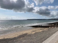
This is a delightful walk climbing up from the coast by Amroth Castle through woodland and then traversing west through a farm to eventually reach Colby Woodland Garden, which is National Trust but has free entry to all visitors. Spend time in the garden before returning to the coast via a minor road and then east along the coastal path to the parking.
For more walks, use our search engine .
The GPS track and description are the property of this route's author. Please do not copy them without permission.

