Cézanne’s Mill Circular Route

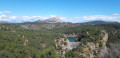
A refreshing circular walk starting from Cézanne’s Mill and passing by the ruins.

Details

10556044
Creation:
Last update:
Last review:
  • Walking
    Activity: Walking
  • ↔
    Distance: 1.80 mi
  • ◔
    Average duration: 1h 15 
  • ▲
    Difficulty: Easy

  • ⚐
    Back to start: Yes
  • ↗
    Ascent: + 453 ft
  • ↘
    Descent: - 453 ft

  • ▲
    Highest point: 912 ft
  • ▼
    Lowest point: 574 ft
  • ⚐ Country: France
  • ⚐ City: Le Tholonet (13100)
  • ⚑
    Start/End: N 43.523892° / E 5.513944°
  • ❏
    IGN map(s): Ref. 3143ET, 3244ET
  • Hour-by-hour weather

Description of the walk

Park in the car park at Tholonet cemetery.

(S/E) Walk alongside the cemetery, follow the bend and, at the first junction, turn left onto Chemin de Dourdon, heading north-east. At the Y-junction, take the path on the left. Go through the gate and head up the path.

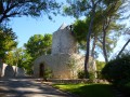
(1) Climb the rock on the left to reach the path and, further up, turn left. Walk down the path to the ruins.

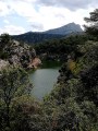
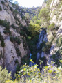
(2) Stop for a moment by the stream where there is a small waterfall – a refreshing break – then cross over and head up the path on the other side of the stream; it’s a bit steep. Continue along the path, generally heading west, and walk down to the gate. Note: if you turn right, you can reach the Zola dam.

(3) Our route suggests turning left. You’ll rejoin the road, which you follow to the left along the Chemin de la Paroisse. On the D17, turn left. Follow the Route Cézanne. Pass the Canal de Provence and the Cause, and, after the Relais de Cézanne, you’ll reach the Moulin de Cézanne.
Turn left, walk past the mill and, at the end of the road, you’ll come back to the cemetery car park (S/E).

Waypoints

  1. S/E : mi 0 - alt. 676 ft - Cemetery car park
  2. 1 : mi 0.24 - alt. 801 ft - Rock climbing - Cause (rivière)
  3. 2 : mi 0.75 - alt. 604 ft - The ruins and the small waterfall - Barrage romain
  4. 3 : mi 1.04 - alt. 679 ft - At the gate, head down to the left - Barrage Zola
  5. S/E : mi 1.8 - alt. 676 ft - Cemetery car park

Notes

The stream, running alongside the ruins and in front of the Canal de Provence headquarters, offers a refreshing stroll.

Worth a visit

Take a refreshing break by the ruins and in front of the Canal de Provence, followed by an artistic tour of Cézanne’s Mill.

Information: Art Season

Reviews and comments

3.9 / 5
Based on 3 reviews

Reliability of the description
3.7 / 5
Ease of following the route
3.7 / 5
Route interest
4.3 / 5
User 3586041

Overall rating : 4.3 / 5

Date of your route : Apr 27, 2026
Reliability of the description : ★★★★☆ Good
Ease of following the route : ★★★★☆ Good
Route interest : ★★★★★ Very good
Very busy route : No

Please note that the lower section after the start is closed. You can walk the circular route in the opposite direction, stopping at the mill and returning via a different path and road.

Machine-translated

User 11436760

Overall rating : 4 / 5

Date of your route : Sep 29, 2025
Reliability of the description : ★★★★☆ Good
Ease of following the route : ★★★★☆ Good
Route interest : ★★★★☆ Good
Very busy route : Yes

Blocked after climbing the first rocks due to the risk of rockfall. I followed another path so as not to be left unsatisfied.

Machine-translated

Glanie
Glanie

Overall rating : 3.3 / 5

Date of your route : May 13, 2024
Reliability of the description : ★★★☆☆ Average
Ease of following the route : ★★★☆☆ Average
Route interest : ★★★★☆ Good
Very busy route : No

We weren’t able to complete the circular path because the path beyond the stream was closed. So we had to retrace our steps and, to get back to the finish line more quickly, we took a shortcut (marked in yellow, like the path at the start) which was quite steep and not easy going. All in all, a mixed experience.

Machine-translated

Other walks in the area

For more walks, use our search engine .

The GPS track and description are the property of this route's author. Please do not copy them without permission.