Country:
 City:


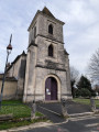
The route is described as starting from the crossroads in the centre of Saint-Romain, but the best place to start and finish is actually the church forecourt, which is well worth a visit.
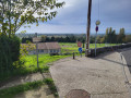
(S/E) Set off along the small road towards Saint-André-de-Cubzac and follow it for 200 m until you reach the hamlet of Lilov.
(1) Turn left down a flight of steps and along a path leading to a sports ground. The path descends alongside the school and joins a road, Chemin de Périnièvre, which you should follow to the right for about 100 metres.
(2) A path opens up on the left between two houses and leads into a residential estate via Rue de Fontenelle and then Chemin des Menuisier. Continue to the right along Chemin de Pradinos, then turn left onto Route de Saint-Martin until you reach the village of Asques.
(3) Turn right at the junction between Rue de l’Église and Rue de la Vieille Côte, and head down to the harbour.
(4) Walk alongside the river for 10 metres before heading back up the hillside via a flight of steps, then take Rue de l’Église, passing in front of the church. Return to the previous junction.
(3) Turn right into Rue de l’Ancienne Mairie, and as soon as possible turn right onto a small road. Continue along Chemin d’Arlequin until you reach a crossroads with a footpath.
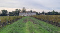
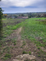
(5) Turn right onto this grassy path between the vineyards. Note: this path is not shown on the IGN map but does indeed exist, as verified on the land registry and on site. Continue along another path until you reach a hedge by a stream. Turn right, then left at the next junction until you reach the hamlet of Malande. Turn left at a 90° angle, then head towards the hamlet known as Le Chemin Court.
(6) Take the small road on the left to cross the marshes. You’ll come to a T-junction.
(7) Leave the road by turning right and walk through the former vineyards: the vines have been grubbed up. Follow a hedge until you reach a very narrow road.
(8) Head straight north up the hillside until you come out onto the D737.
(8) Turn left onto it and follow it for about a hundred metres. Turn right, between two wooded areas, onto a small path. Walk downhill for 50 metres and turn sharply left, more or less beneath a slope and once again through uprooted vines. You’ll come to a four-way junction.
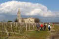
(10) Turn left at a 90° angle, head downhill and then uphill again through the vineyards until you reach the church car park (S/E).
 Visorando Member

 Moderate
 Tourist office