Country:
 City:
City:


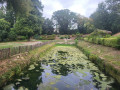


Park in the car park at the Saint-Vincent-de-Paul pond.
(S/E) Follow the road towards the church, then, keeping to the right-hand side of the road, walk up the ramp to the Gustave Eiffel Bridge. Caution! The footpath is also a cycle path; please give way to cyclists. Cross the Dordogne, then walk down the ramp on the opposite bank to the Route d’Asques.
(1) Turn right, making a 180° turn, to take the path that leads back towards the bank of the Dordogne. The path leads to the bridge’s pointed arches, then down to the riverbank. Warning! During strong equinoctial tides, the path and the riverbank may be completely flooded at high tide! Then walk along the river on your left-hand side, towards the harbour, and head up Rue du Port.
(2) At No. 41, take Rue de Conseillant on your left. Walk 350 m, then take Rue de Bonnefont on your left. Pass under the railway bridge and continue for about 500 m.
(3) Turn left, following the cycle route signposts, and follow Route de la Redoute. Pass Chemin de Labry on your left, then take two bends to reach the junction with Rue de la Racace.
(4) Carry straight on along the street, which is now called Côte des Moulins, until you reach the N10 (Avenue de Paris).
(5) Cross the main road: – be careful, as there is heavy traffic.__ Then walk under the railway bridge, staying on the footpath on the left-hand side of the road. Immediately after the bridge, take the road on your left, following the cycle route signs. Walk along this road until you reach a T-junction.
(6) Stop following the cycle route signs and turn right onto the dirt track leading up to Terrefort Castle. Walk past the castle, then turn right to go round the grounds. At the end of the small copse within the grounds, turn sharply left towards the gate that cannot be passed through.
(7) Follow the low wall on your right and ride alongside it until you reach Rue de la Pachette, which lies just behind it. Once on the street, ride alongside the low wall again, but in the opposite direction to before. When you reach the gate again (but on the other side), follow the street towards the church until you reach the Stop sign. Please note that the street is narrow and it can be tricky to pass local residents’ vehicles.
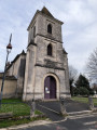
(8) Cross Rue de l’Église with due care, then pass between the church entrance and the war memorial. Further along, look out for a stone wall with a gap through which you can pass. Go through the gap, descending the two steps of a small staircase. Continue until you reach a beautiful viewpoint.
(9) Next, follow Rue de Saint-Julien, keeping the viewpoint on your left. At the Stop sign, turn left into Rue de la Cure. When you reach Rue de l’Église, turn left and stay on the left-hand pavement.
(10) Turn left into Rue du 19 Mars 1962 (one-way street). 250 metres further on, after No. 7, take the Passage de Bicot on your right. Continue to the ‘Stop’ sign.
(11) Cross Avenue de Paris at the pedestrian crossing and enter the alley opposite, on the corner of the PME. About twenty metres further on, go through an opening in the boundary wall of the town hall’s municipal park and enter the park. Enjoy the peace and quiet of the place, the beautiful trees and the little pond. Walk diagonally across the park so that you reach Chemin du Parc at the far end. From there, leave the park by taking Chemin du Parc on your left, moving away from Avenue de Paris. At the end of the path, follow Rue de la Barrière, turning left. At number 7, carry straight on along the road, which is blocked off and marked as a no-entry zone (it is not blocked off for pedestrians). This will take you to the ruins of the Château des Quatre-Fils-Aymon, a former 13th-century fortified castle. At the end of the street, just before the ‘Stop’ sign, turn right towards the harbour and the Café de Paris.
(12) Just before the Café de Paris cellars, turn left into Rue des Terrasses. At the ‘Stop’ sign, cycle along the N10 on the right-hand side until you reach the ‘Stop’ sign for cyclists.
(1) Cross the road following the cycle path: watch out for heavy traffic! After crossing the road, veer right to go up the ramp of the Eiffel Bridge in the opposite direction to the way you came. Cross the Dordogne. Once you reach the left bank and can see the Saint-Vincent-de-Paul pond, just after the end of the metal railing, head down to the left; a stone staircase will take you down to the edge of the pond. Go round the pond on the left to reach the car park (S/E).





 Visorando Member
 Easy
Easy 
 Tourist office