


 Country:

 City:
City:


Start from the car park at the Faulx-les-Tombes football ground, Rue Basse Ramsée. Head west and follow the route shown on the map.
Circular walk around the Domaine d’Arville, Mozet and the Château de Faulx-les-Tombes


Starting from the Faulx-les-Tombes football ground, this walk takes you through woods, meadows and Mozet, one of the most beautiful villages in Wallonia. This region is home to a varied and abundant array of wildlife. It is a varied, undulating and entertaining walk, which I hope you will thoroughly enjoy.
Details
Creation:
Last update:
Last review:
–
–
-
 Activity: Walking
 -
 Distance: 8.39 mi
 -
 Average duration: 4h 30
 -
 Difficulty: Moderate
 -
-
 Back to start: Yes
 -
 Ascent: + 735 ft
 -
 Descent: - 715 ft
 -
-
 Highest point: 820 ft
 -
 Lowest point: 430 ft
Description of the walk
Waypoints
- S/E : mi 0 - alt. 574 ft - Football ground car park – Faulx-les-Tombes
- 1 : mi 0.66 - alt. 584 ft - Junction
- 2 : mi 1.22 - alt. 679 ft - Crossroads
- 3 : mi 1.47 - alt. 666 ft - Junction
- 4 : mi 2.07 - alt. 719 ft - Crossroads - Chapelle Notre-Dame (Mont-Sainte-Marie)
- 5 : mi 2.18 - alt. 689 ft - Start of the trail
- 6 : mi 2.57 - alt. 476 ft - Crossing the N941
- 7 : mi 3.36 - alt. 610 ft - T-junction
- 8 : mi 4.29 - alt. 515 ft - Crossroads
- 9 : mi 4.62 - alt. 456 ft - Crossroads - Tour de Royer (Mozet)
- 10 : mi 4.71 - alt. 456 ft - Crossroads - Église Saint-Lambert (Mozet)
- 11 : mi 4.84 - alt. 443 ft - Start of the trail
- 12 : mi 5.63 - alt. 512 ft - Crossing the N941
- 13 : mi 6.29 - alt. 453 ft - N942 road - Château de Faulx-les-Tombes
- 14 : mi 6.34 - alt. 449 ft - Start of the trail - Samson (Rivière) - Belgique - Affluent de la Meuse
- 15 : mi 6.97 - alt. 469 ft - Roundabout
- 16 : mi 7.15 - alt. 479 ft - Start of the trail
- 17 : mi 7.34 - alt. 522 ft - Crossing the N942
- 18 : mi 7.57 - alt. 571 ft - Rue de Courrière
- 19 : mi 7.72 - alt. 594 ft - Start of the trail
- 20 : mi 8.04 - alt. 604 ft - Rue de Courrière x Au Mitan
- S/E : mi 8.39 - alt. 574 ft - Football ground car park – Faulx-les-Tombes
Notes
Please keep your dog on a lead.
On several occasions, the public footpaths cross private woodland; it is strictly forbidden to leave these areas.
Other walks in the area
Arches and Wings from Gesves
 Visorando Member9.10 mi
+535 ft
-505 ft
4h 40
Moderate
Visorando Member9.10 mi
+535 ft
-505 ft
4h 40
Moderate
 Departure from Gesves (Province de Namur)
Set off to explore the countryside and forests between Faulx-les-Tombes and Gesves.
Nature walk in Faulx-les-Tombes
10.55 mi
+902 ft
-889 ft
5h 40
Moderate
Departure from Gesves (Province de Namur)
A beautiful nature outing: that's the essence of this walk.
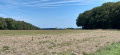
Arville Woods and Pauvres Woods
 4.56 mi
+390 ft
-381 ft
2h 25
4.56 mi
+390 ft
-381 ft
2h 25
 Easy
Departure from Gesves (Province de Namur)
Easy
Departure from Gesves (Province de Namur)
Walk through woods and countryside around Arville Castle
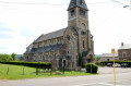
The springs of Arville de Faulx-les-Tombes and Mont-Sainte-Marie de Mozet
 5.53 mi
+633 ft
-659 ft
3h 05
Moderate
Departure from Gesves (Province de Namur)
5.53 mi
+633 ft
-659 ft
3h 05
Moderate
Departure from Gesves (Province de Namur)
Between the white farmhouse and the red farmhouse, take a narrow country road to discover an old mineral water production site that was the village's main industry for 60 years until 1971. Then head back up towards the hamlet of Mont-Sainte-Marie, whose origins date back tothe 12th century.
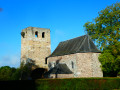
From Mont-Sainte-Marie to Sart-Mère circular
 13.29 mi
+1,306 ft
-1,335 ft
7h 15
13.29 mi
+1,306 ft
-1,335 ft
7h 15
 Difficult
Departure from Gesves (Province de Namur)
Difficult
Departure from Gesves (Province de Namur)
This walk alternates between forests and countryside in the 'Fête de Mai' area of the Namur Condroz. The route allows you to discover some of the works of art created over time since the beginning of the 21st century. You can admire the works 'Mange-Bois', 'Cathédrale de Lumière', 'Je suis furieux', 'Parle Papote Chhhuuuuut', 'Cairn de Feu' and 'Serpon-Dragent'.
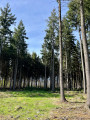
Courrière Educational Woodland
 1.62 mi
+66 ft
-66 ft
0h 50
Easy
Departure from Assesse (Province de Namur)
1.62 mi
+66 ft
-66 ft
0h 50
Easy
Departure from Assesse (Province de Namur)
Located in the village of Courrière (in the municipality of Assesse), this woodland has been developed to help visitors discover: the forest, local biodiversity and ecosystems. It is a short, fun and educational walk. The three walks through the woodland: green trail (1.6 km), blue trail (2.3 km) and red trail (2.8 km)
From Mozet to Mont-Sainte-Marie circular
 6.53 mi
+584 ft
-571 ft
3h 30
Moderate
Departure from Gesves (Province de Namur)
6.53 mi
+584 ft
-571 ft
3h 30
Moderate
Departure from Gesves (Province de Namur)
This circular walk alternates between countryside and forest, starting from one of the most beautiful villages in Wallonia and leading to the hamlet of Mont-Sainte-Marie and the remains of a Romanesque watchtower dating from the 11th-12th centuries, as well as the Gothic choir of a 16th-century parish church. On the way back, the route passes the farms of Basseilles and Bialy, as well as some works of art from the Fête de Mai festival.
For more walks, use our search engine .
The GPS track and description are the property of this route's author. Please do not copy them without permission.

