Country:

 City:


Park in the car park at the Col de Belle Barbe.
(S/E) Head towards the Col du Mistral by following the tarmac track until you reach it.
(1) Stay on the road, heading down to the left to quickly reach the Pont du Perthus.
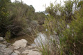
(2) Leave the road as it bends to the left and take the track on the right. Follow the Ruisseau du Perthus along its right bank. Navigate several bends to follow the meandering course of the stream. You’ll reach the Pont des Cantines.
Note on this section: the tracks have been damaged in places following heavy rainfall.
(3) Cross the bridge and then follow the Ruisseau du Maraval to the left, keeping to its left bank. You’ll come to a Y-junction of tracks marked by a fire hydrant.
(4) Take the track on the right. Continue uphill until you reach the top of a rise, where you’ll come to another crossroads.
(5) Leave the track and turn left onto the narrow path, which presents no particular difficulty. Cross a few streams, which may be dry, and continue the ascent for about 4 km until you reach theGR®51at the highest point.
(6) Turn right onto it and, a few metres further on, you’ll reach the junction with the Route des Cols track. Take this to the right and begin an easy descent, which will eventually lead you back to the Baisse Violette cistern.
(7) Turn sharply right (90°), continue the descent, still following theGR®51marked in red and white, and reach the Col des Suvières junction.
(8) Keep to the track on the right and reach thetrack-GR® junction. Leave theGR® on your right and continue along the track. Still on a gentle descent, you’ll rejoin theGR®51at the Baisse Mathieu junction.
(9) Keep left onto the track, which here follows theGR®51with its characteristic red-and-white markings. Continue on to reach the Baisse de la Grosse Vache, a junction of several tracks.
(10) Take thefirst left, towards L’Écureuil; the track descends to a small lake. Continue along the track until you reach the Croupe Baptiston Termes.
(11) Here, too, take a 90° turn to the right, passing beneath the Sommet des Redonnets whilst skirting it to the right. Continue the descent to reach the former Lac de l’Écureuil, which, sadly, no longer exists.
(12) Stay on the track, ignoring the path to the left. Carry on until you reach a ford.
(13) Cross the stream here to reach the left bank, then carry on through the Ravin du Mal Infernet until you reach another ford.
(14) Cross the stream at this ford and stay on the track and theGR® to reach, further on, the Col de Belle Barbe car park (S/E).


 Visorando Member


 Moderate
 Easy