Country:

 City:


Starting point at the foot of the statue entitled ‘Le Guide’, next to the tennis and basketball courts (plenty of parking spaces).
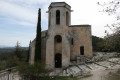
(S/E) Head towards the car park exit and the cemetery. Join the Grande Rue and follow it to the right, keeping Maubec Church in sight.
(1) At the fork in the road (cemetery car park on the left), take the left-hand track. At the foot of the church, turn right onto the Chemin d’Oppède-le-Vieux. Continue straight on along this even, slightly stony track (view of the Luberon on the right). This will lead you to a road junction.
(2) Turn right onto the Chemin de la Combe de Saint-Pierre and walk alongside a patch of vines on your right. At the junction at the corner of the vineyard, turn right.
(3) After about fifty metres, turn right through a gap in a wall and follow the vineyard uphill. Follow the path as it winds its way through the pine trees for about fifty metres. You’ll come out onto a forest track; follow it to the left. Follow the ridge line (on the right, a view of the village of Maubec).
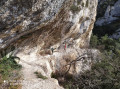
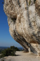
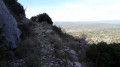
(4) Further on, the exposed rock formation forms a section resembling steps. Descend this for one or two metres, then turn right onto a path running alongside a rock face. Continue straight on (north-west). Towards the end, the path is protected on the left by metal railings, followed by wooden ones.
(5) You’ll emerge onto Rue des Pompes; follow it to the right and turn immediately right into Rue de l’Église. Walk past the church on your right and you’ll come to a junction you passed earlier in the walk.
(1) Follow the Grande Rue, walk past the cemetery and you’ll soon come to the car park on the left (S/E).

 Visorando Member
 Difficult

 Moderate