Country:

 City:
City:




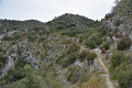
The route starts from the car park just past the cemetery, opposite the playgrounds.
(S/E) From the car park, go to the left or right of the church to climb up to the old village and then descend on the other side towards the “Les Royères du Prieuré” campsite.
(1) Go through the main entrance to the campsite and follow the road opposite uphill. At the top, a small gate allows you to pass through the campsite fence.
(2) Take the path on the left towards the Combe de Saint-Pierre.
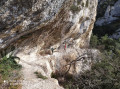
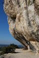
(3) When you reach theGR®6, you can head up to the right along a well-marked path to explore a small cave and, further up (about 130 m higher), a rock shelter. Head back down towards theGR®6and follow the path to the right towards Oppède.
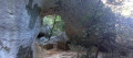
(4) Just before reaching Oppède, take the yellow-marked path on the right towards La Jassine. After about 300 m, you’ll come across a beautiful natural arch on the right.
(5) Continue climbing, due south, up the Vallon de Combrès until you come to a flowerbed at the foot of an oak tree, to the right of the path.
(6) Turn right here and climb up the scree slope into the Vallon de Fréguié. This is the most difficult section: the slope is very steep and the scree is unstable, with no real path.
There may be a path on the right leading to the arch. Personally, I couldn’t find it and climbed all the way to the top of the scree slope.
(7) Head back down towards the arch along a barely visible track.
After climbing back up from the arch, continue due south along a path marked by cairns. You’ll reach a junction, marked by a large cairn, with the Chemin de la Barre de Gautier.
(8) Follow it to the left, still heading south, until you reach a wide track.
(9) Follow this track north-west for about 800 m, towards the Sommet des Fourcats. Ignore a track branching off to the right and look out for a path on the right immediately afterwards.
(10) Follow it down the Vallon de Passéguier to the Vallon de la Sapine.
(11) Head down the valley on the left until you reach a junction at a place called La Citerne.
(12) Head uphill to the right towards “Les Taillades”, then 80 m further on, at another junction, continue uphill to the right until you reach the top, still heading towards Les Taillades.
(13) Then turn right towards “Le Quillot”. 60 metres further on, ignore the first path on the left and carry on straight ahead for about a hundred metres until you reach a fork.
(14) Head down the path on the left marked “Drovers' Road of Maubec, Brothers Nouguier”. This long descent takes you back tothe GR® 6 and the campsite fence. Turn right to find the small gate.
(2) Turn left, cross the campsite and return to the large car park past the cemetery (S/E).


 Visorando Member

 Moderate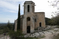
 Easy
Easy