Circular Thieure starting from Vals-les-Bains

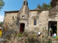
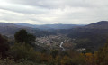
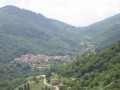
The spa town of Vals-les-Bains is situated in a partly volcanic and fairly steep landscape, particularly to the north. From the heights, you can still clearly see the old farm buildings in the valleys and on the slopes. Thieure is a small hamlet perched on a promontory overlooking Vals. To get there, you have to climb a steep slope, but the view that greets you at the top is well worth the effort.

Details

46327813
Creation:
Last update:
Last review:
  • Walking
    Activity: Walking
  • ↔
    Distance: 8.47 mi
  • ◔
    Average duration: 5h 30 
  • ▲
    Difficulty: Moderate

  • ⚐
    Back to start: Yes
  • ↗
    Ascent: + 1,831 ft
  • ↘
    Descent: - 1,857 ft

  • ▲
    Highest point: 1,844 ft
  • ▼
    Lowest point: 794 ft

Description of the walk

Park in the Domaine des Bains car park in Vals-les-Bains.

(S/E) Follow Rue de la Santé to Boulevard de Vérone. Turn left onto Pont Saint-Jean and cross the Volaine.

(1) Turn right onto Rue Jean Jaurès, then leave this road at the next junction and turn left onto Route d’Oubreyts. Walk past the cemetery, then the pumping station. Continue to the junction with Route d’Autuche.

(2) Turn left onto it and continue up a gentle slope to reach a multi-way junction, past the village of Autuche.

(3) Turn right onto Chemin du Cousteja and arrive at the entrance to the village of Meysonnent.

(4) Take the path on the left, cross the Route de la Javarde, continue along the path and emerge at the hamlet of Guibourdenche. Continue the climb via a series of hairpin bends to reach a high point in the hamlet of Les Ayres.

(5) Head diagonally to the right along the downhill path to Aulagnet Haut. Before reaching the hamlet, after passing over a ridge, take the PR®-marked path to the right. Pass between the trees, cross a stream, then emerge next to a house in the hamlet of Aulagnet Haut.

(6) Join the track at the bottom of the hamlet and follow it down to the right; turn left up the steps to reach Aulagnet Bas and the D243. Cross this road and, before the river, turn left onto the path that crosses the Besorgues. Begin a steep climb with a series of hairpin bends, leading to the hamlet of La Vieille Église.

(7) Turn right at the next crossroads, after the hairpin bends. Continue until you reach the hamlet of Thieure.

(8) Begin another descent, with hairpin bends, through the woods, leading to the junction with the D578.

(9) Follow it to the right, taking care, for about a hundred metres. You’ll come to a three-way junction, with a bridge over the Volane in sight – this is the Pont de Bridou. Stay on the road to the right, on the right bank of the Volane. This is theGRP® marked in yellow and red. Follow the Volane along its right bank. You’ll reach the D243, near the Pont de l’Ocre.

(10) Follow it to the right as far as Pont Neuf. Take the bridge to the right, staying on theGRP® the whole time, following the Besorgues and then the Volane again, until you reach the Mas de Cros neighbourhood.

(11) Continue along theGRP® and the bank of the Volane, passing the ‘Au Fil de la Volane’ campsite. Walk past the cemetery and the fire station, then past the town hall. Join Rue du Four; turn right onto it to return to the junction with Route d’Autuche, which you passed on the way out.

(2) Turn left and retrace your steps along the route you took on the way there until you reach the Pont Saint-Jean.

(1) Opposite, take Rue Auguste Clément; turn left off it to enter the woods, head towards the thermal baths, turn left, cross the footbridge, and continue on to the thermal baths car park (S/E).

Waypoints

  1. S/E : mi 0 - alt. 833 ft - Thermal Baths car park
  2. 1 : mi 0.24 - alt. 820 ft - Pont Saint-Jean
  3. 2 : mi 0.55 - alt. 876 ft - Autuche crossroads
  4. 3 : mi 1.3 - alt. 968 ft - Autuche
  5. 4 : mi 1.51 - alt. 1,066 ft - Meysonnent
  6. 5 : mi 2.27 - alt. 1,654 ft - Les Ayres
  7. 6 : mi 3.18 - alt. 1,270 ft - L’Aulagnet Haut
  8. 7 : mi 3.61 - alt. 1,342 ft - The Old Church
  9. 8 : mi 4.22 - alt. 1,841 ft - Thieure
  10. 9 : mi 4.97 - alt. 1,033 ft - D578
  11. 10 : mi 5.77 - alt. 955 ft - Pont de l’Ocre
  12. 11 : mi 6.86 - alt. 896 ft - Le Mas du Cros
  13. S/E : mi 8.47 - alt. 833 ft - Thermal Baths car park

Notes

(5) Lavoir aux Ayres.

Always be cautious and plan ahead when you're outdoors. Visorando and the author of this route cannot be held responsible for any accidents occurring on this route.

The GR® and PR® markings are the intellectual property of the Fédération Française de Randonnée Pédestre.

Reviews and comments

4.6 / 5
Based on 3 reviews

Reliability of the description
4.7 / 5
Ease of following the route
4.3 / 5
Route interest
4.7 / 5
ludovic.sauvajon
ludovic.sauvajon
• Edited:

Overall rating : 4 / 5

Date of your route : Aug 17, 2025
Reliability of the description : ★★★★☆ Good
Ease of following the route : ★★★★☆ Good
Route interest : ★★★★☆ Good
Very busy route : No

The route isn't very interesting until point 6, with a paved section and trails that are moderately passable; the rest is very nice. GPS is essential. Take the time to explore Bezorgues and Volane.

Machine-translated

legodvicien
legodvicien
• Edited:

Overall rating : 5 / 5

Date of your route : Jul 31, 2025
Reliability of the description : ★★★★★ Very good
Ease of following the route : ★★★★★ Very good
Route interest : ★★★★★ Very good
Very busy route : No

A beautiful hike punctuated by steep climbs and beautiful descents amid chestnut trees.
Fantastic views upon arrival in Thieure.
We had a picnic near a beautiful waterfall at the foot of the climb to Thieure.
A fairly challenging route, but easy to follow.

Machine-translated

User 4416025

Overall rating : 4.7 / 5

Date of your route : May 26, 2025
Reliability of the description : ★★★★★ Very good
Ease of following the route : ★★★★☆ Good
Route interest : ★★★★★ Very good
Very busy route : No

I completed the route in two stages, starting from the Pont du Bridou; I then made my way back to the Pont de l’Ocre to return.

Machine-translated

Other walks in the area

For more walks, use our search engine .

The GPS track and description are the property of this route's author. Please do not copy them without permission.