


 Country:
 City:
City:


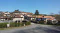
Park in the hamlet of Veyrinas.
(S/E) Head north-east along the Route de Veyrinas; you’ll very quickly reach the three-way junction.
(1) Turn left onto the Route des Veyrières. Stay on this road at the following junctions until you reach an X-shaped crossroads.
(2) Facing the road leading to Peyreleine, take the path on your left that winds down alongside a field. When you reach a road, turn left onto it. At the next road, turn right to reach the village of Brégéras.
(3) Head up to the left until you reach the bus stop. Turn right and follow the road, which turns into a path.
This track goes through a wood and comes out onto a road. Head downhill to the right to find a car park at Le Chambon.
(4) Cross the D32 road, then the village, and begin the descent to the bridge over the river.
(5) Turn right after the bridge, follow the Briance river, and head for the ford on the small tributary of the Briance.
(6) Cross this ford and immediately begin a climb which may be a little difficult depending on the season. Follow the edge of the Grand Bos to reach a large crossroads of paths.
(7) Turn left twice, then follow the path which starts off flat before gradually climbing. When you reach a cobbled track, turn left onto it and continue along it to reach the village of Banneix.
(8) Walk through Banneix and continue to the crossroads. After a small pond, turn left towards Le Puy de Banneix. Walk through this village and head for a small manor house on the outskirts of the village.
(9) At the crossroads, take the path leading down to the left. Stay on this main path heading south. You’ll reach the banks of the Ruisseau d’Envaud. Follow its left bank to reach another ford.
(10) Cross the ford and begin another steep climb, which can be tricky depending on the season. Leave the woods and arrive at the crossroads in the hamlet of La Plagne.
(11) Turn left, almost 180°, onto the road which heads due north towards the village of Envaud.
(12) Stay on the road after passing through the village; a long stretch of road will take you to the Pont Rompu.
(13) Turn right onto the road; at the next junction, veer left to descend towards the Ruisseau du Cheyrol, where the third ford awaits you.
(14) Cross it and, as with the previous ones, tackle another climb which may prove difficult depending on the season. After leaving the woods and passing through a clearing, you’ll come out onto a road.
(15) Turn right onto this road to reach the village of Villebon.
(16) Pass the farm opposite and walk alongside the house with blue shutters. Take the path opposite, with a farm on your right.
You’ll reach another small stream for a fourth fording. Another climb leads to the path junction at the edge of the woodland and a clearing.
(17) Turn left; after a short climb, you’ll join theGR® shared routes 4 and 654, marked in red and white. Follow it to the left to reach the junction of the hamlets of Chabiran and Gounaudou.
(18) Head due north at the first left; the path alternates between woodland and clearings before, after a hairpin bend to the right, reaching a bridge over the Briance at the entrance to Solignac
(19) Cross this bridge, then leave theGR® and turn left onto Rue des Fosses. Continue to Avenue Saint-Éloi.
(20) Turn right onto it, then turn left at the next junction. Stay on this new road, ignoring all the roads branching off to the right.
Cross the railway bridge and continue along Route Les Gallands.
(21) Cross the railway line a second time. Keep heading north along the road; at the top of the hill, you’ll reach a junction near the hamlet of Pouzol.
(22) Turn left onto the track and head south-west towards the hamlet of Les Conces. Keep left at the junction and continue down the hill. At the last houses, you’ll come to a Y-junction.
(23) Turn right onto the road signposted ‘Sans Issue’, which quickly turns into a footpath. Stay on this path and head north-west to reach the junction you passed on the way out.
(1) Follow the same route as on the way out to return to the car park at Veyrinas (S/E).

 Visorando Member
 Easy
Easy 
