Country:

 City:
City:


The starting point is a car park on the bayfront, close to the town, which is handy for doing a bit of shopping before setting off on the walk. The car park is pay-and-display during the summer season, and free at other times.
(S/E) From the car park, walk along the quays.
(1) After walking along the quays, turn onto the road towards Higuer Lighthouse and, very soon after, turn right onto the path towards the first headlands (puntas), following the red and yellow markers.
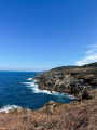
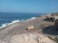
(2) Pass the Higuer lighthouse, cross the road and join the path that marks the start of the GR® 121 towards Pasaia. The view opens out onto the coast once you’ve passed the sewage treatment works below. You then follow the coastline, moving from cove to headland and back again. The rock becomes increasingly eroded and the path runs as close as possible to the water’s edge. There are a few stream crossings, most of which have been made safe.
(3) A pretty cove, well sheltered from the swell. The water is crystal-clear, making you want to take a dip. Be sure to follow the signposts carefully here, as the path running alongside the cove is a dead end: go back a short way and take the path up the cliff; everything is clearly signposted.
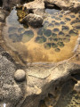
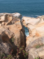
(4) Look for the face of an old woman gazing out to sea through a crevice in the rocks! The rocks have been carved by the water and the wind, and it’s easy to be captivated by their evocative shapes. It’s also easy to find yourself drawn down towards the base of the cliffs, whilst the path actually climbs back up to allow a stream to pass through.
(5) A small waterfall before heading towards Punta Biosnar, a spot that’s perfect for a break on the rocks and a moment of contemplation.
(6) Head towards the red marker on the left and begin the climb up to Jaizkibel.
(7) Leave the path and carry on straight ahead across the fields. This section is steeper than if you were to follow the path, but it’s quicker. Take the path on the left and continue climbing until you reach the road, which you’ll cross.
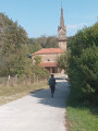
(8) Join the Camino del Norte to reach the Chapel of Guadalupe.
(9) After a break at the chapel, take the path on the right-hand side of the road which leads down to Hondarribia, our starting point. This path is quite steep and clayey in places, so watch your step. You’ll soon reach sections of tarmac road.
(10) You’ll come to a roundabout, which you should cross. Take the footpath and cycle lane to the entrance to Hondarribia’s old town.
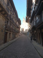
(11) Pass through the archway and wander through the old town, with its houses featuring wide roofs.
(12) Walk along San Pedro Kalea, the heart of Hondarribia, the perfect spot for a few pinchos and a couple of glasses of Crianza to lift your spirits. Then head back along the quays to return to the starting point.
 Visorando Member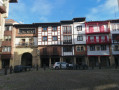
 Easy
Easy 
 Association / Club / Walk leader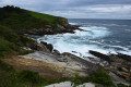
 Moderate