


Circular route around Les Forbos to mark the 50th anniversary of Unit DL 007


A short, picturesque circular route starting from the centre of the village of Grand-Rechain. This lovely route is suitable for pushchairs and offers a lovely view of our beautiful Pays de Herve, its hedgerows and countryside.
Details
Creation:
Last update:
Last review:
–
–
-
 Activity: Walking
 -
 Distance: 2.50 mi
 -
 Average duration: 1h 15
 -
 Difficulty: Easy
 -
-
 Back to start: Yes
 -
 Ascent: + 154 ft
 -
 Descent: - 125 ft
 -
-
 Highest point: 1,024 ft
 -
 Lowest point: 860 ft
 Country:
 City:
City:


Waypoints
- S/E : mi 0 - alt. 906 ft - Grand-Rechain
- 1 : mi 0.18 - alt. 889 ft - Fourche
- 2 : mi 0.95 - alt. 961 ft - Fourche
- 3 : mi 1.6 - alt. 1,024 ft - Crossroads
- 4 : mi 2.17 - alt. 928 ft - Crossroads
- S/E : mi 2.5 - alt. 906 ft - Grand-Rechain
Other walks in the area
50th Anniversary of the DL 007 Unit Circular via the Bois de Hervé
 Visorando Member5.09 mi
+249 ft
-276 ft
2h 35
Easy
Visorando Member5.09 mi
+249 ft
-276 ft
2h 35
Easy
 Departure from Verviers (Province de Liège)
A short, picturesque circular route starting from the centre of the village of Grand-Rechain. This lovely route offers exceptional views of our beautiful Pays de Herve, its hedgerows and countryside. This route is not suitable for pushchairs.
DL 007 50th Anniversary Circular from Grand-Rechain
9.29 mi
+673 ft
-699 ft
4h 50
 Moderate
Departure from Verviers (Province de Liège)
Moderate
Departure from Verviers (Province de Liège)
A short, picturesque circular route starting from the centre of the village of Grand-Rechain. This lovely route offers exceptional views of our beautiful Pays de Herve, its hedgerows and countryside. This route is not suitable for pushchairs.
Soiron naturally between Olne and Lambermont
 10.22 mi
+1,686 ft
-1,670 ft
6h 10
Moderate
Departure from Pepinster (Province de Liège)
10.22 mi
+1,686 ft
-1,670 ft
6h 10
Moderate
Departure from Pepinster (Province de Liège)
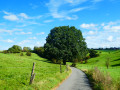
Starting from the pretty Place du Moulin in Soiron – one of the most beautiful villages in Wallonia – after admiring the old wash house, the walk gradually heads west into the countryside and offers a beautiful view of the Bola valley. The entrance to Olne crosses the Bois d'Olne and takes the beautiful Côte en Égypte before branching off to descend into the valley. The climb up the Croupet du Bois is hard on the calves, as is the descent on a bend in the Vesdre l'Est. At the viewpoint over the Vesdre, the route heads due east across meadows towards Cornesse and Wegnez, to the Paire sports complex, where it turns north towards the splendid wooded area of Tribomont and the bottom of Fiérain on the edge of Lambermont (Verviers). The route offers beautiful countryside scenery and some panoramic views of this pretty, hilly region.
Hike without description to be followed with the Visorando app.
Tour of Herve
25.22 mi
+2,021 ft
-1,995 ft
13h 20
 Very difficult
Departure from Dison (Province de Liège)
Very difficult
Departure from Dison (Province de Liège)
This fairly long and adjustable hike, measuring approximately 40 km, will take you along numerous small paths and allow you to discover some of the monuments of the Herve region and its surroundings. You will begin your adventure in the peaceful little village of Chaineux, then take a small rural path via Manaihant to the Xénemont mill (please note that the tunnel crossing the motorway may be closed). You will then pass through the town of Herve, where you will discover a farmhouse ice cream parlour. Head towards line 38 (an old railway line) towards a slag heap in Soumagne (an old coal mining area). Continue your journey through the small village of Melen and its woods and pass in front of Bolland Castle. You can decide to climb up to see the Charneux cross or follow the main road towards Battice to return to Chaineux via the meadows.
"Si la soupe m'était contée..." trail in Verviers
2.26 mi
+66 ft
-69 ft
1h 05
Easy
Departure from Verviers (Province de Liège)
3, 2, 1... let's go! Put on your trainers, grab your map and set off on a walk! Look up: along the route, you may be surprised by some small details. 3km circular walk (to be repeated for verification), accessible to all.
Photo trail organised as part of the Fureur de lire festival by the Verviers Library.
The Val de Fierain and the neighbouring villages
 7.86 mi
+607 ft
-610 ft
4h 10
Moderate
Departure from Pepinster (Province de Liège)
7.86 mi
+607 ft
-610 ft
4h 10
Moderate
Departure from Pepinster (Province de Liège)
Starting from Cornesse, make your way to the Val du Fierain through woods, meadows and villages. Treat yourself to this idyllic yet challenging walk.
For more walks, use our search engine .
The GPS track and description are the property of this route's author. Please do not copy them without permission.

