Country:

 City:


Park in the car park directly opposite the “La Bourbonnière” lodge.
(S/E) Take the D477 road with care, heading towards Roanne and the cemetery. Turn right onto a lovely uphill path marked by the GR®3A. Continue to the second junction.
(1) Follow the path opposite, still on the GR®3A. Pass by the Grand-Croix and continue along the GR®3A until you reach the D478. Turn left onto it for about a hundred metres, then turn left onto the forest track until you reach the junction just after.
(2) Leave the GR®3A, carry on straight ahead and, further on, turn left towards the Moulin Grand Valet.
(3) Cross the D120 with care and take the path leading downhill opposite. Continue along a lovely path (not shown on the IGN map), running alongside a low wall of old stones, until you reach the hamlet of Les Hormières.
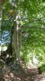
(4) Join the GR®3A again, turn right onto the D477 and walk through the hamlet (castle). 200 m further on, turn left onto the GR®3A. Continue straight on to the hamlet of Fayot. Along the way: magnificent hundred-year-old beech trees.
(5) In this hamlet, leave the GR®3A and take the path that descends to the left. Cross the Barbenan. Head back up to the hamlet of Épalle and walk through it.
(6) As you leave the hamlet, near the wash house, take the path on the right.
(7) Take a sharp right-hand bend onto a wide forest track.
(8) Carry on straight ahead at the crossroads.
(9) Turn left at the next crossroads. A little further on, turn right onto the D420 and continue for about 200 m.
(10) Take the sharp left-hand bend onto the wide path leading downhill. Pass through the hamlet of Villefort, then that of Sénepin.
(11) Turn right onto the footpath just after a small stream. A little further on, turn left, cross the Coindre via a small wooden bridge and continue straight on along the wide forest track.
(12) At the crossroads, turn left onto a grassy track and carry on until you reach the D120.
(13) Cross the road carefully and take the path opposite.
(14) Turn right just before reaching a road, then left at the next junction, then right 200 metres further on.
(15) At the next crossroads, near the winding beech-lined avenue, turn left onto a newly marked GR® trail. Further on, take the path on the left and you’ll reach a junction after 100 m.
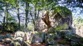
(16) Follow the GR® straight ahead. Head uphill through the woods. Cross the Pierre Châtel climbing area. Once on the plateau, take the road on the right and, at the crossroads, take the road on the left for a few metres.
(17) Take the grassy path on the left; at a place called Boffet, join a small road and follow it to the right for 600 m. Turn left onto a wide grassy track and you’ll reach the car park 200 m further on (S/E).

 Visorando Member
 Easy

 Difficult
 Association / Club / Walk leader