Country:

 City:
City:


Please note: this is an unmarked walk. You must be able to read a map and interpret the terrain.
Park in the car park of the L’Ortensia restaurant.
(S/E) The route starts at a signpost marked ‘Chemin de Béziers’, above the car park. An easy climb through the chestnut trees to the Col des Très Vents, where you rejoin the road.
(1) From there, continue left onto the Saint-Gervais / Hérépian road.
After passing the pass, turn left onto the Maurian road. This isn’t the best route, but it offers views of the plain. Carry on to Maurian, which you’ll pass through.
(2) After passing the church and the cemetery, take the path on the right, level with the last house. Initially flat, this path then begins to descend. You’ll reach the Col des Vignes.
(3) Take the path leading down to the right, ignoring the one on the left.
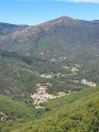
The descent follows a track offering views of the mountains and a glimpse of Graissessac.
(4) Once you reach Castanet-le-Bas, cross the old railway bridge and follow the railway line which runs alongside the fields. You will then arrive at the Rongas cemetery.
(5) Carry on to the old gatekeeper’s house.
(6) Take the road on the left which joins the main road. Follow it to the right for about a hundred metres.
(7) Turn right onto the Route de Mécle. Continue along this road.
(8) Leave the road when you see a (fairly steep) path on the left that winds its way up towards Neyran Castle. Climb up to the castle, walk through it whilst exploring the ruins, and look for the small path that leads back to theGR®. Don’t be afraid to go past the ruins to find it.
Head back down to Saint-Gervais.
(9) Cross the Notre-Dame bridge and head back towards the town centre via the street on the left. Cross the main road, continue along the small street opposite, then walk back up through the village. Pass the chemist’s, one of the two bakeries, and the post office (the former Hôtel Moutou, a local institution in the last century).
(10) Cross the bridge, from which you can admire the old washhouse.
(11) At the café, take the pedestrian alley (Ruelle du Lioch) which leads uphill in front of you and is on the corner with the grocery shop. At the end of this alley, you’ll come to the car park (S/E).




 Visorando Member
 Very difficult