Circular route around Changis

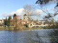
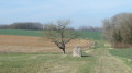
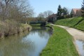
The plateaus between the Pays Briard and the Pays de l’Omois, nestled amongst the Marne hillsides.

Details

17062006
Creation:
Last update:
Last review:
  • Walking
    Activity: Walking
  • ↔
    Distance: 12.45 mi
  • ◔
    Average duration: 6h 15 
  • ▲
    Difficulty: Difficult

  • ⚐
    Back to start: Yes
  • ↗
    Ascent: + 561 ft
  • ↘
    Descent: - 561 ft

  • ▲
    Highest point: 466 ft
  • ▼
    Lowest point: 171 ft

Photos

Description of the walk

Park in the car park at Changis-sur-Marne station.

(S/E) Go under the railway lines via the underpass, follow Rue de la Gare and leave it at the corner by the old café. Turn right onto Rue du Général de Gaulle, then turn right onto Rue de la Ducharme, heading towards the cemetery; carry on, ignoring any side roads. You will then reach an X-shaped junction at the pumping station.

(1) Turn right, before the pumping station, onto Chemin de l’Ormois. Cross the railway bridge, carry on straight ahead, then turn into the first track on the right, Chemin des Godicheux.

(2) Turn slightly left at the end of the track, then turn left again onto the D53, continuing as far as the Ferme de Chivres.
(You can take a path on the right that runs along the edge of the woodland; it is not maintained as far as the cistern but is cleared beyond that. Then, at the second junction, turn left onto thePR®).

(3) Cross the bridge over the Ru de Chivres, then take the first steep path on the right which leads into the Bois de la Chapelle. Turn sharply right onto the first path, cross the woods and continue left across the fields along the Chemin des Vignes to reach the hamlet of Jaignes.

(4) Turn into the first street on the right, then at the junction with the Chemin du Grand Girat, turn left onto the Ruelle de la Source Sainte-Geneviève. Join the Rue de Verdun, turn right onto it and proceed to the junction with the D3 road.

(5) Carry on straight ahead, still on the D53. After passing under the power line, turn right then left to enter the hamlet of Rutel; cross it by following Rue Jean Camille Fourcy.

(6) Turn sharply right (90°) onto Chemin des Grands Marois at the corner of a derelict farm building.
PR® yellow markings. Head back down towards the Ru de Rutel, cross it, then follow the road uphill to the tunnel under the motorway.

(7) Pass under the motorway and continue along a path lined with thorny bushes. Carry on along the farm track through the orchards until you reach the tarmac road. Turn right onto it for a few metres and you’ll reach the entrance to the hamlet of Molien.

(8) Leave the yellow markings here, turn right, cross the hamlet of Molien and continue along Route Samuel Beckett until you reach the ‘Stop’ sign at the junction with the D3.

(9) Cross the junction, follow the D21p for a few metres, then turn right onto a farm track. Stay on this track, continuing straight on at the various junctions. Go round the Changis-sur-Marne service area, then follow the A4 motorway, veering to the left, until you reach the tunnel beneath it.

(10) Turn right (be careful – lorries may be passing?), follow the railway line, then take the first road on the right, behind the road waste disposal site; leave the road and turn left onto the path leading up into the Bois de la Muette. Ignore all turnings to the right and left and continue almost in a straight line to reach the junction where you’ll find the yellow signposting.

(11) Turn 90° to the left onto thePR® trail, marked with yellow signposts, which you follow as far as Changis station.
Pass the old forester’s cottage, leave the woods and continue through the fields until you reach the junction with the D53.

(12) Cross the D53, go past the barrier and the roundabout, then follow Rue des Vieilles Vignes straight ahead.
At the end, turn slightly to the right, then take the first left to return to Place de la Gare (S/E).

Waypoints

  1. S/E : mi 0 - alt. 210 ft - Gare de Changis - Saint-Jean
  2. 1 : mi 0.69 - alt. 184 ft - Pumping station
  3. 2 : mi 1.69 - alt. 279 ft - Branch office: Les Hauts de Changis
  4. 3 : mi 3.3 - alt. 171 ft - Rue de Chivres - Marne (la)
  5. 4 : mi 4.64 - alt. 358 ft - Jaignes
  6. 5 : mi 5.13 - alt. 394 ft - Junction of the D53 and D3
  7. 6 : mi 6.17 - alt. 440 ft - Rutel
  8. 7 : mi 6.92 - alt. 449 ft - Tunnel under the A4
  9. 8 : mi 7.64 - alt. 341 ft - Molien
  10. 9 : mi 8.54 - alt. 295 ft - Rue Samuel Beckett
  11. 10 : mi 10.1 - alt. 220 ft - Tunnel under the A4
  12. 11 : mi 11.13 - alt. 312 ft - Crossroads (‘Private’ sign on the right)
  13. 12 : mi 12.14 - alt. 240 ft - Rue des Vieilles Vignes
  14. S/E : mi 12.45 - alt. 210 ft - Gare de Changis - Saint-Jean

Notes

Departure from Changis-sur-Marne/St Jean-les-Deux-Jumeaux station
(Transilien line P, on the section between Paris-Est and Château-Thierry).
One train per hour in each direction on the P line between Paris-Est and Château-Thierry.
For further details, visit the Transilien website.

Make sure you bring enough water and food for the duration of the trip.
There are no water points along the route
Shops in St Jean les Deux Jumeaux.

Worth a visit

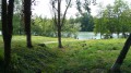
The Changis gravel pits and their wildlife.
The Briard Plateaus and their traditional farms.
The church at Jaignes and its Neolithic grinding stone. (A short detour to Jaignes, picnic)
The orchards of Molien and its shop (check opening times).
The landscapes of Hayden, ‘the Monts Moyens’.
S. Beckett’s house with its views over the Marne Valley.

Always be cautious and plan ahead when you're outdoors. Visorando and the author of this route cannot be held responsible for any accidents occurring on this route.

The GR® and PR® markings are the intellectual property of the Fédération Française de Randonnée Pédestre.

Reviews and comments

3.9 / 5
Based on 3 reviews

Reliability of the description
3.7 / 5
Ease of following the route
4.3 / 5
Route interest
3.7 / 5
champagne
champagne

Overall rating : 4.7 / 5

Date of your route : Mar 04, 2022
Reliability of the description : ★★★★☆ Good
Ease of following the route : ★★★★★ Very good
Route interest : ★★★★★ Very good
Very busy route : No

A very good walk

but there’s a very, very dangerous stretch when there’s roadworks at the depot
The section under the motorway is in the dark and the lorries can’t see us – you need a high-visibility vest and a torch to be seen, otherwise…???

Thanks for this walk
Michel

Machine-translated

User 3689083

Overall rating : 3.3 / 5

Date of your route : Jan 15, 2022
Reliability of the description : ★★★☆☆ Average
Ease of following the route : ★★★★☆ Good
Route interest : ★★★☆☆ Average
Very busy route : No

Good evening,

I came across a gate with a ‘private road’ sign at Chivres Farm (Wednesday 12 January).
Is it possible to open this gate and walk along the path to reach Changis? It’s frustrating.

Joël

Machine-translated

ageep
ageep

Thank you for visiting this route, especially at this time of year!
I’ve updated the description on Rutel to include the name of the trail.
I’m looking into the ‘Chemin des Carrières’ in Changis.
We use it for our sporting outings, but I’ll check with the local council to see whether it’s open or not.

Machine-translated

ovil
ovil

Overall rating : 3.7 / 5

Date of your route : Nov 30, 2021
Reliability of the description : ★★★★☆ Good
Ease of following the route : ★★★★☆ Good
Route interest : ★★★☆☆ Average
Very busy route : No

An easy walk on a misty, cool day that turned freezing as soon as the wind picked up.
We walked around Jaignes to see the church and the Neolithic grinding stone situated next to it.
A note on the section through Rutel: the path doesn’t go all the way to the village’s edge, and the farm building is more of a ruin. The path we took has a name; if I remember correctly, it’s the ‘Chemin des Grands Marois’, though I can’t say for certain.
A question about the path leading to the Chivres farm. The path at the edge of the woods (point 1) is blocked by a gate; the one on the right (point 2) is blocked halfway by rocks bearing the sign “Private road – no motorbikes or quads”, and to reach the D53 you have to open a gate, where you’ll find signs reading “Private property – no motorised two-wheeled vehicles or quads”. Although there is no ban on pedestrians, are we allowed to use this path?

Machine-translated

Other walks in the area

For more walks, use our search engine .

The GPS track and description are the property of this route's author. Please do not copy them without permission.